Severe storm risk in Central Canada means end in sight to extreme heat

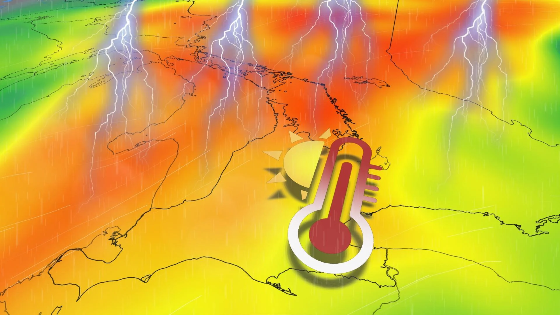
A cold front will slice through Ontario and Quebec's extreme heat and humidity Wednesday, bringing the threat for some hazardous storms before it brings cooler conditions
Unusual September heat remains in place for much of Ontario and Quebec Wednesday. Most regions of southern Ontario will spill into the low 30s for the third-straight day, with humidex values reaching above 40.
Saint-Anicet, Que., broke the September provincial humidex record for Quebec with a value of 43.4°C. Moosonee, Ont., also broke its September all-time temperature record, reaching a sizzling 35.1°C.
LOOK AHEAD: Warm or cool? Reversing patterns to dominate Canada in September
But a stormy change is on the horizon for Wednesday, bringing severe weather hazards with the heat as fuel, as well as some significant temperature relief as we head into the weekend.
RELATED: Heat warning prompts school closures in parts of Quebec

Wednesday
Timing: Afternoon and evening
Location: Northeastern, central and southern Ontario, through western and central Quebec
Weather: By Wednesday, there’s a thunderstorm threat across much of Ontario and Quebec as a frontal system approaches from Michigan. The slow-moving boundary will trigger heavy rainfall and possibly localized flooding within the storms, which could be severe through the afternoon and evening.
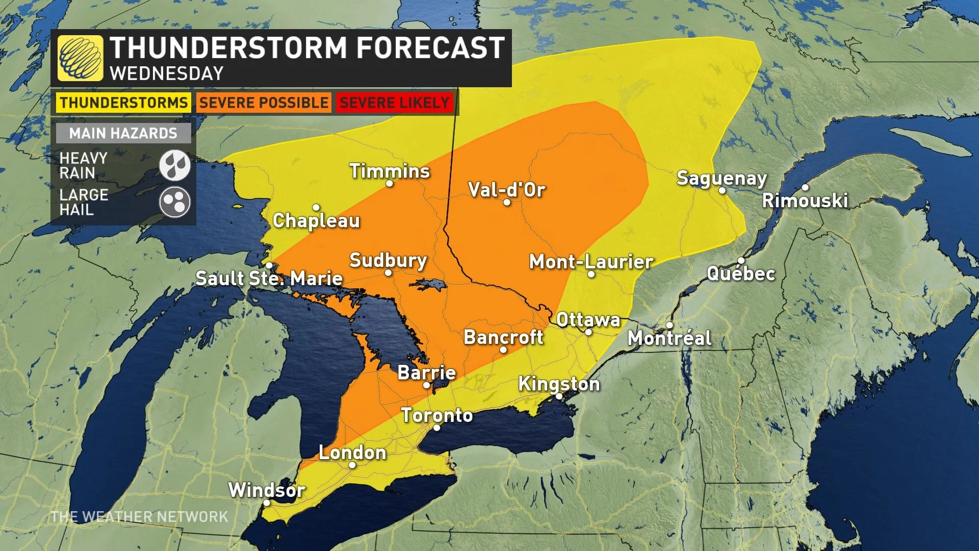
The ample heat has left behind enough thunderstorm energy to also produce large hail. Severe thunderstorms are most likely near Lake Superior and Georgian Bay shores, extending northeast into western Quebec. Some stronger storms may move through cottage country and southern Ontario, too, but with lower confidence that hinges on the speed of the front.
A faster-moving front would spill higher chances for severe storms into the south, but current guidance has the cells rolling through the Greater Toronto Area (GTA) late Wednesday into Thursday.
RELATED: The importance of staying hydrated in warm weather

Thursday and beyond
The streak of 30-degree days may be behind us by Thursday, as cloudy, rainy and stormy weather takes over. The same slow-moving boundary heads east, and drapes over the GTA and St. Lawrence. That will trigger another round of thunderstorms for Toronto, Ottawa, Montreal and surrounding regions.
Humidex values hold onto an uncomfortable mid-to-low 30s, until a more seasonal air mass settles in for the weekend.
Although temperatures will be much cooler, periods of rainfall may interrupt weekend plans to enjoy it.

The arrival of September marked the start of meteorological fall, though the autumnal equinox doesn’t officially occur until the wee morning hours of Saturday, Sept. 23.
Join us for the release of our 2023 Fall Forecast on Wednesday, Sept. 13. Our experts will take a look at temperature and precipitation trends for the upcoming season, revealing what you can expect during this highly changeable season across Canada.
WATCH: What longer, hotter, and more frequent heat waves means for your health
Stay tuned to The Weather Network for more forecast updates for Ontario.