Damaging wind threat prompts warning across B.C.'s South Coast

A potent Pacific low will has prompted wind warnings for parts of B.C. with coastal rain and interior mountain snow set to close out the week as well.
The grand "frontal finale" sweeps through southern British Columbia to round out the workweek, bringing rain and snow -- along with the potential for damaging winds -- for Friday. There's good news on the horizon, however, as an extended break from autumn's unsettled weather is in store for the weekend and beyond. We take a look at this unusual stretch of pleasant, dry fall days, and the strong winds that precede them, below.
WEATHER HIGHLIGHTS:
Sharp cold front impacts the west coast of B.C. through Friday with heavy rain and high elevation snow
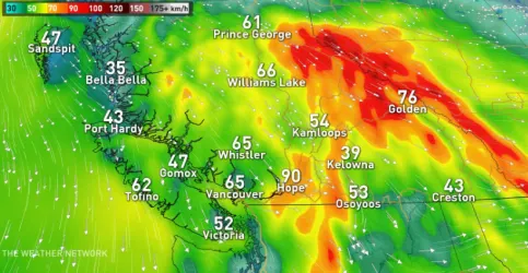
Widespread strong northwest winds with gusts of 80+ km/h through Straight of Georgia
High pressure builds in on Saturday and beyond
Stay up-to-date on the ALERTS in your area
STRONG NORTHWEST WINDS ARRIVE FRIDAY
It will be a windy end to the week for parts of the Lower Mainland as gusty northwest winds develop in the wake of a passing cold front. Widespread gusts in excess of 80 km/h are likely along the Strait of Georgia through the afternoon and evening hours on Friday, including around Vancouver International Airport.
That puts Vancouver's main weather station in line to see some of the strongest wind gusts of the past ten years with the potential for damage and travel disruptions.
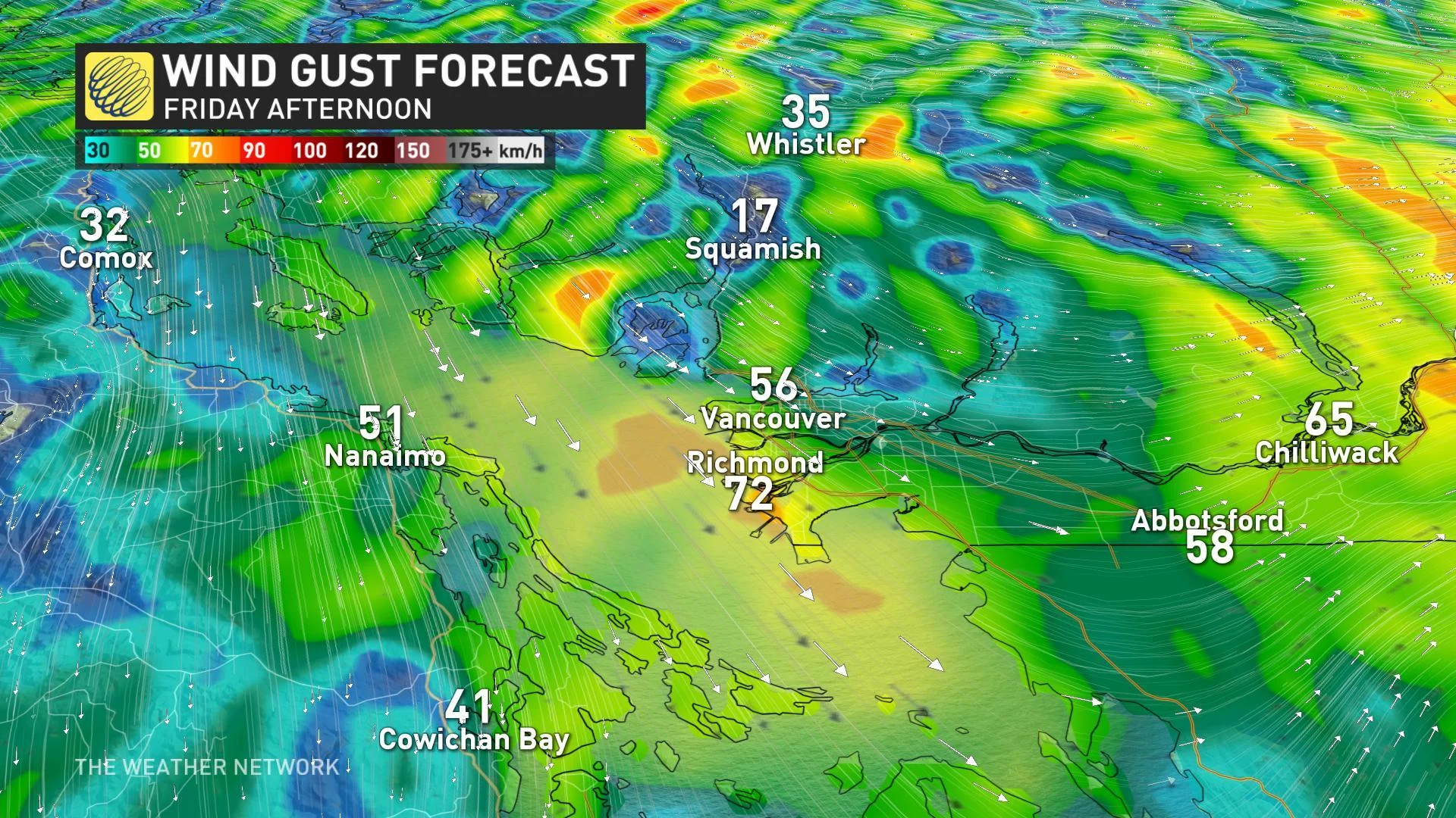
Environment Canada has issued wind warnings for the South Coast, including the Metro Vancouver area for the strong northwesterly winds on Friday.
WIDESPREAD RAIN AND SNOW
While the winds will be the most impactful part of this system for many, the rain and snow will be the most widespread. Rain started creeping down the North and Central coasts on Thursday afternoon, and those showers spread across the Lower Mainland by the early morning hours on Friday.
WATCH BELOW: TIMING FRIDAY'S MESSY MIX
Heavy snowfall with this system will be mainly limited to the north as freezing levels descend to around 1500 metres through Friday. A snowfall warning covers the B.C. South Peace River region, where 15 to 20 cm are expected by Friday evening.
"Expect conditions to really deteriorate along Highway 97 with gusty winds and snowfall expected across the area," warns Weather Network meteorologist Kelly Sonnenburg.
The southern Interior mountain passes can still expect to see some mixing or snow flurries through the day Friday as freezing levels hover between 1000 and 1300 metres.
"The good news is, the front will quickly clear just in time for the weekend as a ridge of high pressure builds in behind the system," Sonnenburg adds. "This will bring an extended and unusual stretch of pleasant, dry weather with lots of sunshine into next week."
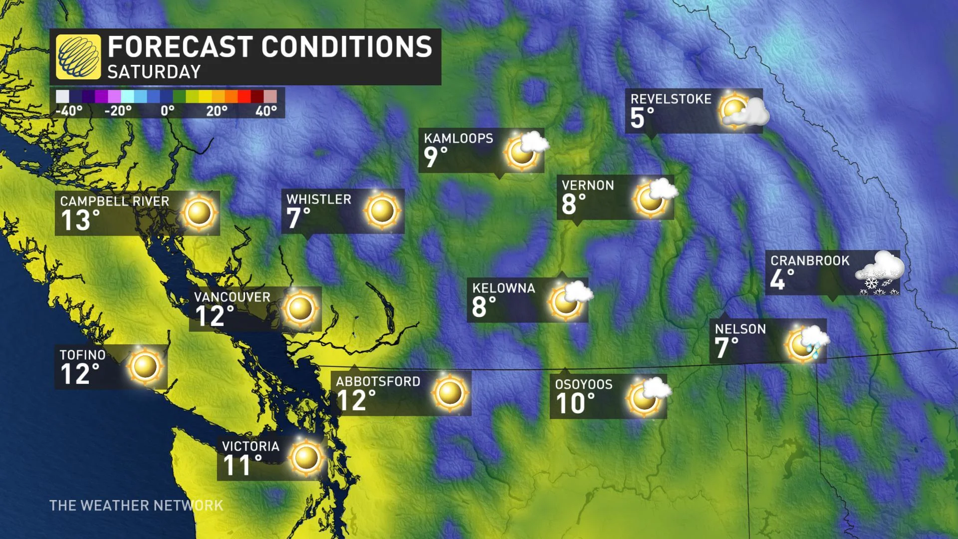
This pattern looks to hold through much of next week and possibly even into the following weekend as well.