Ice, rain and heavy snow make a mess of travel across Quebec

Thursday could be a challenging day on the roads across Quebec as a moisture-packed system threatens periods of heavy rain, ice, and snow.
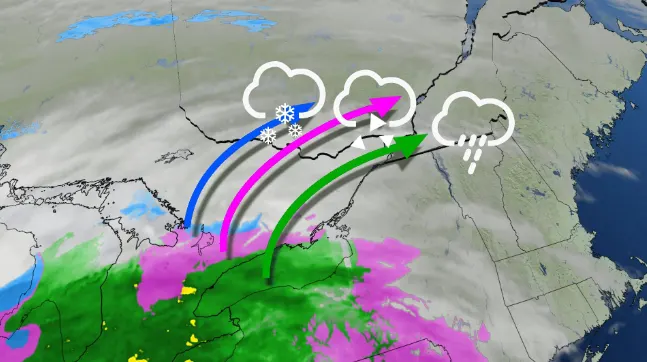
A sprawling low-pressure system arriving from the south will bring a host of wintry headaches to Quebec on Thursday and Friday, complete with the risk for rain, snow, ice, and a period of gusty winds.
Freezing rain warnings, snowfall warnings, and special weather statements dot the province for the mixed bag of precipitation expected with this storm.
Snow will push into the Ottawa Valley and Montreal early Thursday afternoon. This snow will quickly change over to rain in Montreal, with a brief period of freezing rain possible during the transition.
MUST SEE: It may be mild, but the snowiest months are just ahead for these parts of Canada
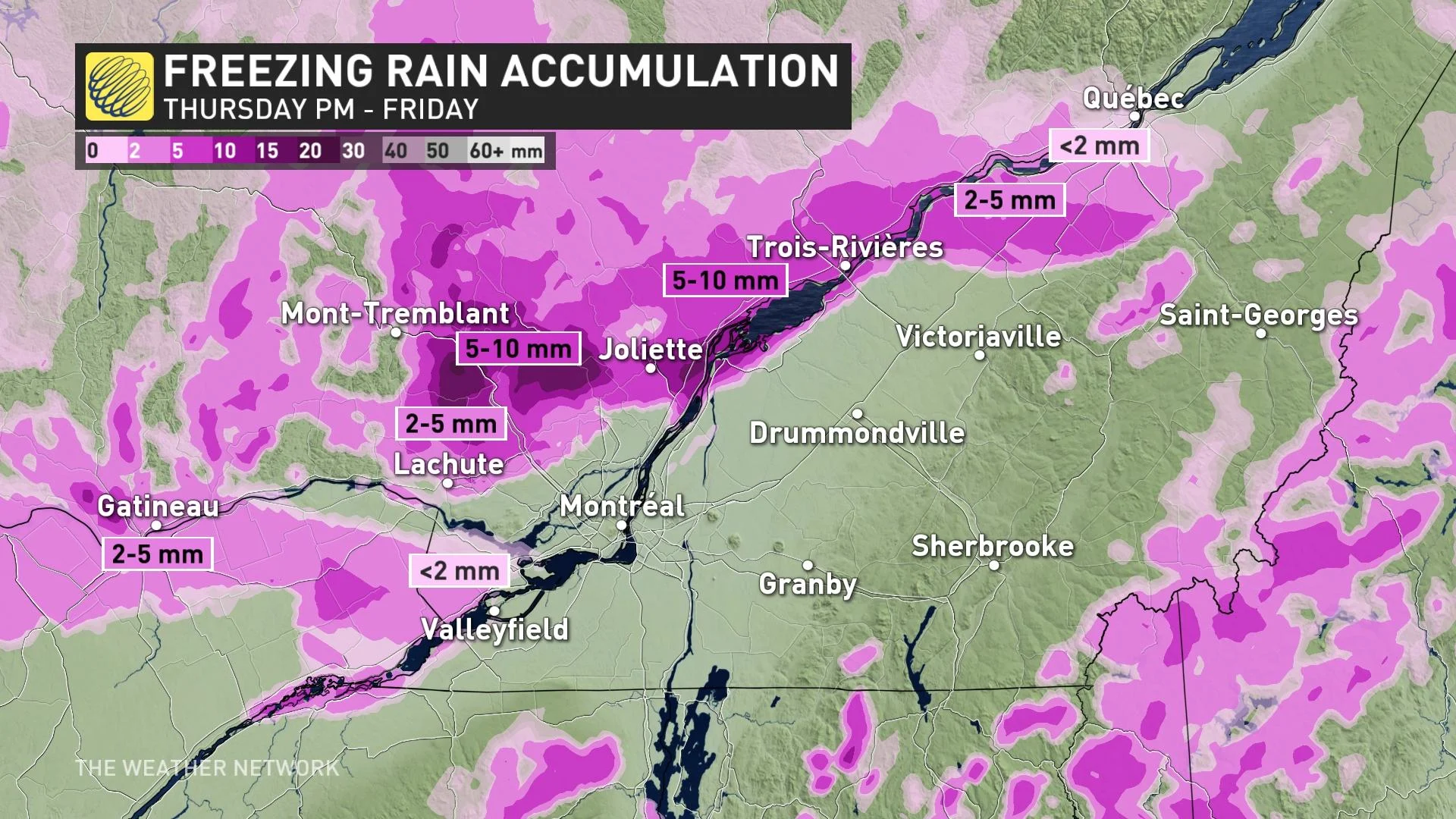
Cold air will hang on longer down in the Ottawa Valley, however, extending the risk for freezing rain. Environment and Climate Change Canada (ECCC) issued a freezing rain warning for Gatineau in anticipation of several hours of ice accretion.
"A prolonged period of freezing rain is expected for the Ottawa River Valley," ECCC said in its warning.
Freezing rain will change over to rain for the Ottawa Valley as warmer air pushes in from the south Thursday night. Precipitation will come to an end Friday morning.

Temperatures will steadily rise across much of southern Quebec behind this warm front. Metro Montreal and the Eastern Townships could see temperatures reach the mid- to upper-single digits overnight Thursday into the pre-dawn hours on Friday.
Montreal’s temperature could rise from 2°C at 9 p.m. on Thursday to 6°C by 3 a.m. on Friday before falling once again. We could even see a quick double-digit reading in the southern Eastern Townships near the U.S. border.

READ ALSO: Freezing rain is the 'worst type' of precipitation. Here's why
Ice accretions of 2–5 mm are possible through the Ottawa Valley and the Laurentians. Rainfall totals will reach 5–15 mm across most of southern Quebec for the duration of this storm.
Farther north, temperatures will remain cold enough for accumulating snow. The heaviest snow will fall in northern Quebec, where 10 to 20 cm or more of snow is expected through Friday. Quebec City could see anywhere from 20 to 30 cm by the time the system departs.

Looking ahead, the pattern is favourable for above-seasonal conditions to dominate southern Quebec through next week, with daytime high temperatures 5+ degrees above where they should be for the middle of February. This warmer pattern will come at a cost, though, as unsettled conditions could lead to several opportunities for rain next week.
WATCH: Canada, it might surprise you how much snow will still fall
Check back for the latest weather updates across Quebec this week.