Treacherous snowstorm makes travel impossible on parts of the Prairies

Thursday will be another difficult day for travel across parts of southern Saskatchewan and Manitoba, with an additional 20-30 cm of snow for some, along with persisting high winds and poor visibility
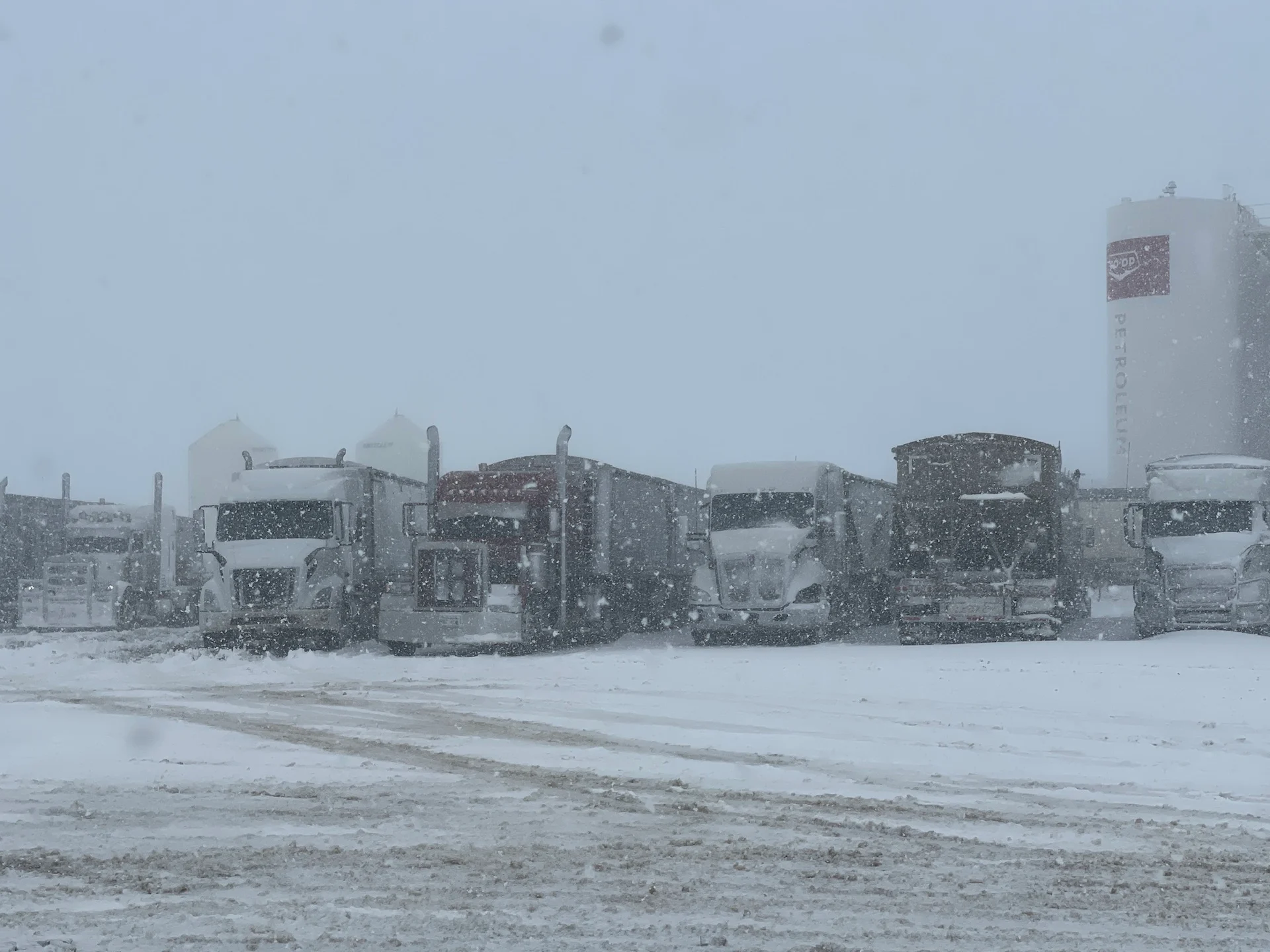
Drivers across parts of the Prairies are being urged to continue avoiding the roads through Thursday, as a potent spring snowstorm with dangerous blizzard-like conditions persists.
Snowfall and winter storm warnings line both southern areas of Saskatchewan and Manitoba, with final snowfall totals of close to or at 40 cm not out of the question for some communities. For the city of Brandon, Man., this could be the biggest snowfall event this season if the region receives 24 cm of snow.
MUST SEE: Uncertainty swirls around 2023 hurricane season as El Niño looms
The slow-moving disturbance impacting the southeastern Prairies will pull another wave of snow into the region on Thursday. Moderate to heavy snow will spread northwards into parts of southern Manitoba early Thursday morning, then spread eastwards across the Red River Valley and southeastern sections through the day.

In Saskatchewan, accumulating snowfall will persist into Thursday for many locations.
Rapidly accumulating snow has made travel difficult over some locations, with reduced visibility expected to linger Thursday.
"Be prepared to adjust your driving with changing road conditions. Prepare for quickly changing and deteriorating travel conditions," says Environment and Climate Change Canada (ECCC) in the snowfall warning. "Public Safety Canada encourages everyone to make an emergency plan and get an emergency kit with drinking water, food, medicine, a first-aid kit and a flashlight."
WATCH: Ongoing snowstorm results in poor, hazardous travel in Saskatchewan
Snowfall rates of 1-3 cm an hour will be possible, and locally even higher in convective bursts of snow. As a result, residents are being urged to prepare for road closures and possible power outages through the duration of the storm.
An additional 20-30 cm of snow is expected in the hardest-hit areas, along with wind gusts of 50-70 km/h.

The strongest winds are expected to gradually diminish overnight Wednesday.
The snow will continue into Friday morning, as well, with snowfall tapering off to flurries as the system finally pulls off towards the east.
RELATED: Get ahead of disaster: Six tips to manage flooding

Additional precipitation totals from this storm will continue to heighten flooding concerns across the south, with water levels expected to peak next week across parts of southern Manitoba where several flood warnings are in effect.
Despite the looming threat of a wintry system this week, it doesn’t look like we'll see persistent extreme temperatures in either direction through the rest of April into early May. However, the western half of the country will likely tip toward the colder side of seasonal for the second half of April.
WATCH: 4 provinces on alert as flooding targets millions of Canadians
Thumbnail courtesy of Jenny Hagan, taken in Weyburn, Sask.
Stay tuned to The Weather Network for the latest forecast updates on the Prairies.