
Travel impacts and outages as heavy snow, rain and winds wallop Atlantic Canada

Another potent winter storm is trekking through Atlantic Canada, bringing with it heavy, wet snow, high snowfall rates, soggy rain and strong winds
Snowfall and winter storm warnings, along with special weather statements, are widespread across Atlantic Canada, as another potent late season storm moves through the region with heavy rain, winds and snow. Snowfall totals of 20-40+ cm are possible for some local areas of the Maritimes, with 15-30 cm potentially for parts of southern Newfoundland by the time all is said and done.
This forecast has proven to be a tricky one, however, as temperatures oscillate above and below the freezing mark, contributing to a messy mix of precipitation of rain, ice and snow.
Visit our Complete Guide to Spring 2023 for an in-depth look at the Spring Forecast, tips to plan for it and much more!
As conditions started to deteriorate, thousands were already without power in Nova Scotia Tuesday night, according to the provincial agency, with numbers expected to fluctuate throughout the storm.
Wind gusts between 50-80+ km/h have been reported as of Wednesday morning across the Maritimes.
The snow will transition to a wet mix and then straight rain through Wednesday for much of Nova Scotia, excluding Cape Breton, where heavy snow is forecast to persist. A heavier band of rain may set up over central or western regions, with localized amounts of 25 mm expected by Wednesday evening. The rain will then change back to snow, with accumulations up to 10 cm possible before gradually easing by Thursday morning.
MUST SEE: Science behind the weather: The infamous nor'easter

Snowfall warnings are in effect across eastern and central New Brunswick, where periods of heavy snow will continue through Wednesday night.
"Visibilities may be reduced in blowing snow this morning over exposed areas," says Environment and Climate Change Canada (ECCC) in the warning. "Snow may become mixed with rain in the southeast today."
Drivers are being urged to adjust with changing road conditions.
Schools across the north and northeastern sections of the province were closed first thing Wednesday, with bus delays reported almost everywhere else.
Snowfall rates will pick up in intensity across eastern Newfoundland through Wednesday evening and into Thursday, with widespread snowfall totals of 15-30 cm forecast for the island, including St. John's.
"If you are planning travel, be prepared for delays, and allow for extra time to reach your destination," ECCC warns.
The heavy, wet snow will make for accumulations that will stick to tree branches and power lines, which could contribute to further power outages. Additional travel issues are likely, as well, with the high snowfall rates and gusty northeast winds.
Higher-than-normal waters levels and pounding surf will also affect the Atlantic coast during high tides on Wednesday.
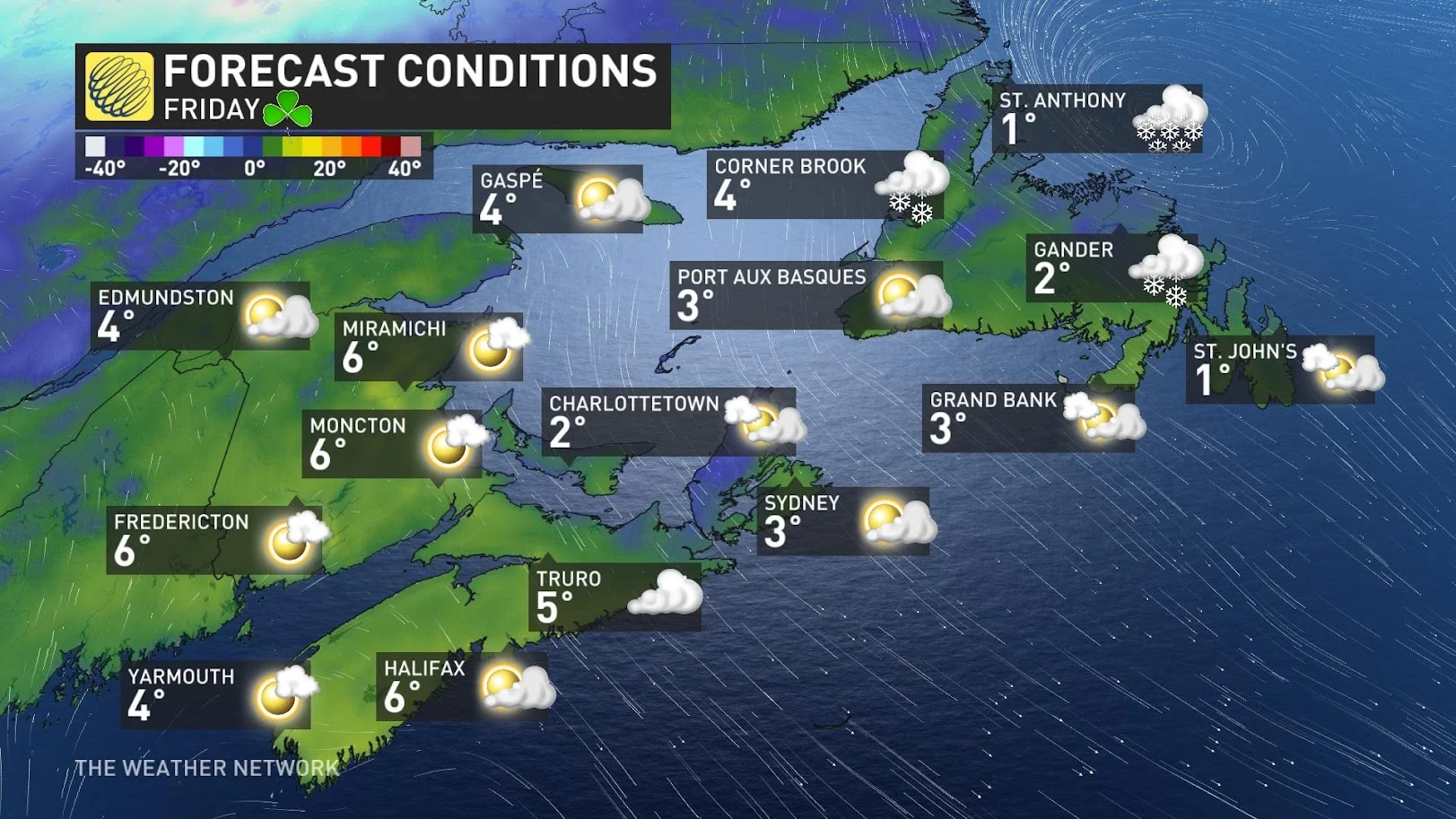
A pleasant St. Patrick's Day is expected for the Maritimes on Friday before another system advances in for the weekend. Rain and snow is forecast with the next system. Measurable snow accumulations will likely be limited and confined to the northern Maritimes, and mainly western parts of Newfoundland.
Fair conditions and slightly cooler than seasonal temperatures are expected for the first half of next week. The next system to watch will be during the second half of next week, with the potential for a more active pattern during the final week of March.
WATCH: Taking a cold plunge in a nor'easter, only in Canada!
Keep checking back to The Weather Network for more forecast information and updates for Atlantic Canada.
Thumbnail image courtesy: RCMP New Brunswick/Twitter