Travel alert: Road conditions deteriorate with snow; strong winds to develop
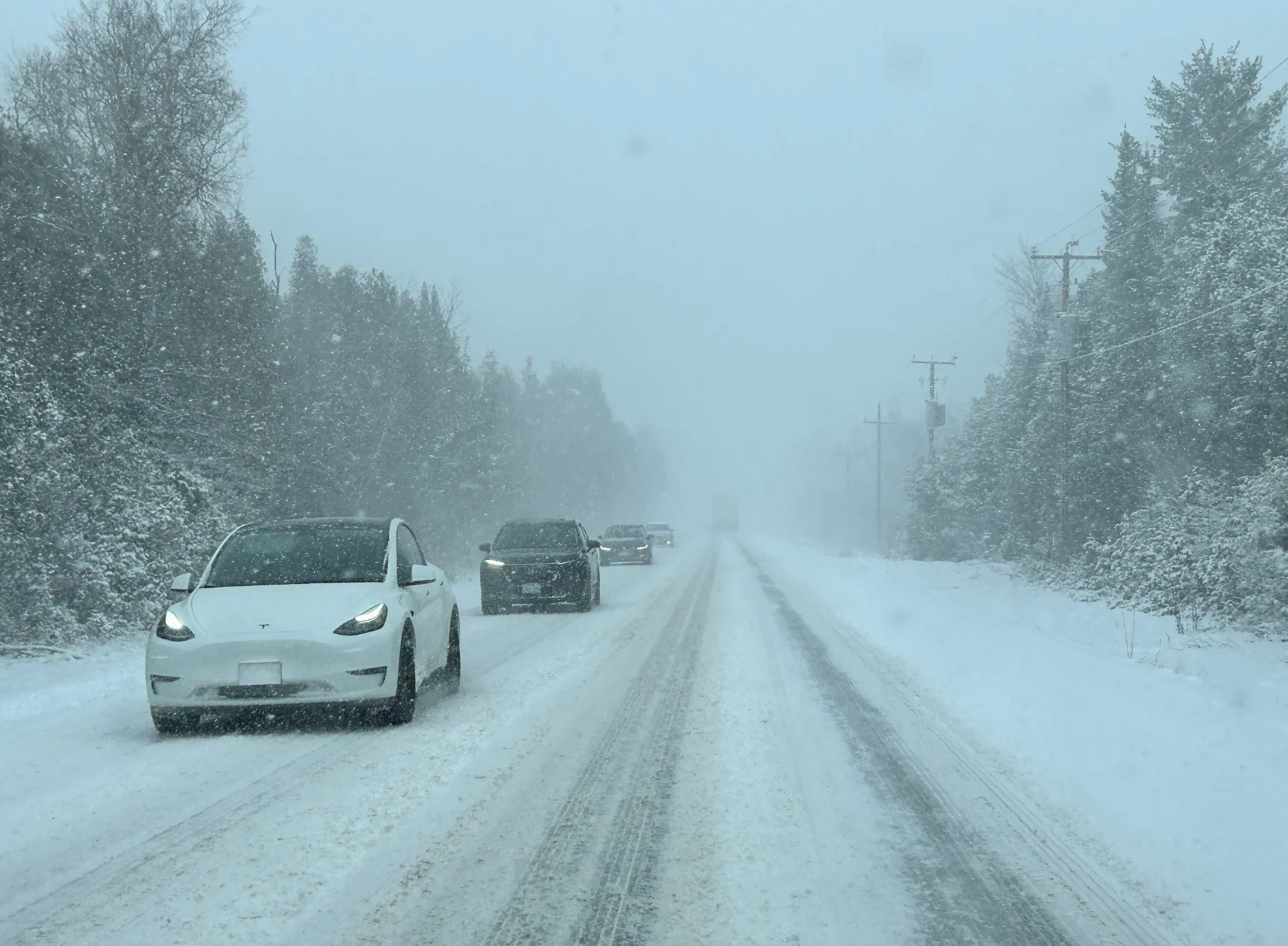
Southern Ontario is facing rapidly deteriorating travel conditions, with 5–15 cm of snow, gusty winds, and freezing temperatures likely creating icy, slippery roads heading into Friday evening
Travel conditions in southern Ontario are expected to deteriorate rapidly from west to east through Friday afternoon, coinciding with after-school commutes and the start of March Break travel.
Snowfall rates may reach 2–3 cm/h, with strong wind gusts of 50–60 km/h (locally higher) developing throughout the day.
Check the road conditions before you head out, and leave extra time for any travel. Roads are likely to become snow-covered and slippery within a short period.
The Ontario Provincial Police is reminding drivers to remain alert and drive according to the conditions.
Additionally, forecasters are closely watching another significant system that could affect the province later this weekend.
Read on to see what's ahead.
Friday: Heavy snow and strong winds, risk of localized outages and travel delays
A clipper system will bring snow to central and southern Ontario on Friday, starting with morning flurries in areas from Windsor to London.
Snow reached the Greater Toronto Area (GTA) by late morning, with the heaviest expected in the afternoon, and early evening.

DON'T MISS: Ontario's late weekend snowstorm threatens 25-50 cm of snow; road closure likely
By Friday night, heavier snow will shift eastward toward Oshawa, Peterborough, and Kingston, while light rain may mix in along the lakeshore from Toronto to Hamilton, reducing totals in those areas.
Snowfall will move into Ottawa late Friday evening, continuing into Saturday morning, with light lake-effect snow lingering around Lake Huron and Georgian Bay into the pre-dawn hours.
Most of the GTA is expected to receive 5–10 cm of snow, with areas closer to Lake Ontario seeing the lower amounts. Snow accumulations of 10–15+ cm are anticipated north of Highways 401 and 407. The Niagara region will see 3–7 cm of snow.

SEE ALSO: A potentially strong El Niño will develop by this summer
Wind gusts up to 90 km/h are expected in areas including Windsor, the Lake Erie shoreline, and across the Niagara Peninsula, with blowing snow and bursts of heavier snow in the GTA and beyond through Saturday morning.

Travellers in the GTA, Ottawa, and eastern Ontario should prepare for slowdowns and reduced visibility Friday afternoon into Saturday morning. Strong winds could lead to power outages in areas with above-ground lines.
Though some snow melt is expected, a drop to below-freezing temperatures overnight Friday will cause any remaining slush to freeze, potentially leading to icy conditions.

Closely eyeing a bigger system later this weekend
Looking ahead, we’ll see a brief break from the active weather on Saturday with below-seasonal temperatures. Forecasters will closely monitor the progress of a powerful weekend storm in the works, which could bring more impactful snow and rain to the region.

This powerful and messy storm has potential to severely impact northeastern and central Ontario Sunday and Monday with heavy snow—25-50 cm—from eastern Lake Superior to Moosonee.
This storm has the potential to close many roads across northeastern Ontario, including an extended stretch of the Trans-Canada Highway.