Toronto’s first 20°C may be record-breakingly late this year

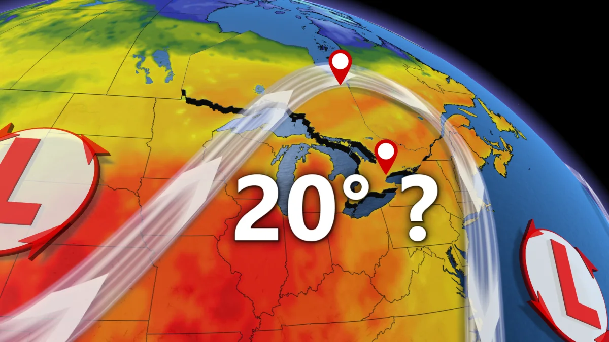
Toronto is enduring a historically long wait for its first 20°C reading of the year.
Toronto’s first 20°C is very behind schedule, now ranking among one of the latest of all time. If you just can’t wait any longer, though, there is some good news. Several days of the long-awaited spring warmth is just around the corner.
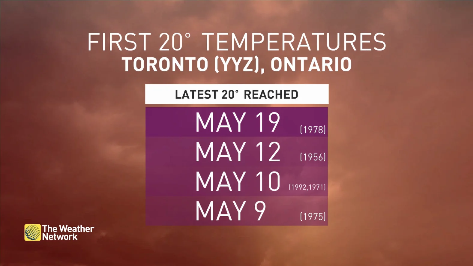
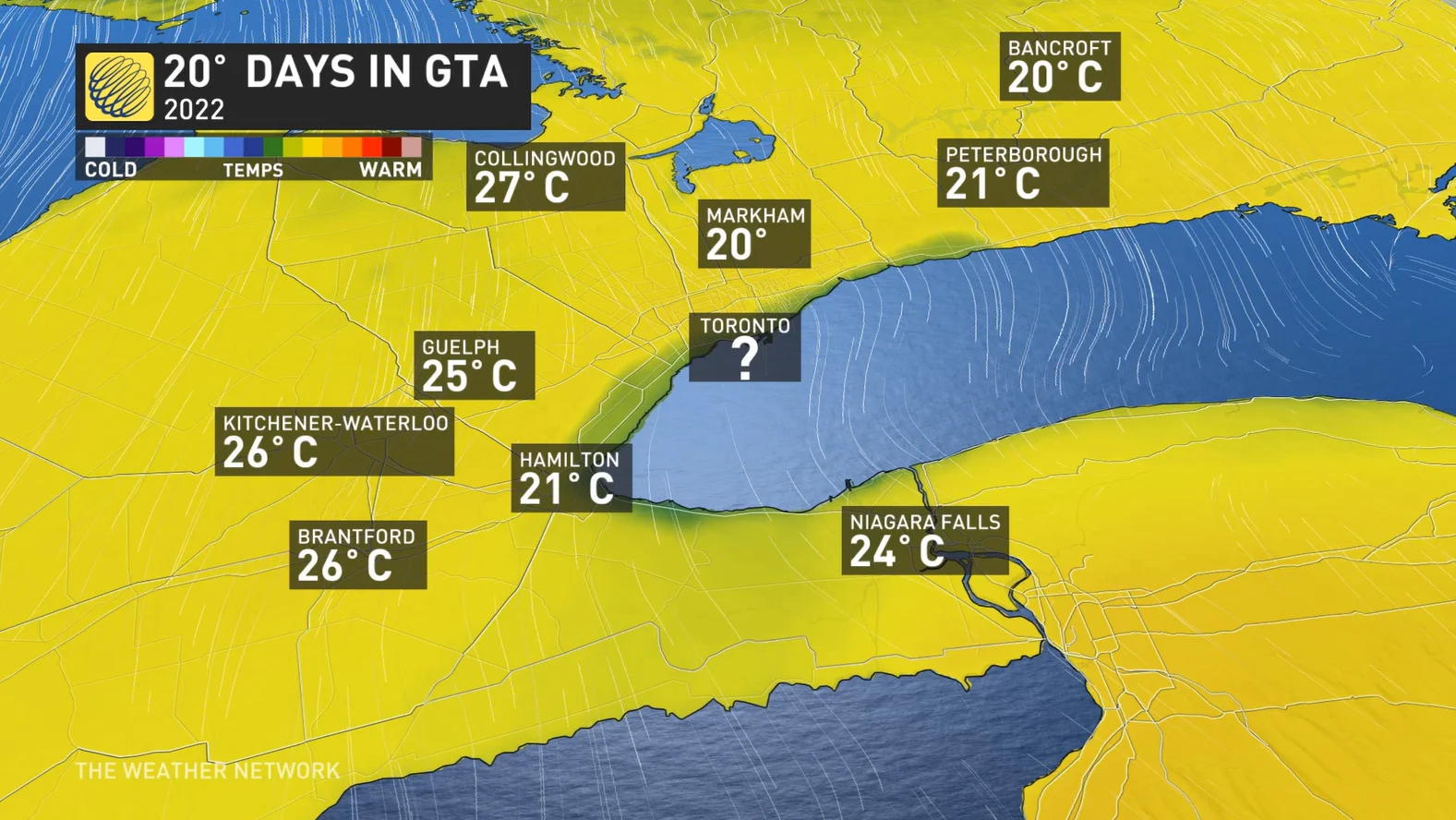
If you are feeling like you have been left out, you’re right! Almost every other year has brought a 20-degree day by now, not to mention how other closeby Greater Toronto Area (GTA) regions have hit 20°C already. On top of it all, some unsuspecting northern areas may reach 20°C several days before Toronto does!
About 900 kilometers north of the city, in Ontario’s Northern region, Moosonee and Timmins both have chances at the 20°C spring warmth as early as Sunday.
So when will Torontontians get to experience 20°C this spring? The best chance, according to current forecast models, will arrive mid next week as a ridge strengthens over the city.
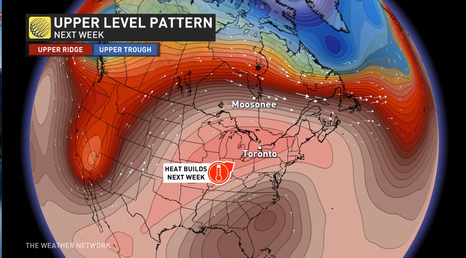
As the ridge and high pressure pattern grows, clearer skies and warmth surging along southerly winds, increasing forecasters’ confidence that Wednesday May 11th could break Toronto’s 20°C drought. Even better news, that won’t be our only chance for 20°C!
The pattern is emerging into what meteorologists call an Omega Block. This pattern forms when two low pressure regions sit on either side of a high pressure region, forming the shape of the Greek letter Omega. The regions interlock like gears, resulting in a stalled-out weather pattern over North America and several days of possible 20-degree weather across Ontario.
However, lakeshore areas may have to once again battle a cooler easterly wind.
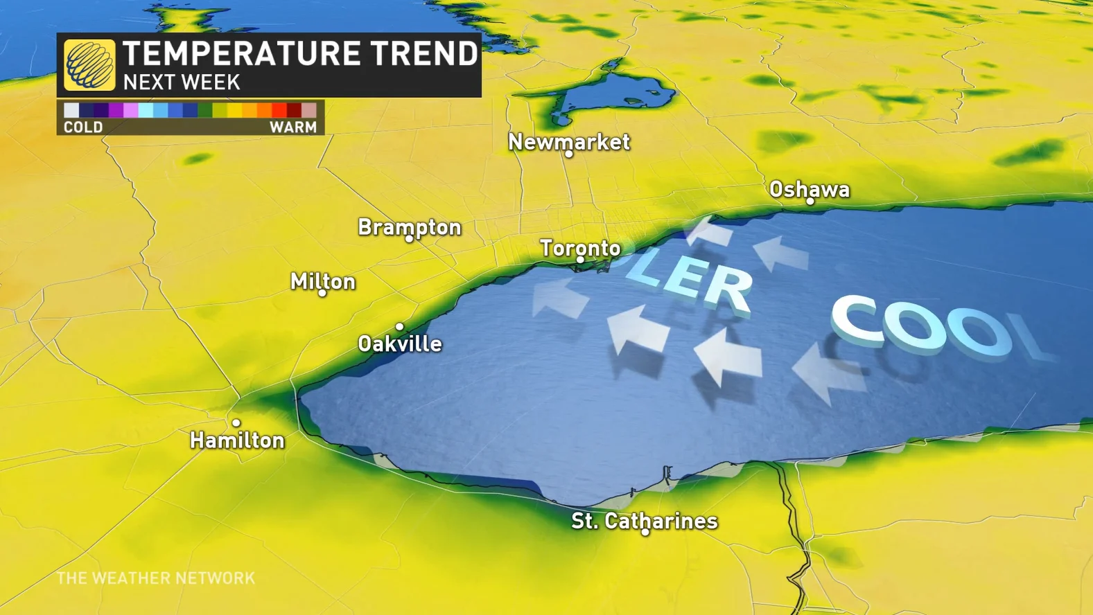
Easterly winds during the spring season act against warmer weather in the GTA. Remember, Lake Ontario warms up much slower than our air temperatures do, so the water remains cold from the winter. Because of this, there exists a layer of chilly air just above the water’s surface. Each easterly breeze delivers this chilly air directly to the Lakeshores. This hyper-local factor results in cooler temperatures in Toronto compared to inland regions a short distance away.
These breezes have spoiled 20°C for Toronto so far in 2022. However, confidence is growing and the scales may be tipped to the warmer side this time around.
Be sure to check back for updates as we continue to monitor the forecast over the coming weeks!


