Tornado watch issued on the Prairies amid multi-day severe storm threat
Ingredients are coming together for a severe-weather event centred in southeastern Saskatchewan and western-southwestern Manitoba on Saturday, including the chance of supercells
2:31 p.m. CDT - A tornado watch is in effect across portions of southern Saskatchewan and Manitoba amid a severe storm threat on Saturday afternoon. A tornado watch means that conditions are favourable for the development of tornadoes.
Any severe storms that develop may also be capable of producing damaging hail, heavy rain and strong wind gusts, Environment and Climate Change Canada (ECCC) added in its watch.
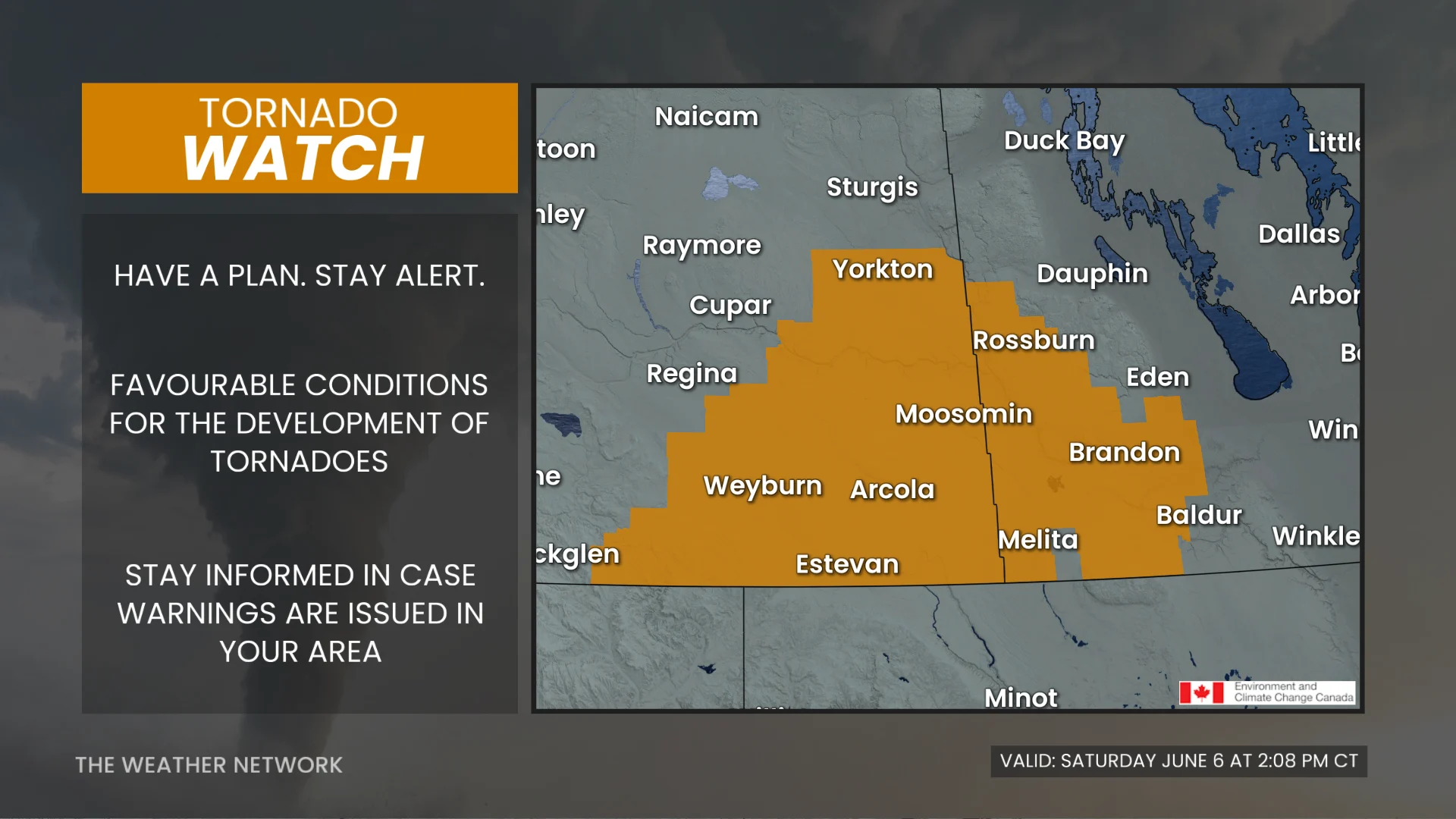
Pay close attention to the latest alerts in case the tornado watch is upgraded to a tornado warning in your area. Have a plan in place to seek safe shelter in case severe weather threatens your home, your office, or while you’re driving.
The original article with the full forecast for the Prairies continues below.
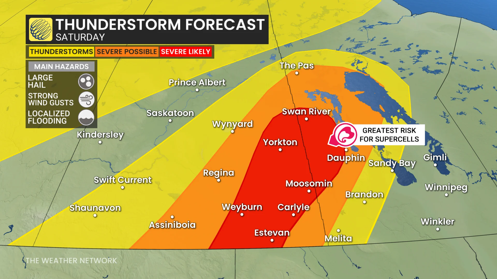
Severe thunderstorms are likely across the southeastern Prairies on Saturday as a dynamic setup swings across the region.
The main hazards will be large hail and strong wind gusts, but some areas could see supercells, so the threat of tornadoes can't be ruled out, as thunderstorms bubble up across the region
Severe weather threat builds on Saturday
Forecasters are closely monitoring a very favourable setup for severe thunderstorms across southern portions of Saskatchewan and Manitoba during the day Saturday.
This environment includes high storm energy, ample moisture, strong winds aloft, and a trigger to kick off the development of thunderstorms.
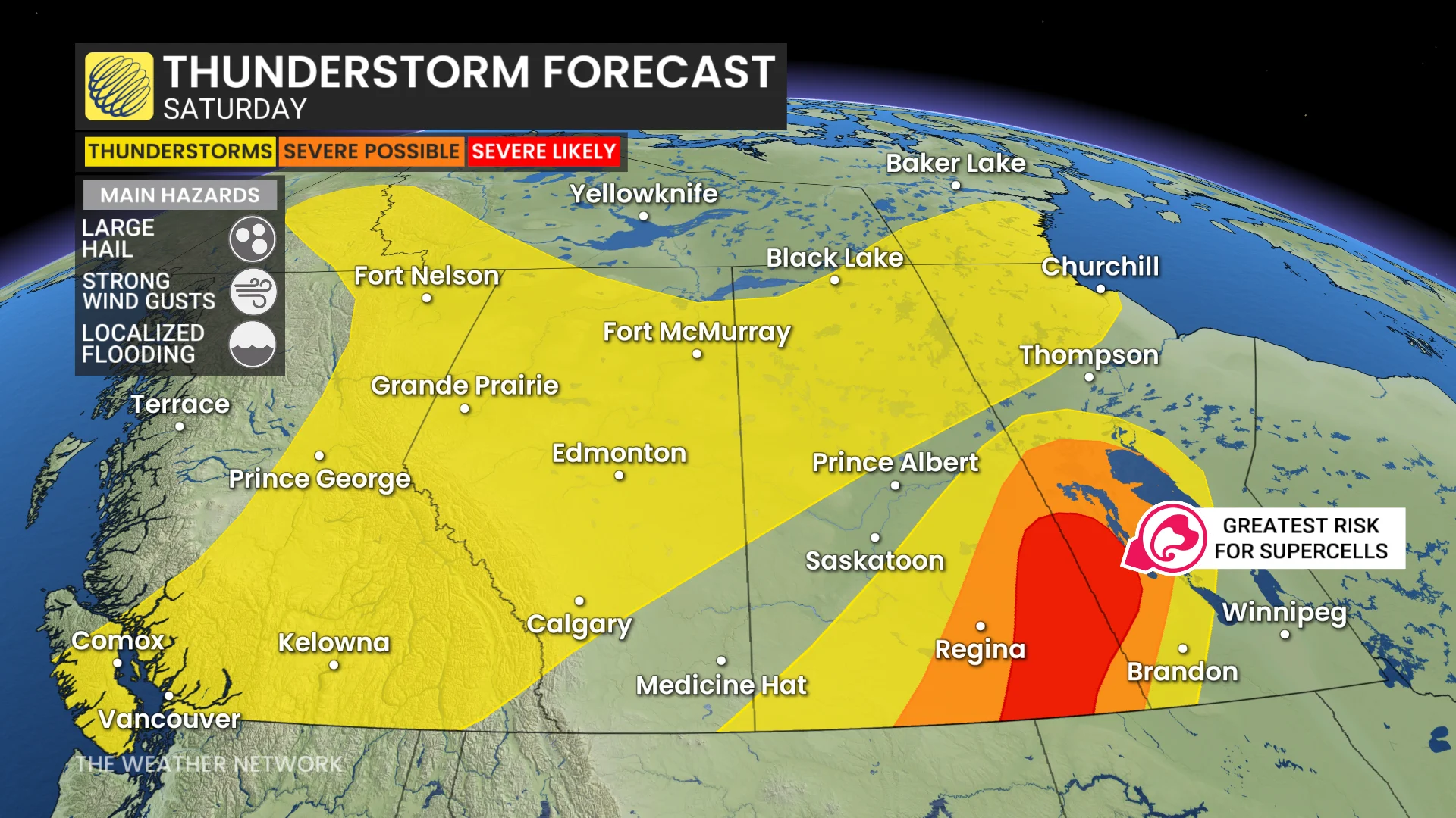
A surface low enters the region around 6 p.m.to 7 p.m. while a trough organizes in Montana, acting as triggers for severe thunderstorm development.
DON’T MISS: The pros and cons of an El Niño summer across Canada
Storms that bubble up on Saturday will encounter favourable dynamics to quickly turn severe, potentially growing into supercells capable of producing large hail and strong, potentially damaging, wind gusts. A threat for tornadoes can’t be ruled out at this time.
By the late afternoon, thunderstorms trigger and may initially become supercells.
Steep lapse rates support very large hail (ranging between ping pong ball- to tennis ball-sized), along with strong winds.
Residents in impacted areas are urged to keep cell phones charged ahead of the storm in case of any power disruptions or outages to receive weather alerts (click here to see how to turn on alert notifications from The Weather Network app).
RELATED: Tornado warning safety: Here’s what you should do

The highest impacts are expected in south-central and southeastern Saskatchewan, including Regina and surrounding communities.
Training storms along the Saskatchewan-Manitoba border are high highly possible through Saturday evening, elevating the flooding threat.
The greatest amount of rainfall accumulation through the weekend is across southeastern Saskatchewan and western Manitoba where the majority of rainfall is along the shorelines of Lake Winnipeg, Cedar Lake and Lake Winnipegosis (north of Dauphin).
WATCH: Severe storm dynamics shaping up in southern Saskatchewan
Sunday sees similar severe storm threat
A nocturnal storm risk from Saturday night into Sunday cannot be ruled out.
The risk continues into Sunday afternoon, shifting slightly eastward.
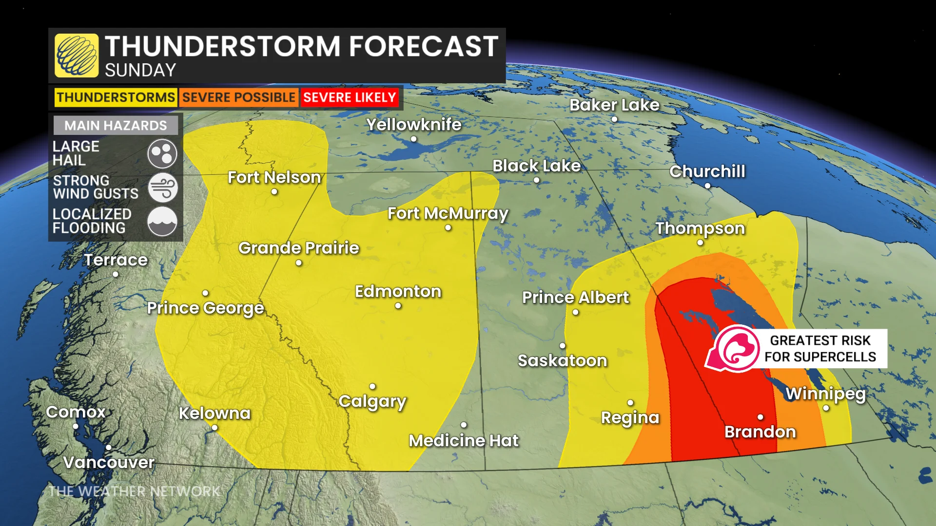
The risk of severe storms, including supercells, will be again focused on southeastern Saskatchewan and southwestern Manitoba.
Take some time to ensure you have emergency supplies and a plan in place in case severe weather threatens your location.
For tips on what to do in case a tornado warning is issued, click here.
Stay with The Weather Network for all the latest on conditions across Saskatchewan and Manitoba.