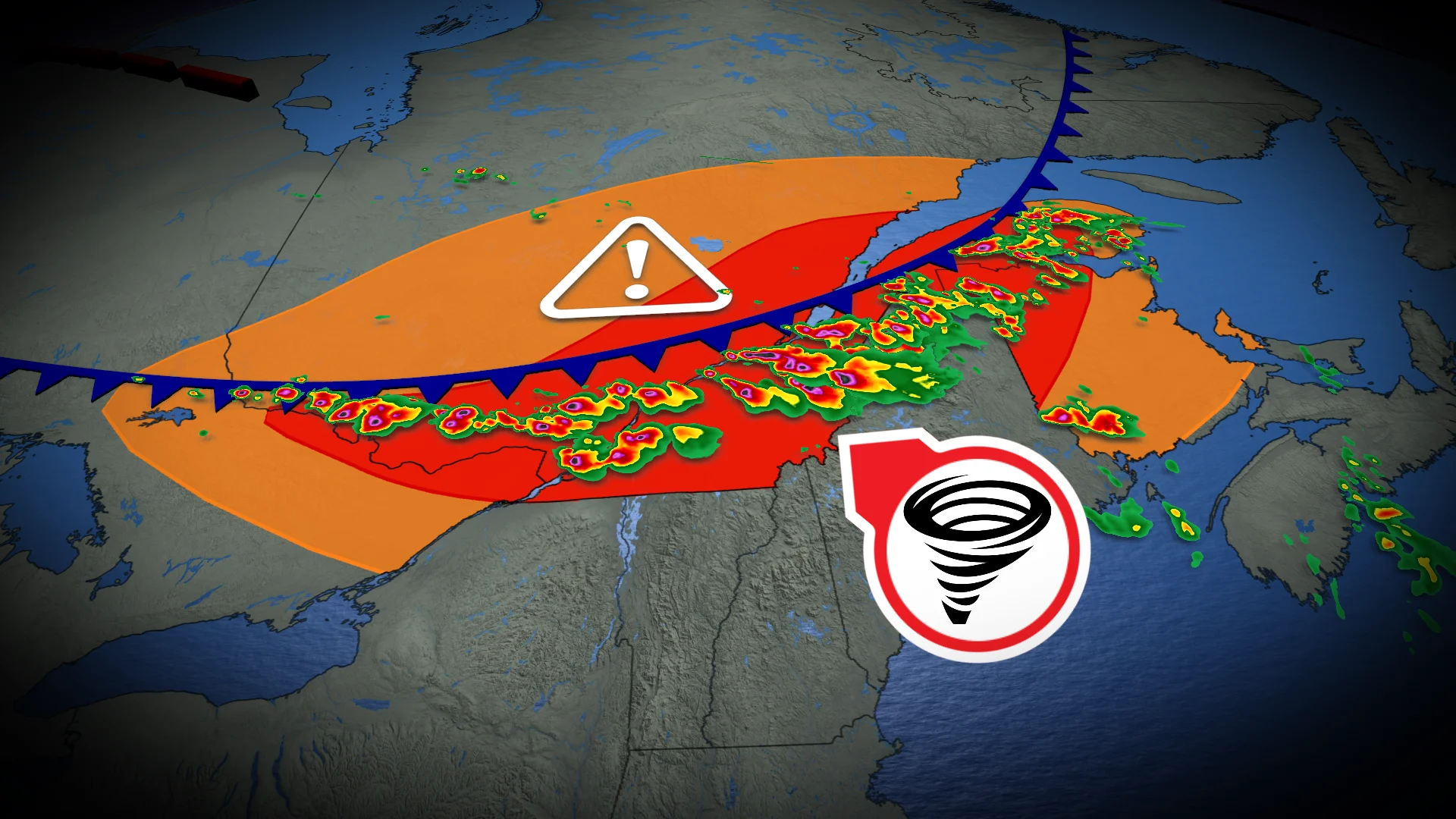
Tornado watch: Dangerous storm threat for Ottawa, southern Quebec Tuesday

A heat dome to the south is generating a "ring of fire" pattern, creating enhanced conditions for severe thunderstorms across eastern Ontario, Quebec, and New Brunswick. Storm threats include torrential rain, damaging wind gusts, large hail, and the potential for tornadoes
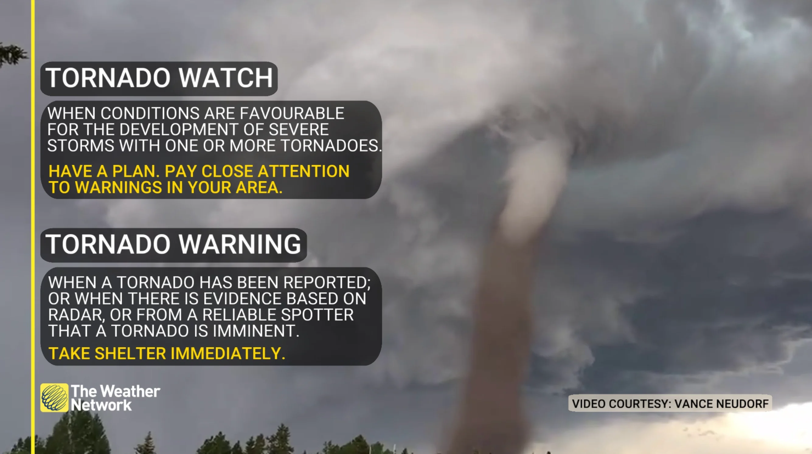
8:55 a.m. ET - A tornado watch is in effect for Quebec amid a severe storm threat Tuesday afternoon/evening. A tornado watch means that conditions are favourable for the development of tornadoes.
Pay close attention to the latest alerts in case the tornado watch is upgraded to a tornado warning in your area. Have a plan in place to seek safe shelter in case severe weather threatens your home, your office, or while you’re driving.
CURRENT TORNADO WATCHES:
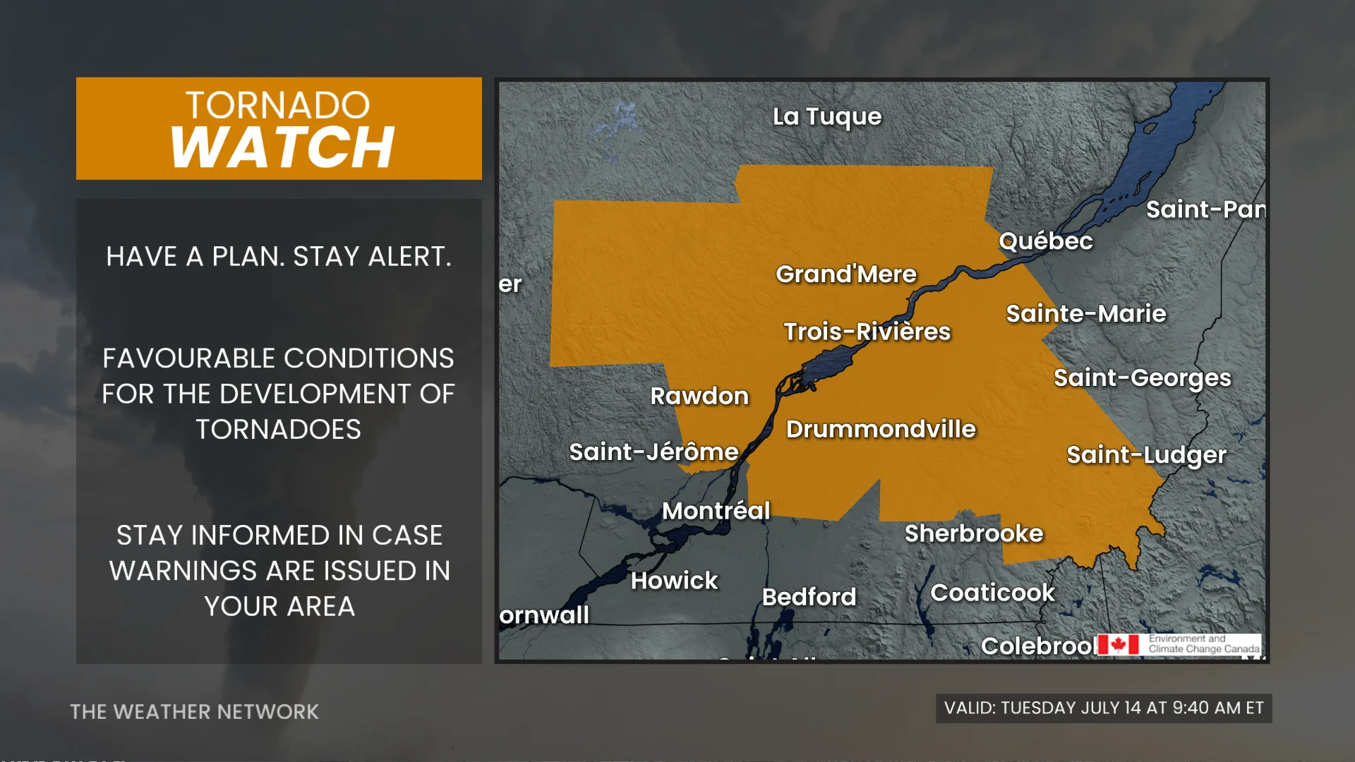
The original article with the full forecast continues below.
A high-impact and severe weather event is projected for the St. Lawrence and Ottawa Valleys on Tuesday. Weather conditions may include torrential rain, large hail up to 4 cm, damaging winds, and the potential for tornadoes.
Regions at risk include the St. Lawrence Valley, Gaspé Peninsula, southern and eastern Quebec—encompassing Montreal, Trois-Rivières, Gatineau, and Quebec City—parts of eastern Ontario, including Ottawa, and northern New Brunswick.
DON'T MISS: How a U.S. heat dome could bring severe summer storms to Canada
Residents across these regions should monitor alerts, and be prepared for the quickly changing and deteriorating conditions.
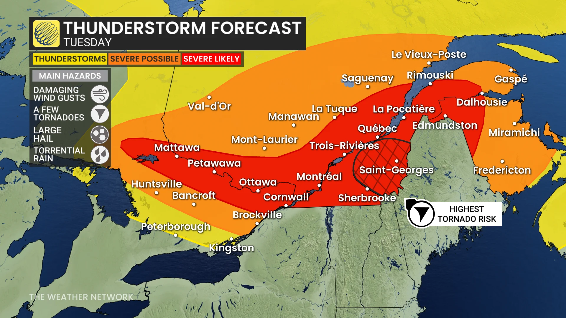
Tuesday: Severe thunderstorm risk for Ottawa region, St. Lawrence, and southern Quebec
Conditions are aligning for a severe weather outbreak on Tuesday, driven by the combination of a hot and humid airmass and a strong atmospheric setup.
Torrential rain locally reaching 30-50 mm in a few hours is expected as storms develop within the high moisture environment.
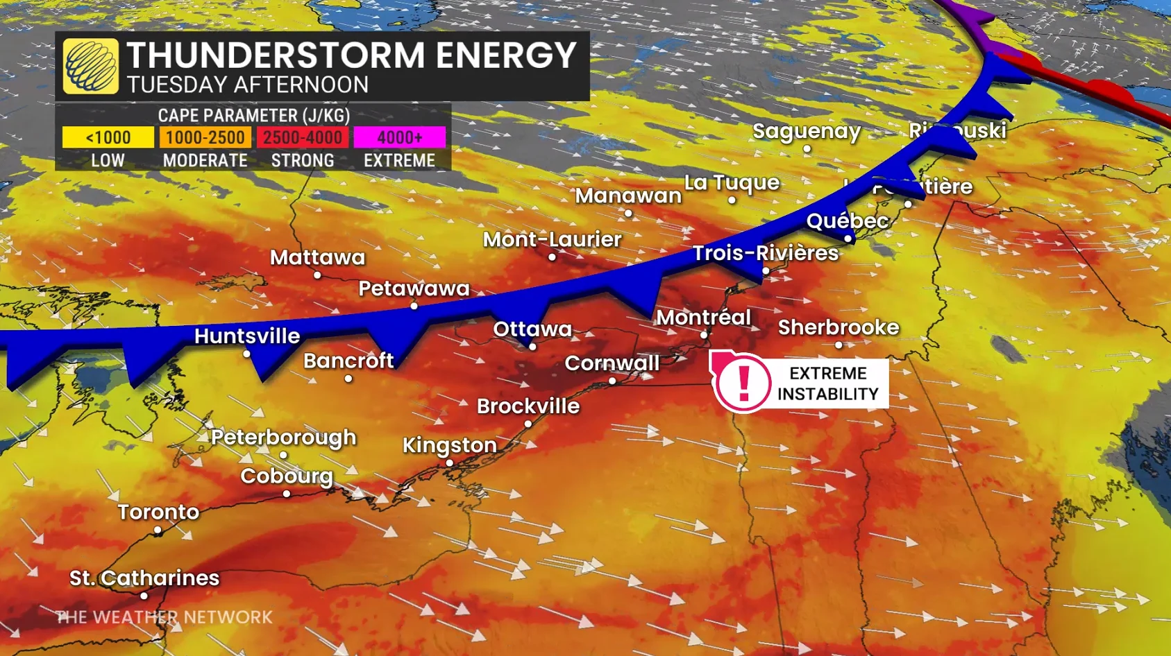
Deep wind shear and increasing atmospheric spin (helicity) later in the day will heighten the tornado risk, with some tornadoes potentially being strong. A robust jet stream from the northeast will enhance storm intensity, supporting large hail up to 4 cm and powerful downbursts. Localized wind gusts between 110-120 km/h are also possible.
DON’T MISS: Tornado season is underway in Canada. Here’s what you need to know
In parts of eastern Ontario and southern Quebec, upper-level dry air may interact with falling rain, triggering rapid cooling and allowing strong jetstream winds to reach the surface. This will increase the risk of damaging winds.
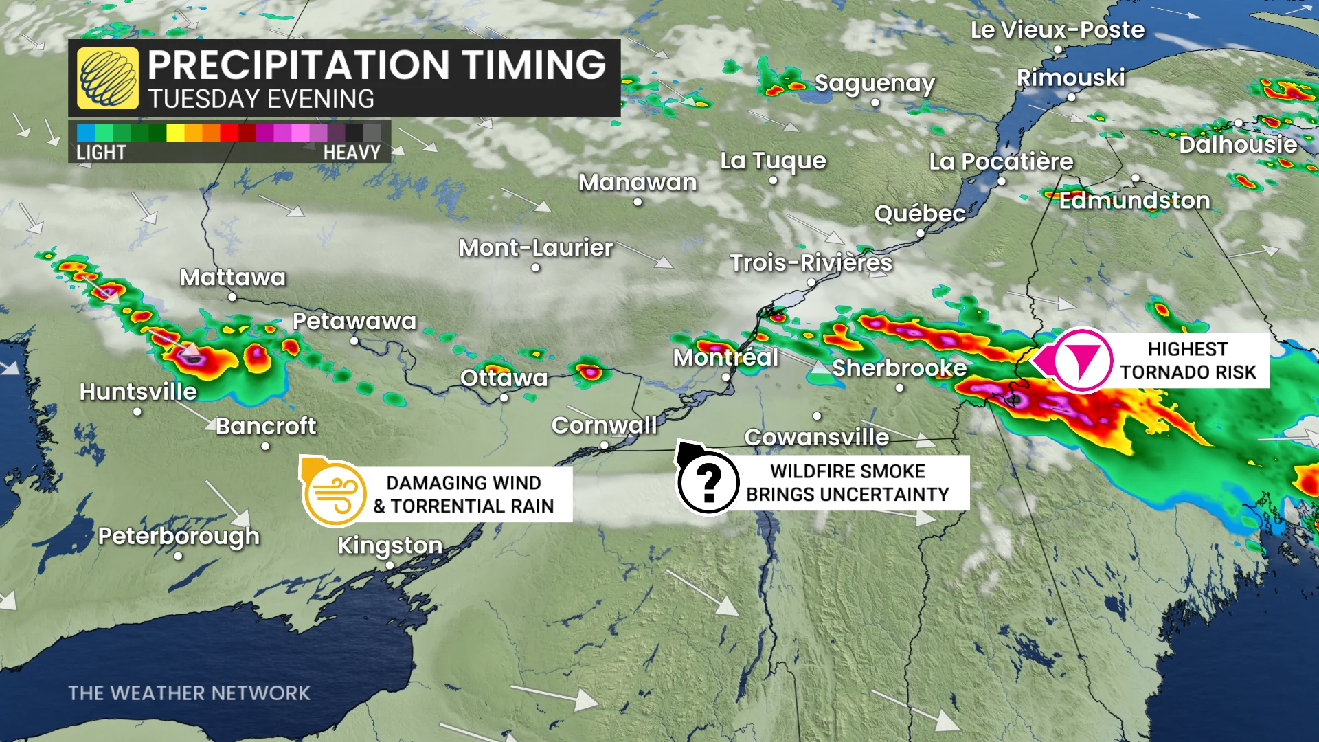
Timing the storms
A sharp cold front will initiate thunderstorms north of the St. Lawrence by 2 p.m. ET, reaching Quebec City and Trois-Rivières by 4-5 p.m. ET.
Storms will intensify, becoming widespread and severe while tracking southeast through the Gaspé Peninsula, northern New Brunswick, and the Eastern Townships by early evening. Southern Quebec and eastern Ontario could see impacts after 5 p.m.
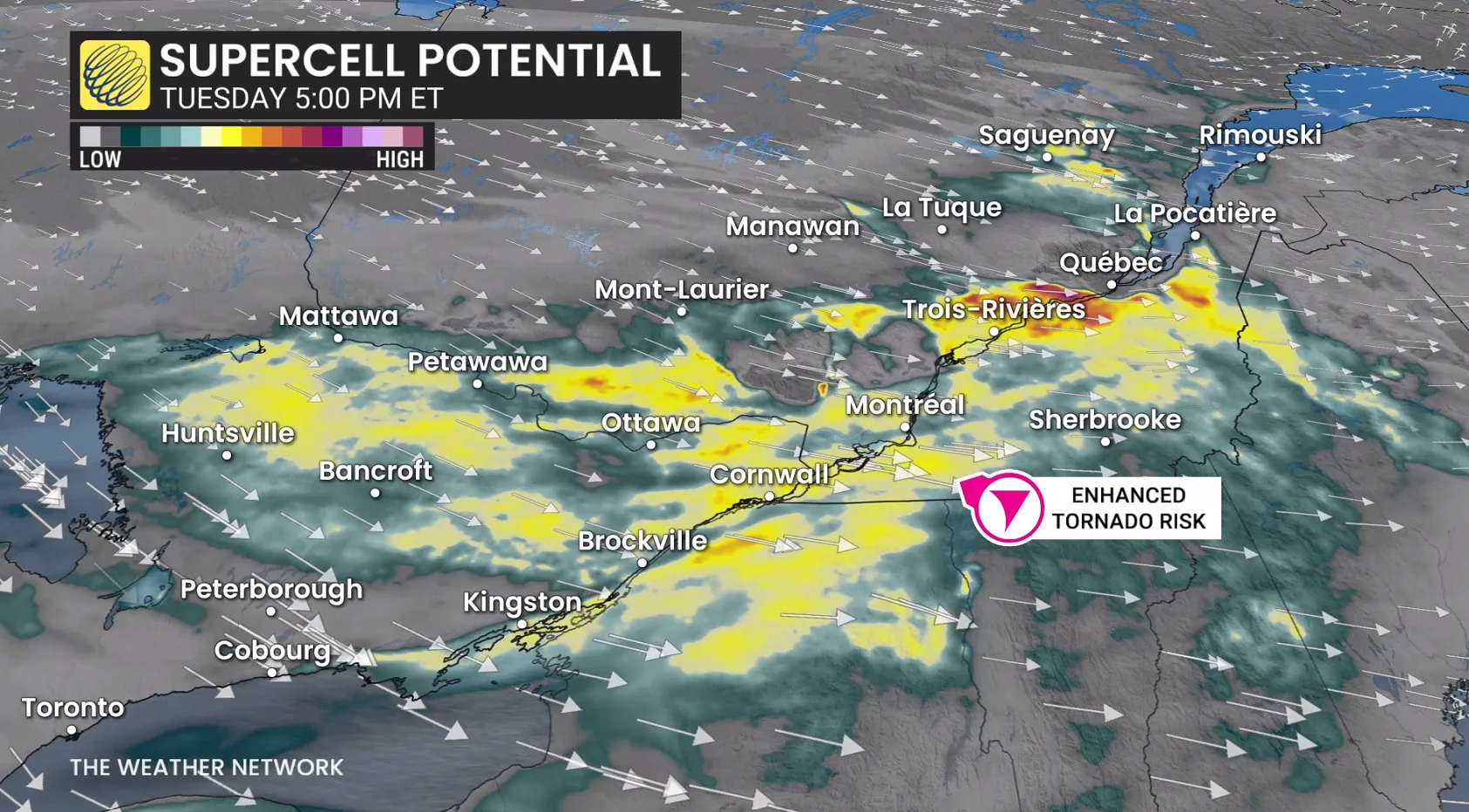
Storm activity will diminish overnight, with more comfortable temperatures arriving Wednesday.
Severe weather safety is paramount
Pay close attention to rapidly changing weather conditions in your area. For tips on what to do in case a tornado warning is issued, click here.
Scout out a safe place to take shelter in your home well before storms approach your location. The safest place is an interior room on the lowest level of the building. The goal is to put as many walls as possible between you and flying debris.
If you’re in a vehicle and a tornado warning is issued, pull over at the nearest sturdy shelter. Never try to outrun a tornado.
Residents in impacted areas are urged to keep cell phones charged ahead of the storm in case of any power disruptions or outages to receive weather alerts (click here to see how to turn on alert notifications from The Weather Network app).