Thunderstorms to wet flurries: A tale of two seasons on the Prairies

Thunderstorm season will get started for parts of the Prairies this weekend, including a severe risk, but it will just be a short taste as wintry weather returns with cooler temperatures and wet flurries for some by Sunday night.
After a surge of summer-like warmth this week on the Prairies, a reversal of fortunes is anticipated as the weekend progresses. It will start off with fleeting warmth for parts of the region -- the remnants of the past few days -- mixed in with the risk of thunderstorms, potentially severe for some, but will end with noticeably cooler temperatures and the chance of wet flurries for southern Alberta as the cooldown continues. More on the storm threats and what else to expect this weekend, below.
SEE ALSO: Toilet explodes after powerful lightning bolt zaps through ceiling
THIS WEEKEND: FLEETING WARMTH GREETED BY SEVERE STORM THREAT, RETURN OF SNOW?
Parts of the Prairies saw temperatures soar into the mid-high 20s this week, but a different taste of summer is coming.
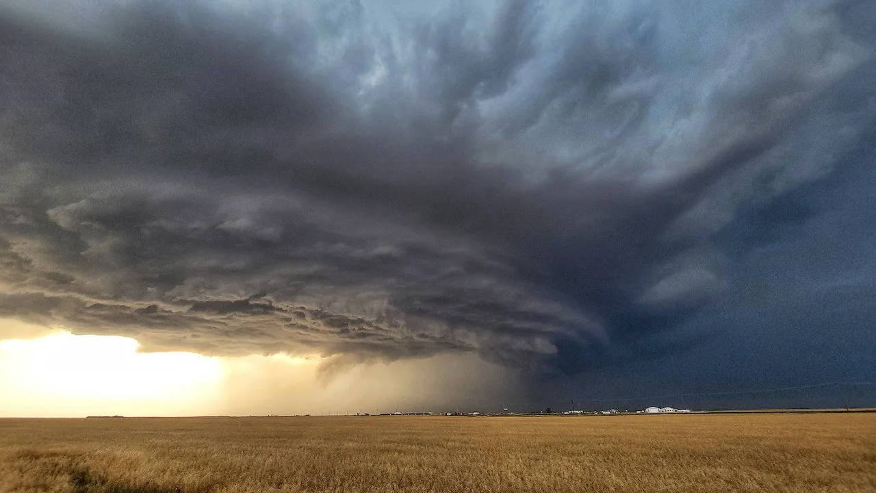
On Saturday, there is a risk of sever thunderstorms in the east. The general threat for storms will stretch from southern Alberta to northern areas of Saskatchewan and Manitoba. The chance for severe storms will encompass southeastern Saskatchewan and southwestern Manitoba, with pockets in parts of northern sections, as well.

There has only been one severe thunderstorm warning in southeastern Manitoba this year -- April 23 - the only in one Canada, in fact. But that is likely to change as there is the risk for severe thunderstorms Saturday. The main threats with these storms will be strong wind gusts and the risk of large hail.
Saturday will see the cooldown reach Saskatchewan, with temperatures dipping down to the mid-teens, while the lingering warmth remains in southern Manitoba where daytime highs remain in the low 20s. By Sunday, the 20-degree weather will be all but gone from the Prairies.
Sticking with what is reality for Alberta in spring thus far, we're talking about the risk for thunderstorms in southern sections over the weekend, with snow in the foothills and northern Alberta. However, come Sunday night into Monday, those thunderstorms in southern Alberta will be replaced with wet flurries as temperatures drop.

As well, another system is expected early next week. Low confidence in the storm track, but unfortunately it appears that this will bring more rain to the areas that are recovering from flooding and miss the areas where it is needed most. More unsettled weather is expected later in the week with the potential to impact areas farther to the west.
LOOK AHEAD: A TASTE OF SUMMER MAY HAVE BEEN A TEASE
This sample of summer-like warmth isn’t long for the world. Make sure you get out and enjoy it while it lasts, because it looks like the pattern will start to flip toward the cooler side of seasonal heading into the middle of the month.
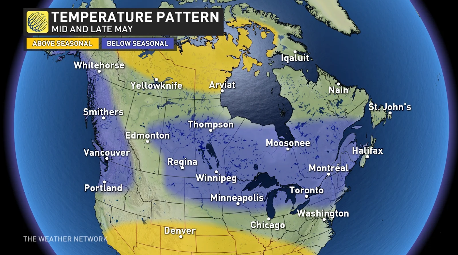
“Our forecast for mid- and late May calls for temperatures to be near or slightly cooler than normal across most of Canada,” according to Dr. Doug Gillham in his exclusive May outlook for The Weather Network.
It’s not all bad news, he adds.
“However, while there is a lot of blue on the map, we don’t expect that temperatures will be far off of seasonal across these regions. Also, keep in mind that ‘seasonal’ steadily climbs through the month. Even a cool May will include many days of pleasant spring weather.”
Stay tuned to The Weather Network for the latest updates across the Prairies.