Thunderstorms roll across the Prairies, severe risk in Alberta

July’s final cold front advances through the Prairies and is bringing the risk for thunderstorms with it
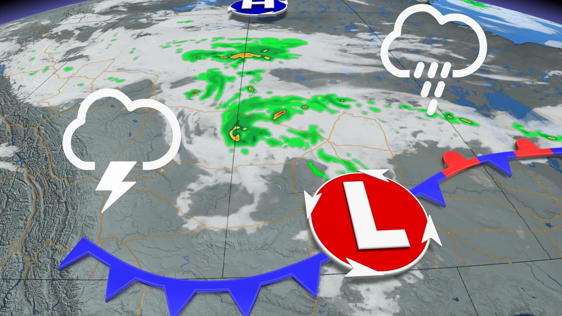
The heat has asserted itself across the Prairies for most of July. The sweltry temperatures sustain even after a fairly active month of weather trying to knock it down. To end the month, another cold front is going to try to break the heat creating the risk for thunderstorms through Friday. To see what to expect from this system, read below.
MUST READ: There's a mustard seed shortage due to low yield on the Prairies
Friday: Severe weather possible in the foothills, isolated thunderstorms across the Prairies
A cold front sinking from the northern Prairies paired with the ongoing heat has created a risk of thunderstorms Friday. Central Saskatchewan could have isolated thunderstorms throughout the day. The scattered storms will also rollover into parts of Manitoba as the recent warm weather has spread into the province.

The most severe risk of storms will be in southern Alberta. Later in the afternoon and into the evening, the southern foothills could see the most active weather with the risk of severe thunderstorms in the region. Large hail and strong wind gusts could possibly form as the system progresses.
The risk continues for Saturday on the Prairies. Alberta may experience isolated showers and thunderstorms throughout the day in the southern regions of the province. Southern Saskatchewan can expect much of the same, though there is a chance that storms could become stronger in that locality.
For the full Prairies forecast, watch the video above.