Thunderstorm threat continues on the Prairies after mid-week tornadoes

After a day of tornadoes and large hail, another system brings risk of storms and strong winds to the Prairies Thursday
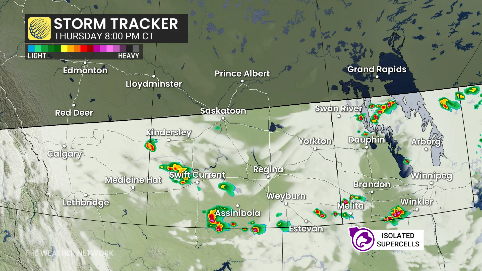
Severe thunderstorms are forecast to move into southern Manitoba and the Interlake regions late Thursday afternoon and evening.
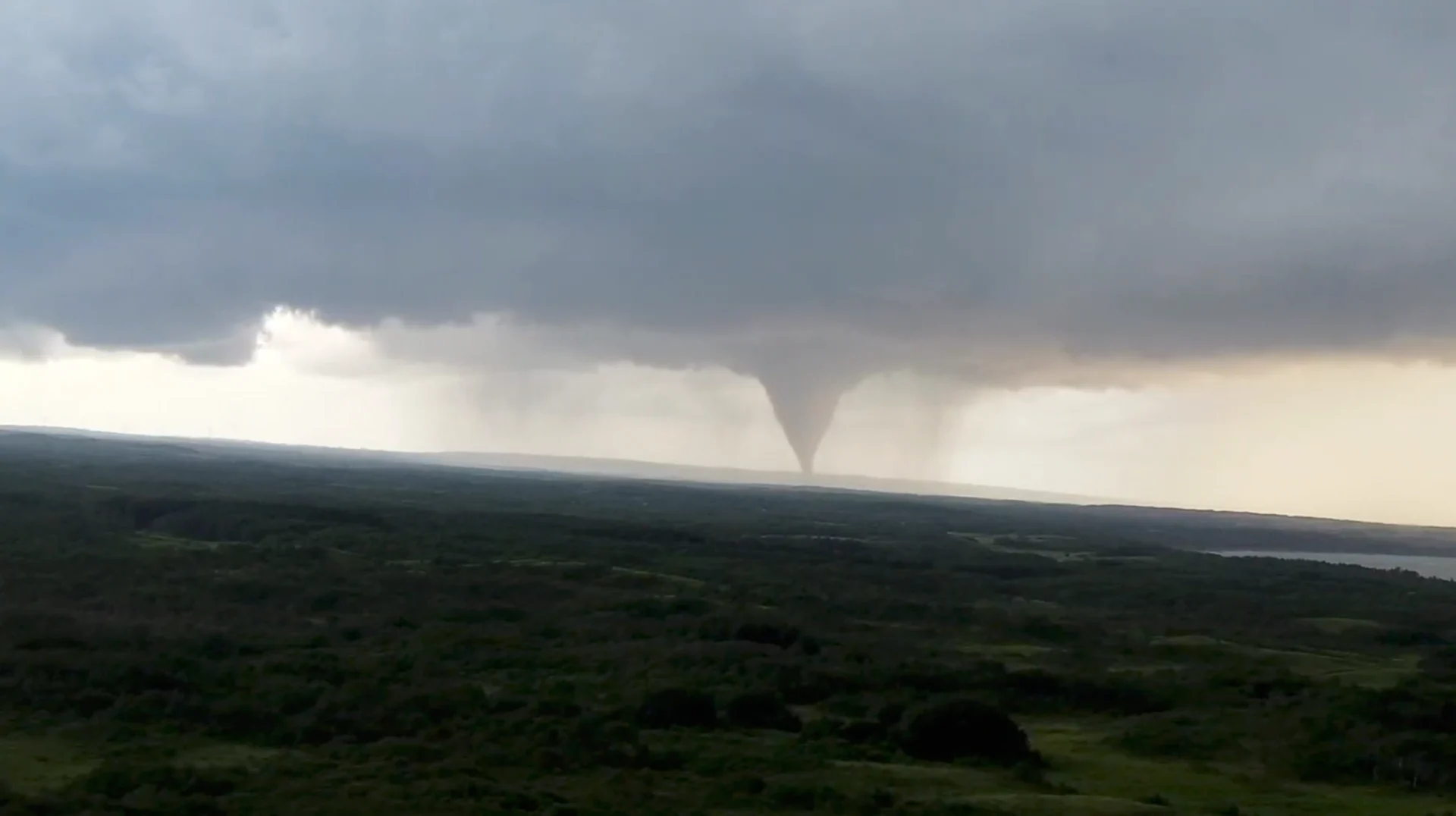
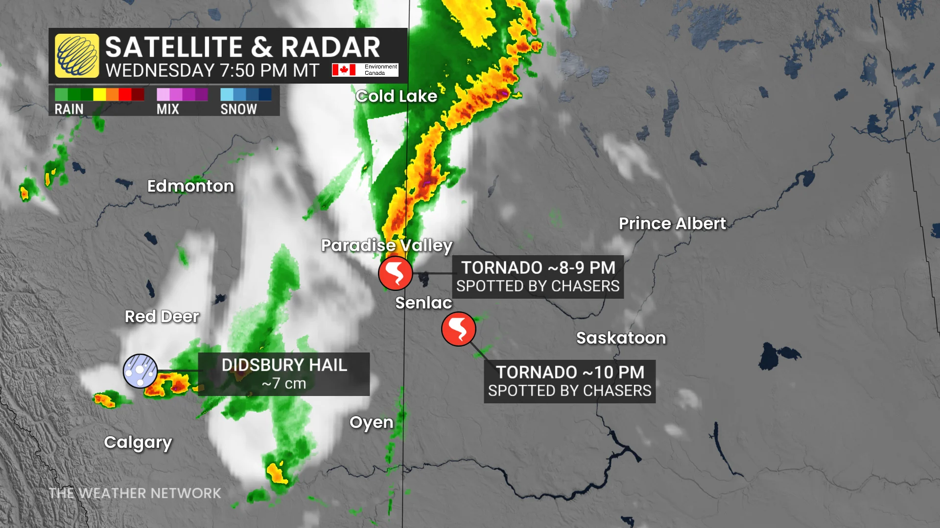
This system follows Wednesday's storm activity that triggered two tornadoes and large hail in central Alberta and Saskatchewan, documented by storm chasers.
SEE ALSO: The pros and cons of an El Niño summer
The Northern Tornadoes Project (NTP) confirmed the first tornado was reported southwest of Paradise Valley, Alta., with no damage reported so far.
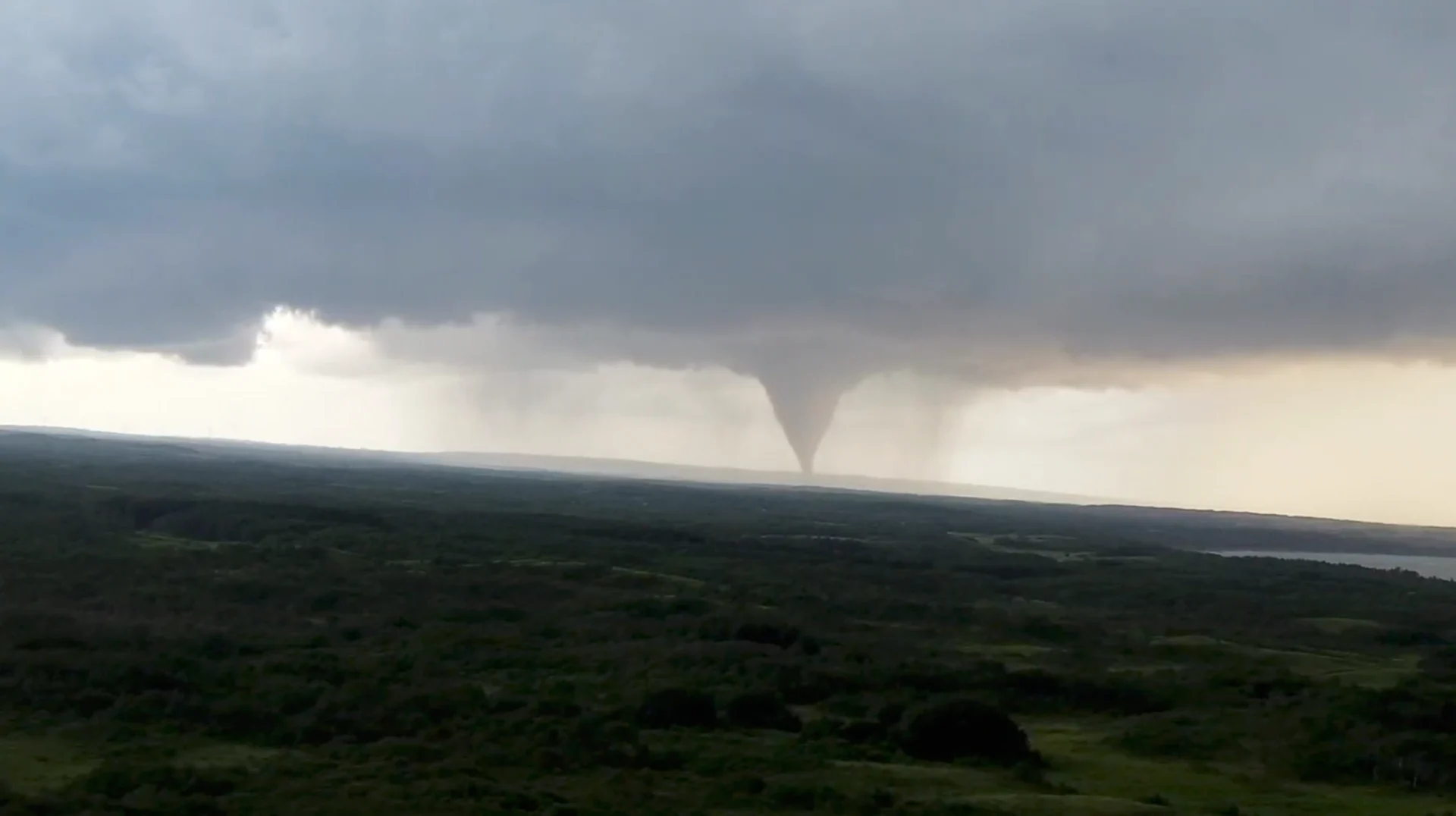
Drone captures tornado in Chauvin, Alberta, on July 8, 2026. (Braydon Morisseau/provided)
The second tornado, southeast of Chauvin, is believed to have impacted a provincial park. It caused tree damage, flipped trailers, and resulted in minor injuries. Search and rescue efforts are ongoing in the affected area.
Stay weather-aware if travelling in areas under severe storm risk Thursday, and keep informed of local alerts.
Severe thunderstorms to impact Manitoba Thursday
As the storm environment shifts eastward Thursday, southern Manitoba can expect severe conditions, including large hail, damaging winds, and the potential for an isolated tornado. The primary storm mode is expected to feature isolated supercells.
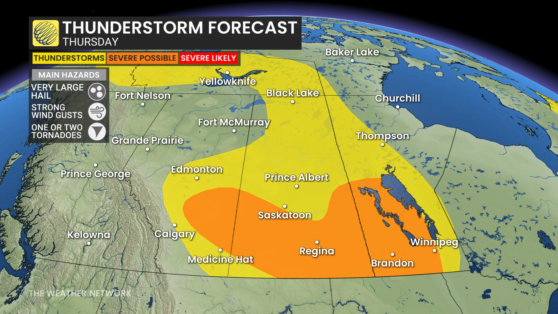
In addition, a few supercells are possible east of Calgary, progressing into southern Saskatchewan.
DON'T MISS: A normal July brings Canada drought, downpours, and dizzying heat
Similar threats remain in these areas as seen on Wednesday: very large hail, severe winds with gusts up to 110 km/h, and an isolated tornado threat.
WATCH: Storm chaser captures multiple tornadoes on the Prairies
Weekend outlook: U.S. heat dome expands into the southern Prairies, active storm track for central Alberta and Saskatchewan
A strengthening heat dome from the U.S. will begin to push into southern Prairie regions on Friday. Temperatures are expected to soar into the mid-30s, with humidex values reaching the 40s on Saturday and Sunday.
This pattern shifts the active storm track through central Alberta and Saskatchewan. A surface low and trough are set to trigger thunderstorms beginning Friday afternoon, with large hail identified as the primary threat. Storms are expected to develop along the foothills before tracking northeast toward Edmonton.
DON'T MISS: Thick wildfire smoke is on the move and impacting parts of B.C. and Alberta
Wildfire smoke from British Columbia’s Brunswick Creek wildfire may influence storm development in affected areas, so stay informed on visibility and air quality conditions.
Stay with The Weather Network for all the latest on conditions across the region.
WATCH: In a tornado warning? Here’s what you should do
Thumbnail image courtesy: Braydon Morisseau/X