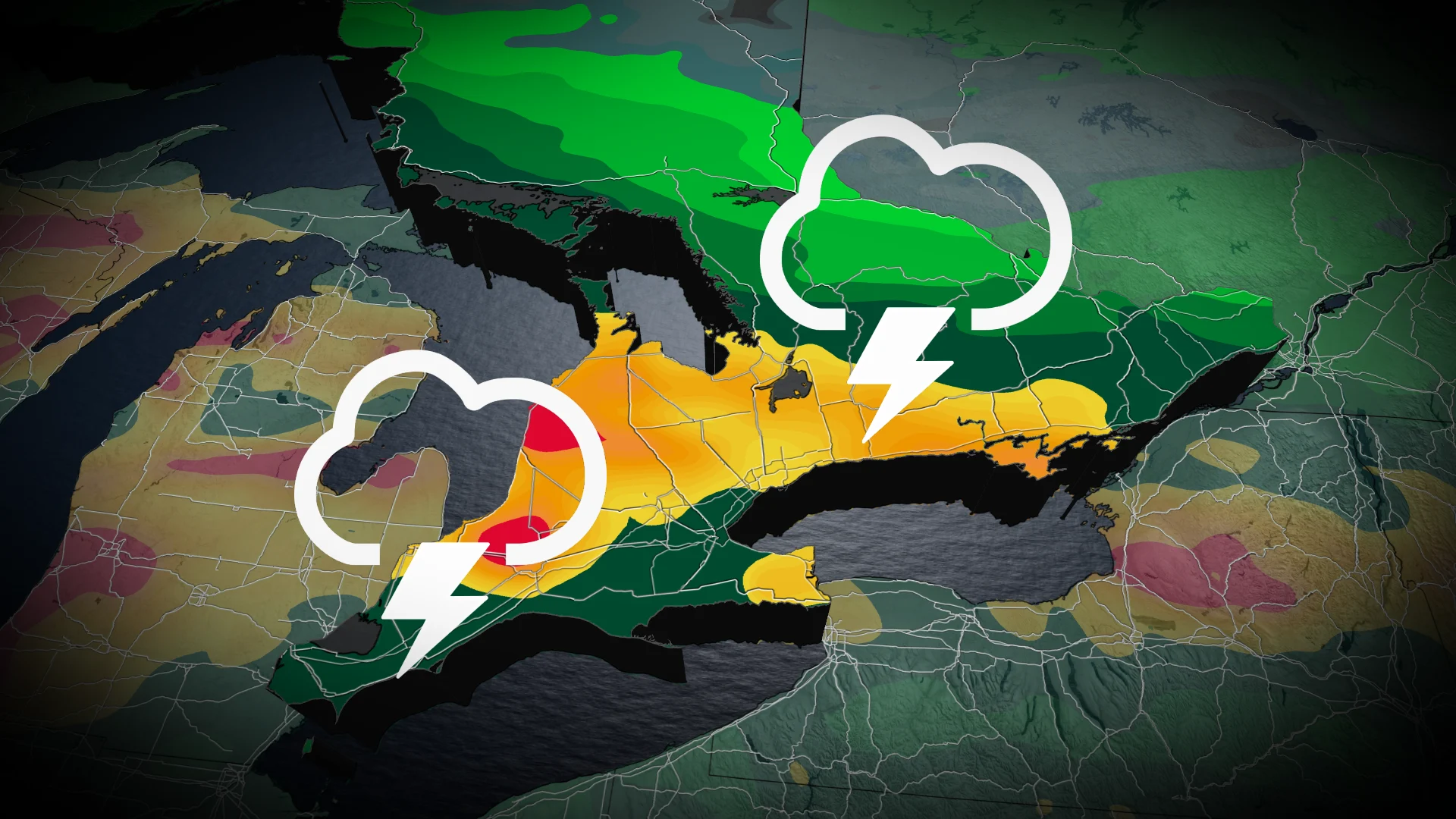
Thunderstorm risk creeps into southern Ontario as air mass turns muggy

A U.S. heat dome is creating a ring of fire, bringing parts of southern Ontario the threat of severe thunderstorms, gusty winds, and heavy rain on Tuesday
Humidity marks its return to southern Ontario this week as summer plays out the final days in the season.
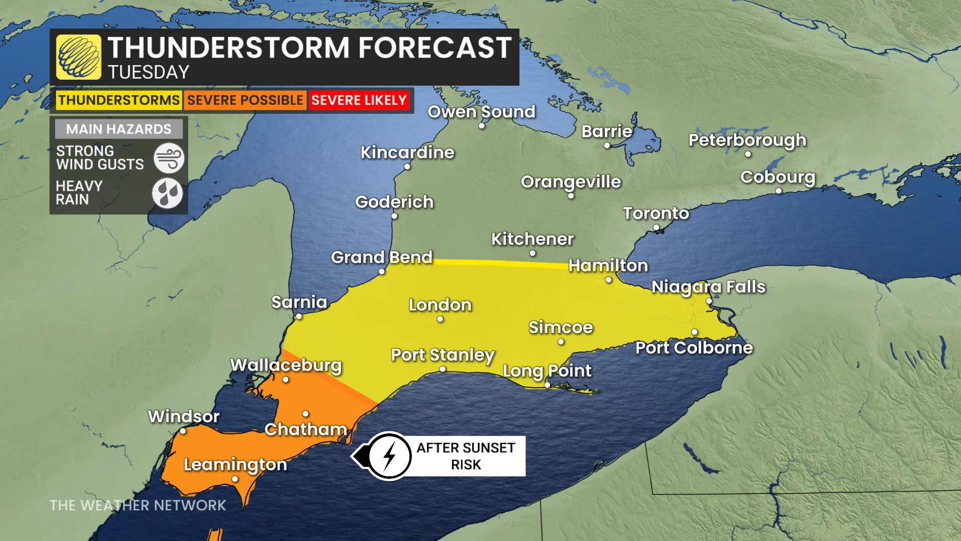
With southern Ontario's inclusion in the ring of fire situated south of the border, with very hot and humid conditions situated over the Mississippi Valley, folks can expect to see rain and a thunderstorm risk on Tuesday. Some of the storms, in the extreme southwest, could reach severe limits.
Visit our Complete Guide to Fall 2026 for an in depth look at the Fall Forecast, tips to plan for it and much more!
Be sure to stay alert to the changing conditions, and check for any weather warnings in your area.
Sticky air mass as summer not ready to depart, yet
A surface high established over the southern Mississippi Valley means a hot and humid air mass over it and the Southern Plains.
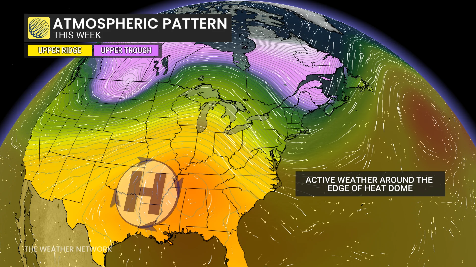
As a result, the muggy and unsettled air mass will be transported into parts of southern Ontario.
Temperatures across southern Onario will be into the mid-20s, but will feel like the high 20s with the humidex.
Humidex values will be even higher in the southwest, which will feel more like the low- to mid-30s.
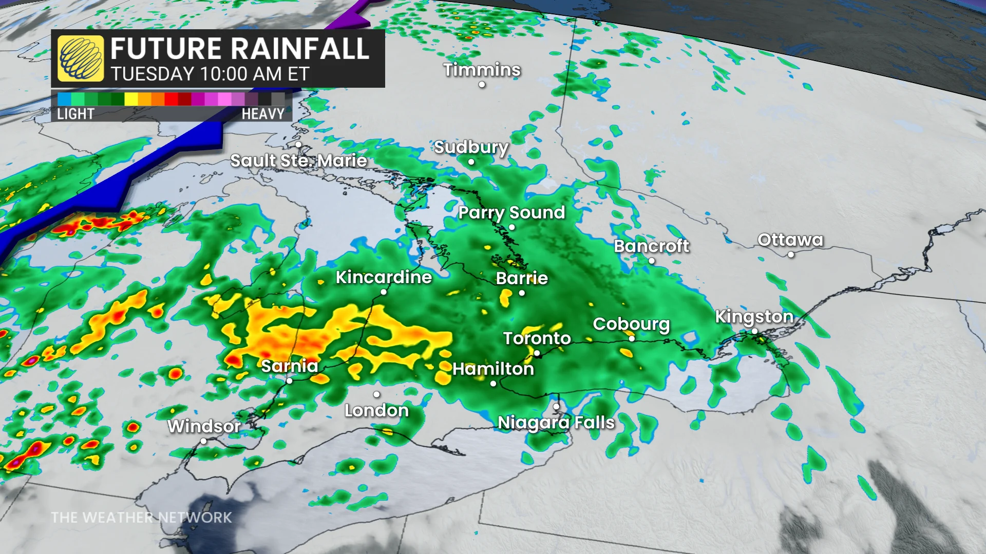
Eastern Ontario will only see a brief, muggy day on Tuesday, where temperatures will stay below seasonal. Values will remain in the high teens and low 20s this week.
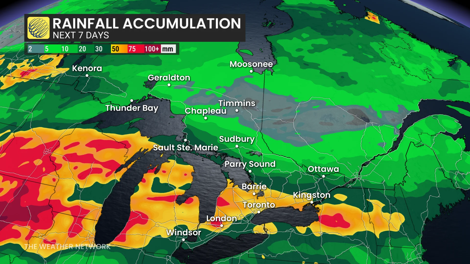
Widespread showers are expected Tuesday morning as a frontal system approaches. The thunderstorm risk starts in the afternoon and will linger to the overnight hours across southwestern Ontario.
Localized flooding is possible thanks to the moisture-laden air mass, especially if you are caught by a thunderstorm.
The stalled, frontal boundary will do the southern Ontario wiggle as it meanders a little north and south.
This will lead to high uncertainty in the exact temperature and precipitation forecast.
Areas north of the front it will be generally dry and warm, but for those underneath it will be warm, muggy, and potentially unsettled.
Folks south of the front will be hot and muggy.
The air mass will be drier and slightly cooler after the boundary exits.
A few days of cooler weather are expected early next week but warmer weather is expected to return during the second half of the week. Warmer-than-normal temperatures should dominate during the final week of September.
Stay tuned to The Weather Network for the latest forecast updates for Ontario.