Heavy rain, thunderstorms to sweep southern Ontario on Saturday
Outdoor plans may require adjustments this Easter long weekend in Ontario
One down, one to go. A second Colorado low tracking into the Great Lakes region will bring a renewed opportunity for heavy rainfall and thunderstorms to begin the weekend.
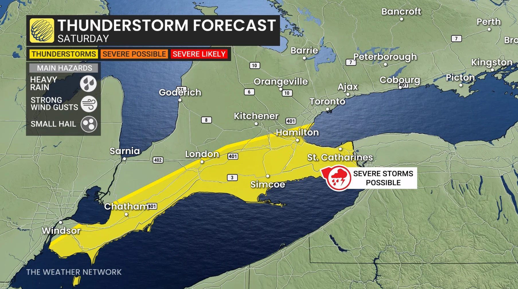
A few of the storms on Saturday could turn severe. Watch out for warnings and rapidly changing conditions in your area.
DON'T MISS: Will Canada's April bring a summer preview or a winter rewind?
Weather Highlights
Mild weather holds on through the first half of Saturday
Widespread rainfall warnings are in effect to start the weekend
Thunderstorms may turn severe in spots through Saturday afternoon
Wintry conditions spread into the region again by Sunday
Heavy rainfall, thunder risk arrives Saturday
We’ll see rainfall spill across southern Ontario beginning on Saturday morning as the low-pressure system moves into the region.
RELATED: How Colorado lows and Texas lows affect our weather in Canada
A cold front approaching through the afternoon hours will trigger another round of thunderstorms from southwestern Ontario through the Niagara Peninsula.
Several of the storms around Niagara could turn severe, posing a risk for heavy rainfall, strong wind gusts, and small hail.

Rainfall warnings remain in effect through Saturday as an additional 10-30 mm of rain is on the way. Locally higher totals may fall in thunderstorms. The combination of heavy rainfall and saturated ground may increase the flood risk in some areas.
Things will change in a hurry behind this cold front. Temperatures will tumble back into the single digits by Sunday, with the chance for a wintry mix spreading across southern Ontario.