After another surge of warmth, a weekend cooldown with some snow beckons

From balmy warmth to winter snows in 48 hours, people in southern Ontario should prepare for a few centimetres this weekend.
Friday's daytime highs might still be above normal after Thursday's surge of warmth (accompanied by strong winds), but the weekend will feel quite a bit more like the seasonal norm. Adding to the more typically winter-like atmosphere will be some wet snow, thanks to a system moving south of the Great Lakes. Some 5-10 cm is possible over much of the south of the province, something for travellers to keep in mind. See below for a more detailed look.
INTO THE WEEKEND: TEMPERATURES FALL, CHANCE FOR WIDESPREAD SNOW
People across southern Ontario experienced another round of strong winds Thursday which, though not as potent as the previous windstorm of a few days ago, still left a few thousand outages in their wake, with some 23,000 customers still in the dark at around 7:30 p.m.
The upside was another surge of warmth, and temperatures, though down from Thursday, will remain a few degrees above seasonal on Friday. But a widespread cooldown arrives shortly after for the weekend. Daytime highs will fall back to seasonal or even a few degrees below that.

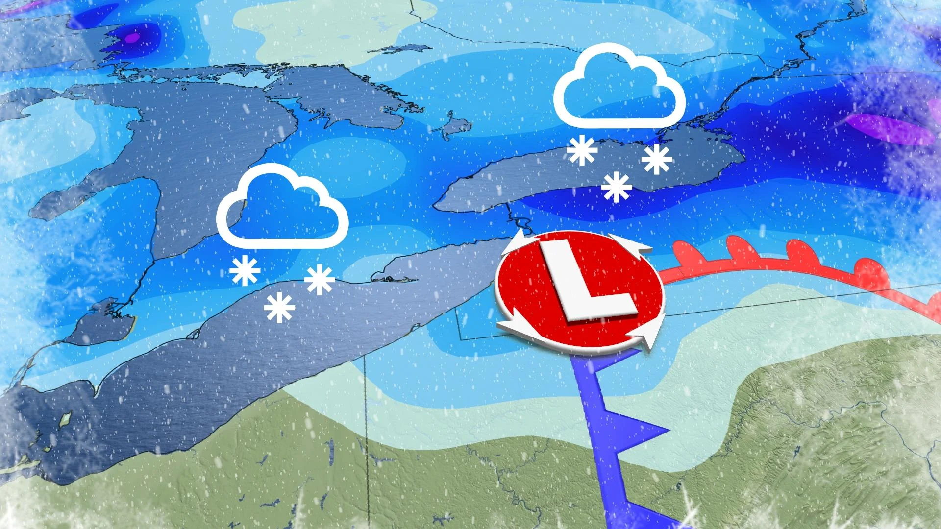
Something else for people across the region to watch: a system is set to track south of the Great Lakes on Saturday, with wet snow and a gusty northeast wind expected across much of southern Ontario and Quebec.
"Currently we have widespread snow totals of 5-10 cm for the GTA through to the Montreal area – not a major storm, but this will have a significant impact on roads and highways during the final weekend for shopping before Christmas," says Dr. Doug Gillham, a meteorologist at The Weather Network. "Higher snow totals are likely across the Eastern Townships, which will be good news for ski areas heading into the holidays."

While the pattern next week looks to be more seasonal, changeable conditions are still expected, with exact storm tracks being the key to a white Christmas.
"There's a higher chance for fresh snow north of the Greater Toronto Area and into Ottawa and Montreal," Gillham says. "There's also a higher confidence in a more wintry pattern between Christmas and New Year’s and continuing through early January."
Be sure to check back for the latest updates on the changeable pattern across Ontario.


