This blocking pattern may deliver Canada its hottest reading of 2026
Temperatures are set to rise as a wavy pattern develops over Canada for the final days of May
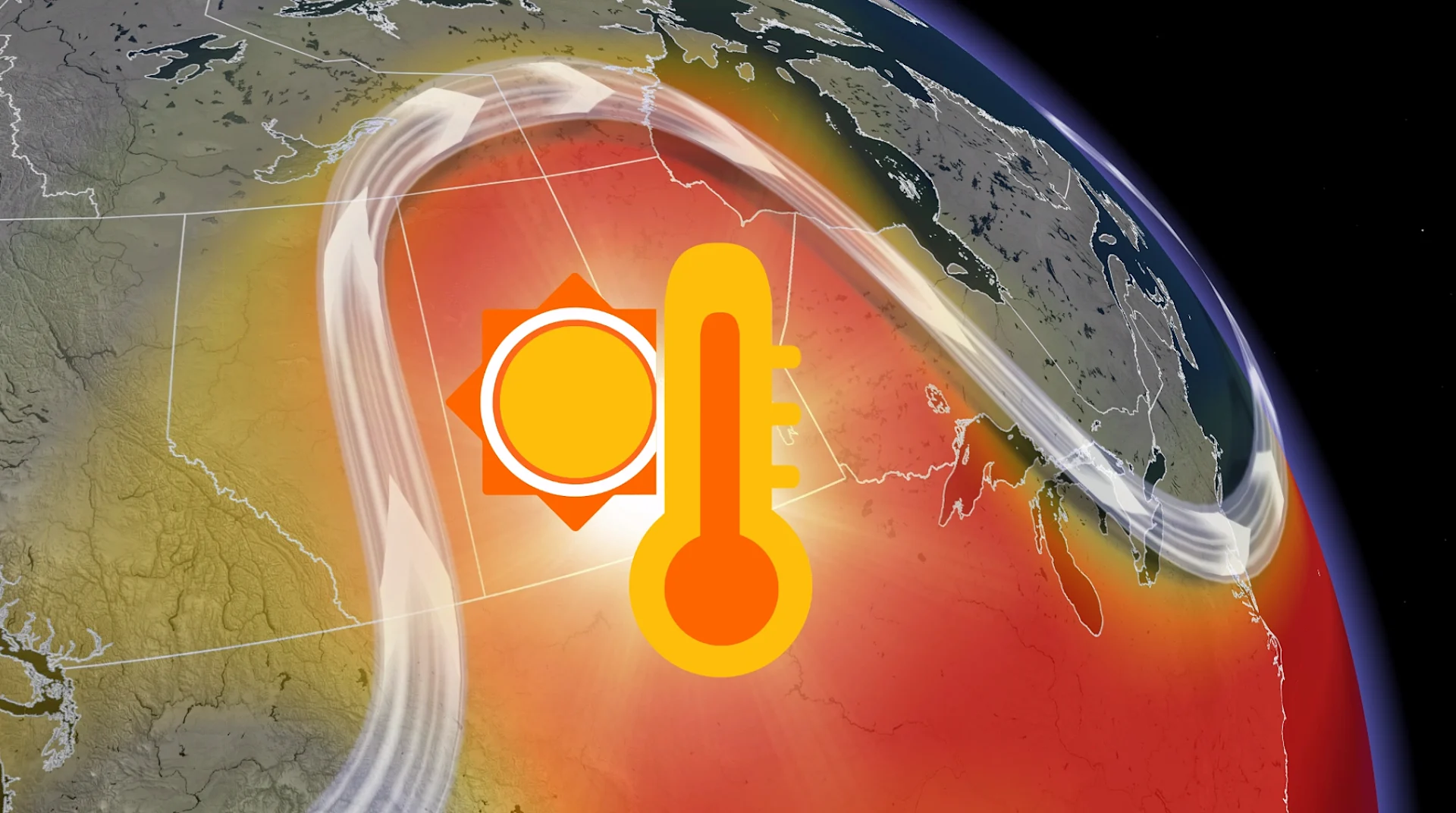
A heat wave is in the cards for parts of Canada heading into the final days of May as a blocking pattern sets up high above the country.
This spell of heat will see daytime temperatures rise into the 30s alongside sticky humidex values.
DON'T MISS: Canada's end to May: Who will get the head start on summer?
Jet stream arches over the centre of the country
The short-lived pattern expected to build over Canada next week is known as an omega block, named for its striking resemblance to the Greek letter omega.
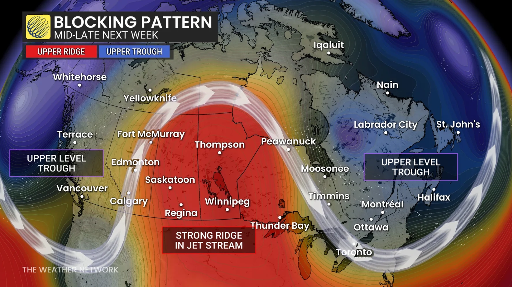
An omega block occurs in the upper levels of the atmosphere when a ridge of high pressure gets bookended by two troughs. Similar to a kink in a garden hose, this wavy pattern can be tough to dislodge and linger for days as a result.
Above-seasonal temperatures are common beneath strong ridges of high pressure, and we’re set to see readings soar across the eastern Prairies during the latter half of next week.
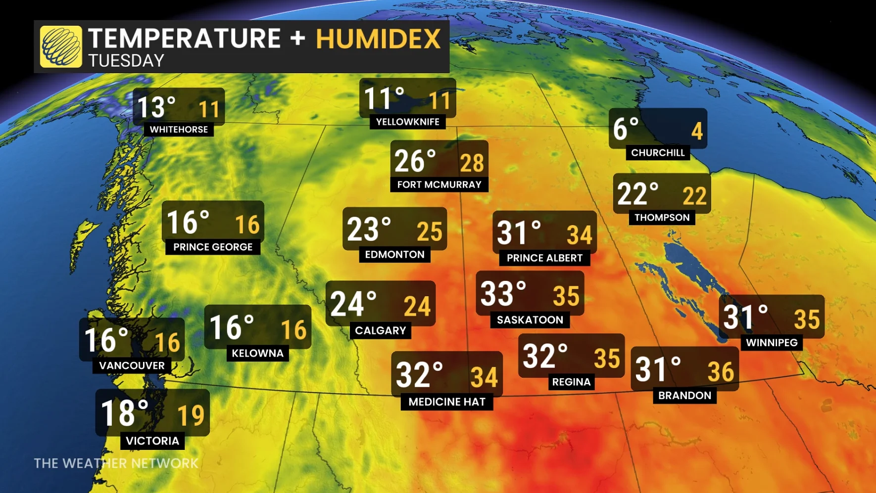
Temperatures and humidity set to rise on the eastern Prairies
The warmest temperature recorded in Canada so far in 2026 was a 33.5°C reading in Lytton, B.C., back on May 5. That national milestone could be in jeopardy during this upcoming heat wave, most likely in southern Saskatchewan.
Temperatures on the southern Prairies are forecast to climb into the low to mid 30s by Monday, remaining there through the middle of the week and possibly beyond.
RELATED: Why extreme heat is one of the world’s deadliest weather disasters
Humidex values will also climb through next week with increased atmospheric moisture, making conditions feel like the mid- to possibly even upper-30s. Humidity makes it harder for our sweat to evaporate, making the muggy heat more impactful on our bodies.
We’ll see the warmth attempt to nudge east into Ontario, where temperatures will likely rise into the 20s for a few days. However, the cool and unsettled trough over the Atlantic provinces may result in periods with warmer temperatures across northern portions of Ontario and Quebec than in southern parts of the provinces.
Stay with The Weather Network for all the latest on your forecast across Canada.