Summer's last long weekend sees reversal of weather fortunes in Canada

The Labour Day weekend is upon us, and that means the end of summer is just around the corner. Here's what you can expect weather-wise across the country for the season's final holiday weekend
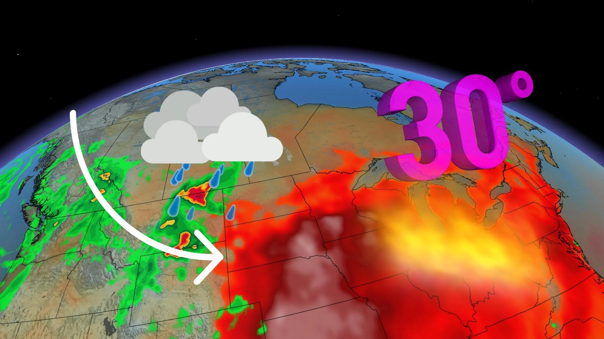
As we head into the Labour Day long weekend, with an unofficial goodbye to summer, we’re going to see a pattern reversal across the country that will make millions of Canadians happy and millions of others, well, maybe not as joyous.
SEE ALSO: Where’s the heat? Many Canadian cities failed to hit 30 degrees in August
Cooler temperatures will be replaced with warmth over the long weekend in Eastern Canada whereas a cooldown will take hold in the West.
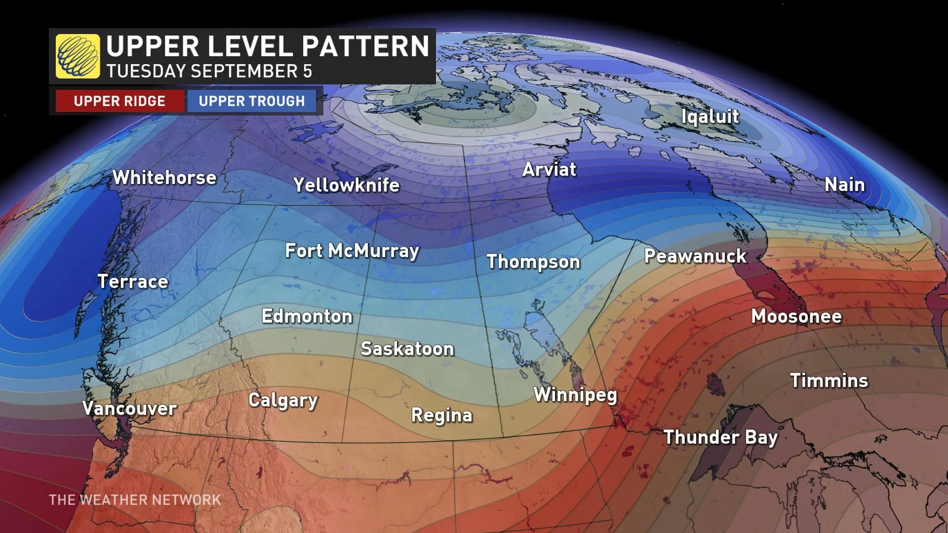
Pattern flip sees a warm East and a cool West
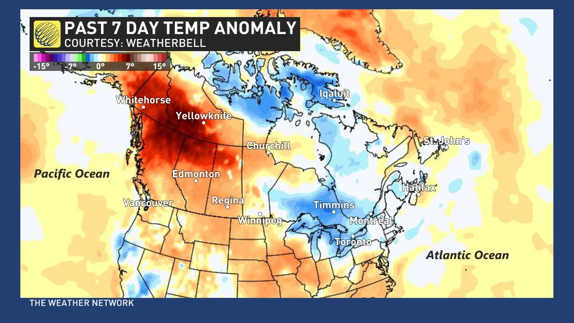
Looking at this past week across the country, there was a contrast with warmth in the West and below-seasonal temperatures in the East.
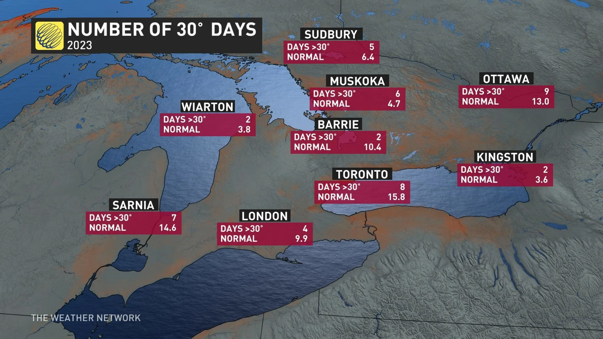
Many places in southern Ontario and Quebec have gone all of August without reaching 30°C. The last time that occurred was in 2008 for Toronto's Pearson Airport, and has only occurred seven times since 1938.
It happens a bit more frequently in Montreal, Que., with the occurrence in 2017. However, that ties (four-way tie with 1982, 1976, 1964) it with being the second-coldest high temperature for Montreal, which only reached 28.3°C. The coldest, maximum monthly temperature was 27.8°C in 1972.
Western cities that reached 30°C in August
Brandon, Man.: Four days
Saskatoon, Sask.: Six days
Calgary, Alta.: Six days (maximum was 33.8°C)
Edmonton, Alta.: Two days
Abbotsford, B.C.: Two days
Campbell River, B.C.: Seven days (maximum was 35.°C)
WATCH: Hottest weather of the summer heading to Eastern Canada
When the switch will occur
Temperatures will start to get into the mid-high 20s for Ontario and Quebec this weekend, with the Maritimes jumping into the mid-20s. But that’s not where the heat stops.
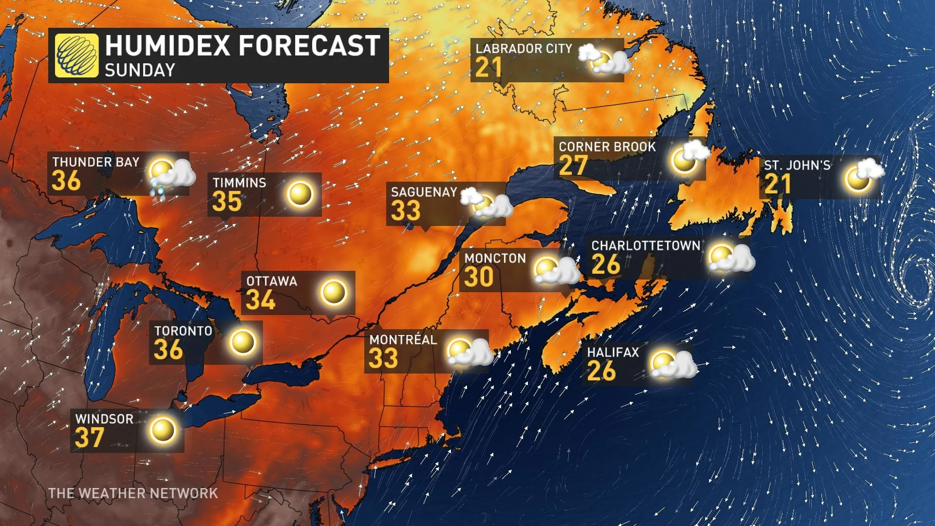
Temperatures will continue to rise next week.
Toronto, Ottawa, and Montreal are forecast to reach the 30°C mark, the first time in a while. For Toronto, that was July 28. For Ottawa, that was July 11. For Montreal, that was July 6.
The heat will continue through the entire week. The Maritimes will also continue to climb but only into the high 20s. However, it could be possible for a 30°C to creep into New Brunswick.
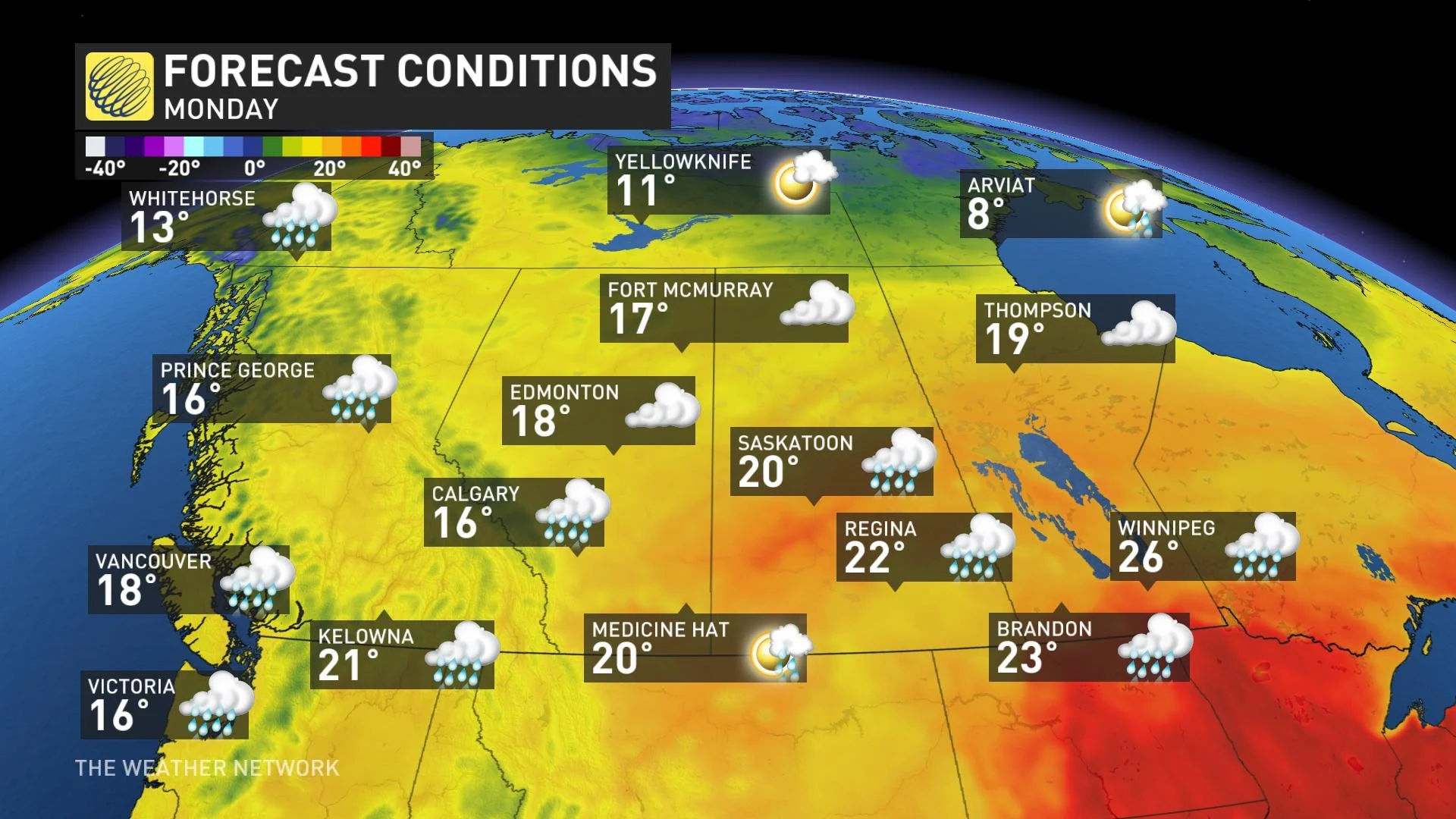
For Western Canada, it was already mentioned it will cool down over the weekend. For coastal B.C., the weekend will start off with temperatures in the low 20s. But then that will quickly change, making it difficult for the region to even hit the 20-degree mark.
SEE ALSO: Why the air quality index needs an upgrade to better measure wildfire smoke
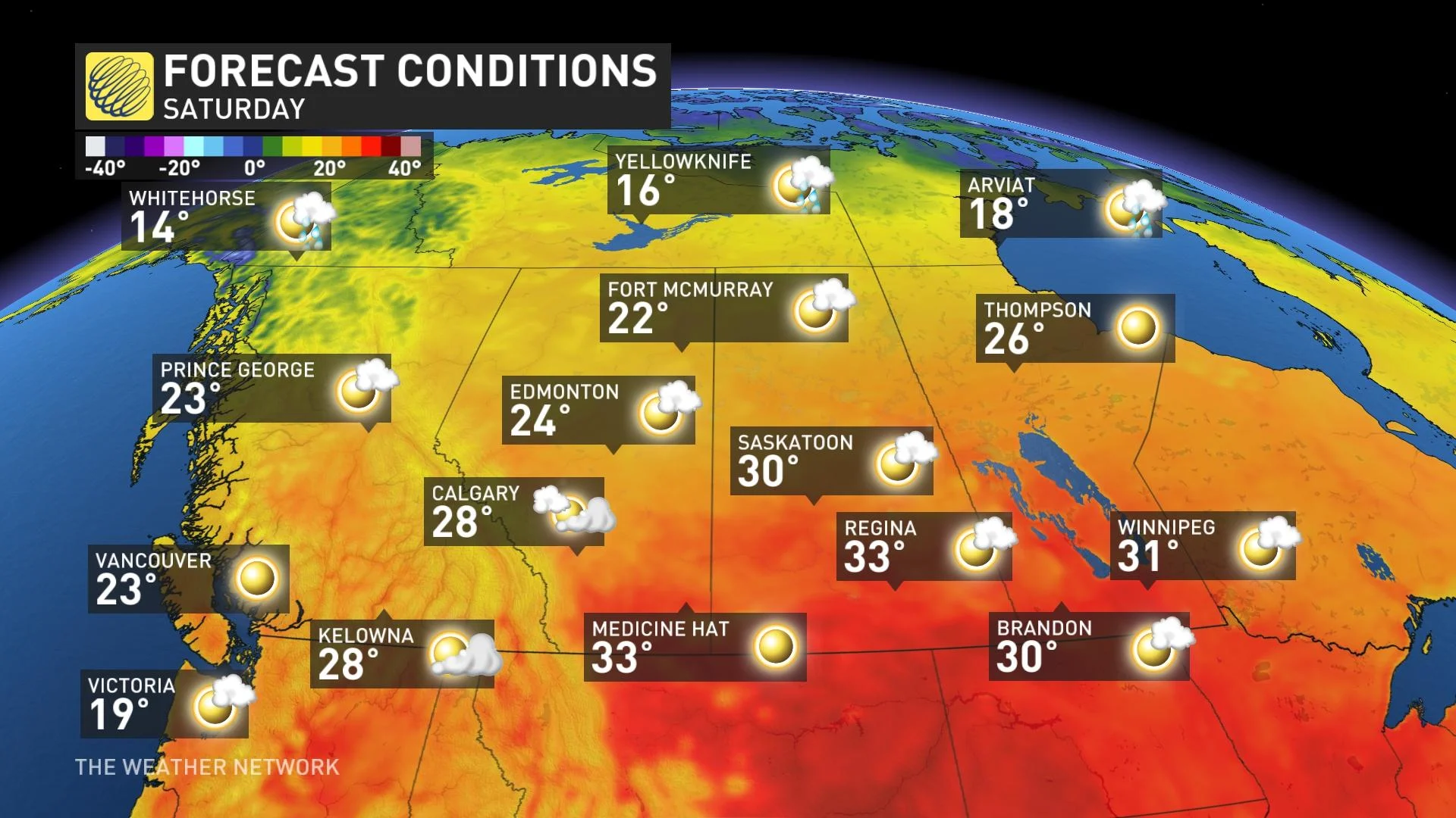
As for the Interior, mid-to-high 20s are expected to start the weekend, followed by temperatures dropping into the low 20s, which will continue for the rest of next week.
That will be the case for the Prairies, too, with mild and even warm temperatures to start the weekend. In fact, Regina, Sask., will reach the 30s on Saturday. But the warmth will quickly turn for the worse, with temperatures dropping down to the high teens and low 20s for the remainder of the week.
A trough will develop into next week, which will bring beneficial rains across Western Canada for several days to relieve some of the ongoing wildfires and drought.
With files from Nathan Howes, a digital journalist at The Weather Network, and Matthew Grinter and Melinda Singh, meteorologists at The Weather Network.