Summer-like heat in Ontario fuels new threat for severe storms on Tuesday
After a stormy Monday night in parts of Ontario, the threat will reappear on Tuesday as the heat fuelling the chance continues for a final day before a drastic cooldown
It's feeling more like summer in southern Ontario as the region will once again see the threat of severe weather on Tuesday after a stormy Monday night.
Severe thunderstorms pushed across southern Ontario Monday evening and overnight, knocking out power to thousands, with some damage reported in the Mattawa region.
DON’T MISS: Stuck in your car during a tornado? Here’s what you should do
The heat helping to fuel the thunderstorm threat will continue for a final day on Tuesday before a sharp cooldown midweek.
Anyone with outdoor plans on Tuesday should keep a close eye on both the radar and local severe weather alerts. Beware the risk for lightning. If you’re close enough to hear thunder, you’re close enough to be struck by lightning.
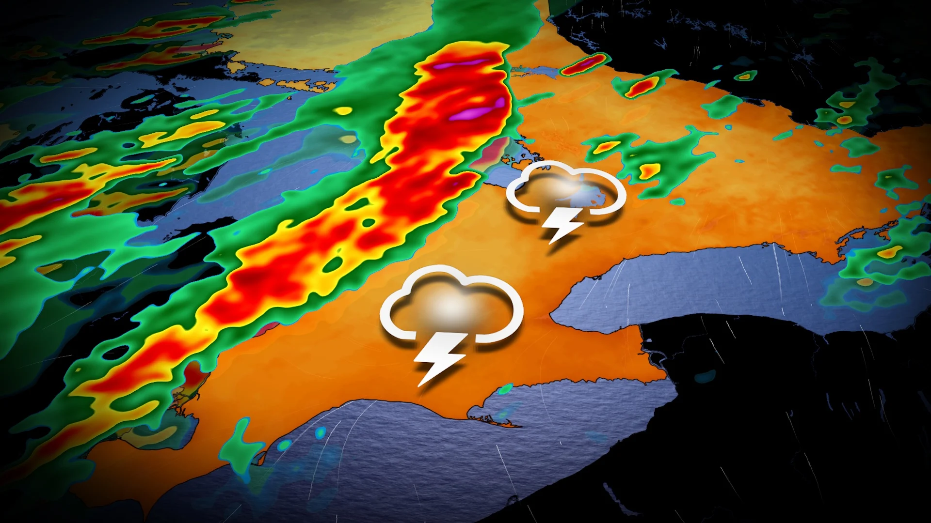
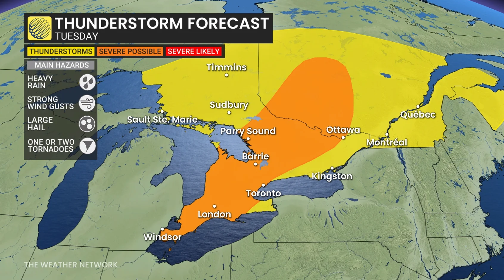
Severe storm risk resurfaces in Ontario Tuesday
Early Tuesday morning, some thunderstorm activity along the warm front is likely across northeastern Ontario, east of Lake Superior.
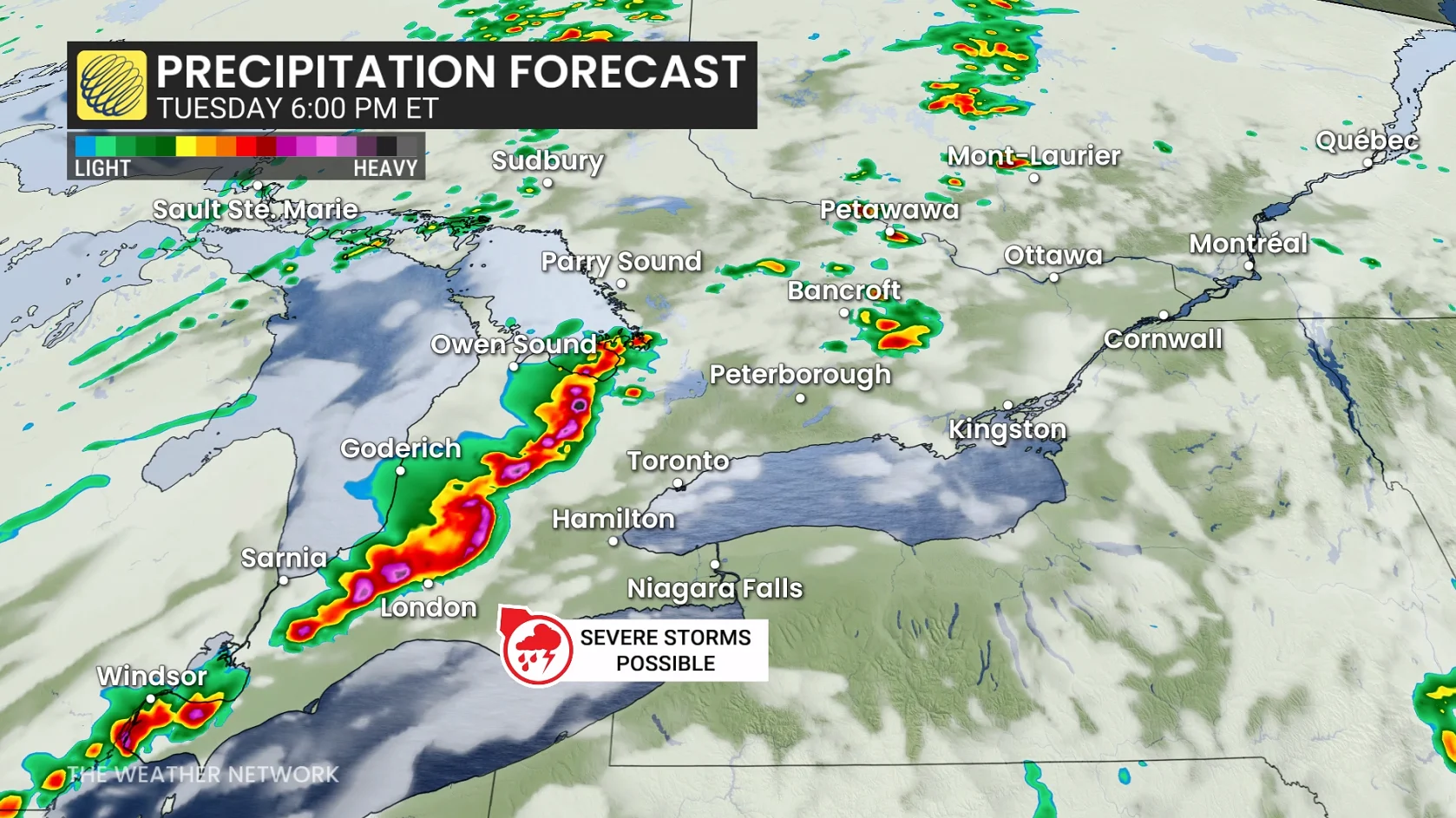
Another low-pressure system developing to the west will pump additional warm air into southern Ontario for our Tuesday, renewing the instability that could fuel a fresh round of thunderstorms.
Thunderstorms are expected across southern Ontario right through Tuesday evening, being triggered by the approaching, sharp cold front.
2 p.m.to 4 p.m.: Storm initiation in cottage country. A line of storms is forecast to develop later Tuesday afternoon across southern Ontario, beginning near cottage country and the Lake Huron shores, then tracking into the Greater Toronto (GTA) after the dinner hour.
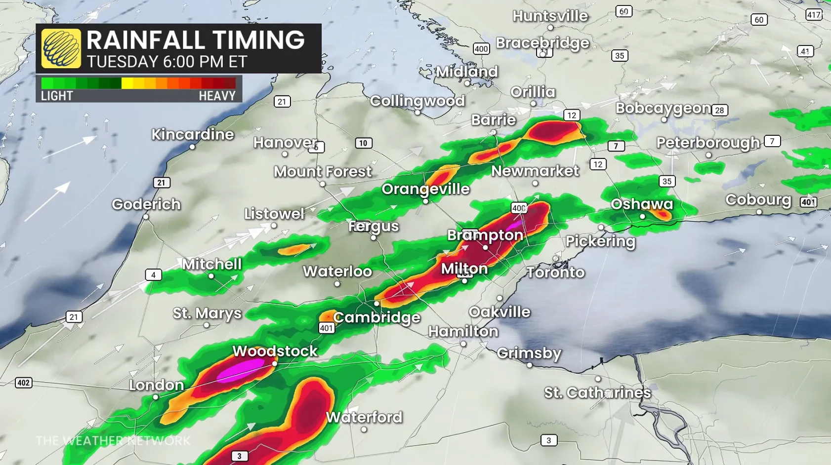
Strong winds, frequent lightning and large hail are all possible in the orange area of the risk map.
Confidence remains rather low on storm coverage, so check back early Tuesday for more model projections.
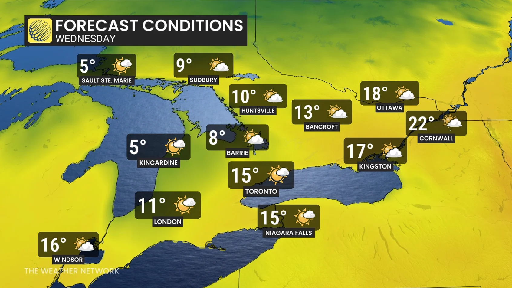
By Wednesday, temperatures have fallen sharply across most of southern Ontario, with a wedge of warmer air ahead of the cold front holding on across extreme eastern sections, but the thunderstorm threat has largely been pushed stateside and across the Maritimes.
Forecast temperature drops from Tuesday afternoon to Wednesday morning
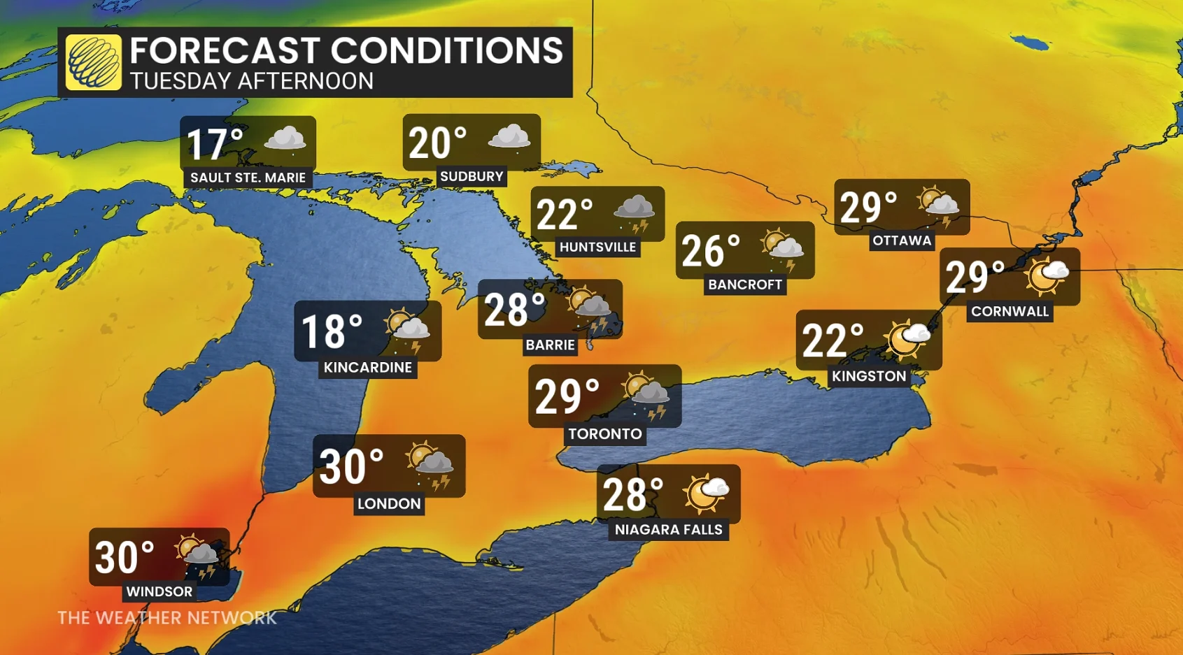
Barrie: 28°C to 6°C (15 hours)
Sarnia: 28°C to 8°C
London: 30°C to 7°C (16 hours)
Ontario records 30-degree temperatures on Monday
Ontario saw numerous communities record temperatures on Monday above the 30-degree mark, as the surge of hot, muggy air pushed in from the southern U.S.
17 weather stations reported more than 30 C in Ontario on Monday, with a hot spot at Wasaga Beach (31.6 C).
Wasaga Beach Provincial Park: 31.6°C
Hamilton: 31.5°C
Delhi: 30.9°C
Sarnia: 30.9°C
Sarnia Chris Hadfield Airport: 30.9°C
Toronto Pearson International Airport: 30.9°C
Muskoka airport: 30.7°C
St. Catharines/Niagara District Airport: 30.7°C
Wiarton airport: 30.7°C
Windsor airport: 30.7°C
Lake Simcoe Regional Airport: 30.6°C
Vineland station: 30.6°C
Burlington lift bridge: 30.5°C
Beatrice: 30.3°C
Egbert: 30.3°C
Hamilton Munro International Airport: 30.2°C
Kemptville: 30.1°C
Stay with The Weather Network for all the latest on conditions across Ontario.