Summer heat continues in B.C., thunderstorm risk elevates wildfire fears

Extreme summer-like heat persists throughout British Columbia, with likely thunderstorms moving through the southernmost parts of the province through mid-week
We're only at the midway point of May, but conditions continue to be summer-like across B.C. This week, the trend will continue for parts of the province, likely to worsen the wildfire situation with a thunderstorm and dry lightning risk Tuesday and Wednesday. Rising freezing levels continue to melt the alpine snowpack, so flooding remains a serious threat.
While the heat conditions have resulted in some daily, and even several all-time monthly temperature records being broken, it must be emphasized that the hot conditions will not approach those reached during the deadly June 2021 heat dome. But, it is on the unprecedented end for mid-May, even pushing the envelope by its standards.
Visit The Weather Network's wildfire hub to keep up with the latest on the active start to wildfire season across Western Canada.

Heat
Extreme heat continues widespread across the province with temperatures in the low- to mid-30s for some across the South Coast and Interior valleys.
Monday saw record-breaking temperatures, with not only daily record temperature highs but monthly high-temperature records after readings climbed into the mid-30s.
Through the week, temperatures are forecast to remain in the upper 20s and low 30s for much of the Interior and valleys. Temperatures along the coast will be slightly cooler. Temperatures will climb towards 30°C even for far northern regions of the province.
DON'T MISS: 9 things you need for the ultimate sun protection`

READ MORE: Talking about the warmth? Add heat dome to your vocabulary, here's why
Wildfire, smoke, and evacuation alerts
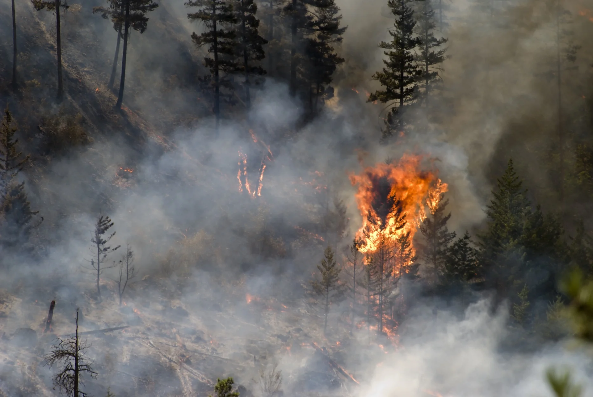
The summer-like temperatures are concerning for the ongoing wildfire situation across the province. With over 62 active fires burning throughout the province, with the largest ones of note burning in the Peace region, where over 20,000 people are under evacuation alerts in the Fort St. John area.
Hot, dry conditions persisting through the week are also fuelling the risk of new fires, especially with the presence of dry lightning. Currently, most of the province is under a moderate to high fire danger rating.
A shift in the winds will usher the wildfire smoke in the north, to southern interior communities and valleys through this week. Expect air quality to deteriorate further across parts of the province.

SEE ALSO: Wildfire terms every Canadian should be familiar with
WATCH NOW: Heat, flood, and fire concerns plague British Columbia
Thunderstorm risk
A slight thunderstorm threat will also impact extreme southern parts of the province through much of the week. Most storms should stay non-severe in nature with locally heavy downpours, wind gusts, small hail and lightning. The lightning is of main concern for the ignition of more fires across the region.

Impacts
Concerns heighten for flooding as temperatures remain 10-15 degrees above seasonal, contributing to an increase in snowmelt and rising river levels. High streamflow advisories remain in effect for much of the province.
High streamflow advisories are issued when river beds are expected to quickly rise, causing non-major flooding.
While the majority of the province faces non-major flooding, some areas are currently under major flood watches and warnings. Some have even had to evacuate or prepare to evacuate.
Is there relief in sight?
Forecasters are cautiously optimistic about a change in weather pattern expected early next week. While it is too to confidently say the pattern will drastically change, a trough in the jet stream may allow a break from the extremely warm temperatures and a return back closer to seasonal temperatures.
The trough could also bring in some beneficial rain across northern regions that have been drier than normal this spring and help contain the ongoing wildfire situation.

Thumbnail courtesy of Getty Images. Keep checking back to The Weather Network for more forecast information and details in your region.