
Strong winds and some significant snowfall to impact parts of Atlantic Canada

Atlantic Canada braces for an active weather pattern as a powerful storm system moves through. The system is set to bring a range of impacts, including damaging winds, heavy rainfall, and snowfall on the system's backside through Wednesday
A sprawling low pressure system centred over southern Labrador is set to bring strong winds and fresh snowfall to parts of Atlantic Canada on Tuesday. This system is expected to linger through the day before gradually moving out by Wednesday morning.
DON'T MISS: First blizzard warning of the season for major Canadian highway
Winds will strengthen significantly, with gusts reaching 60–80 km/h inland and up to 90 km/h or higher in coastal regions, particularly around the Northumberland Strait, Bay of Fundy, P.E.I., and the mouth of the St. Lawrence River.
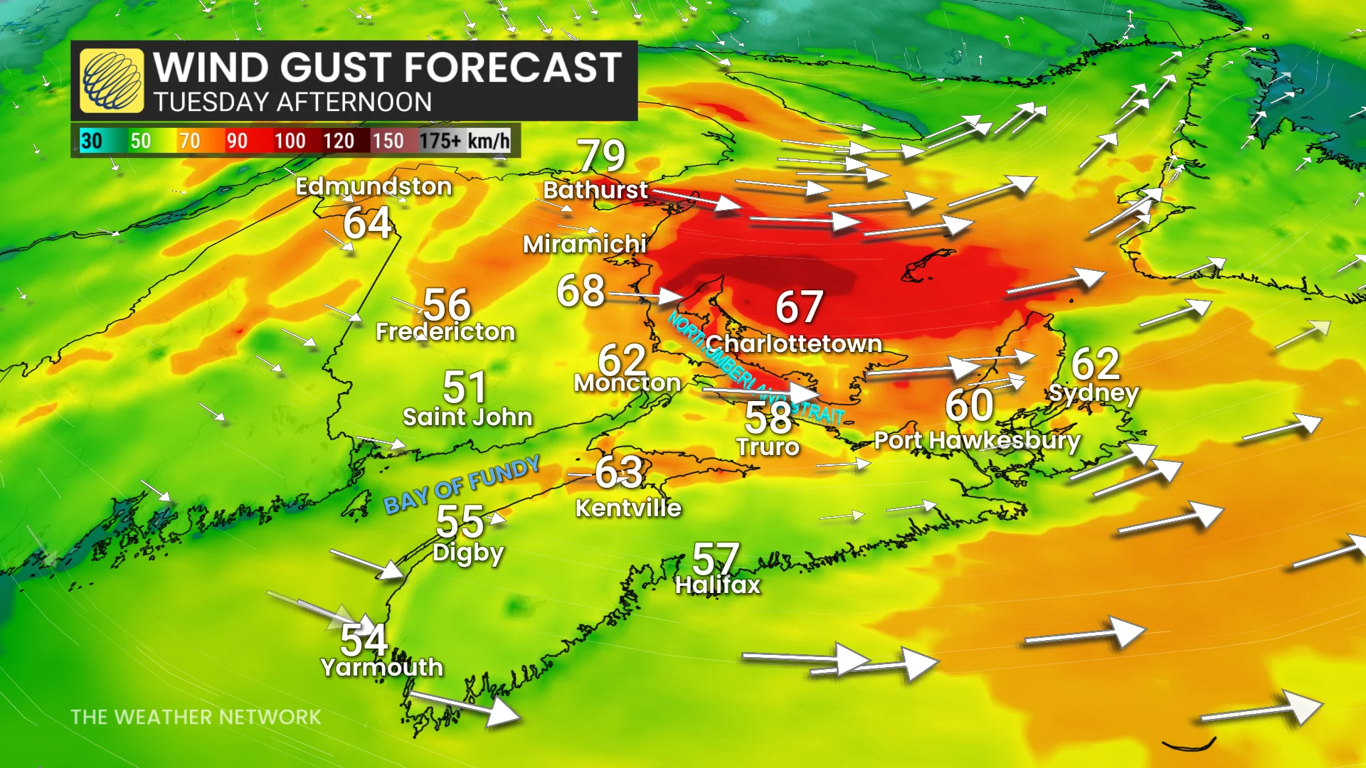
Wind gusts will peak Tuesday afternoon into the evening and remain blustery overnight before easing across the Maritimes and Newfoundland by Wednesday morning.
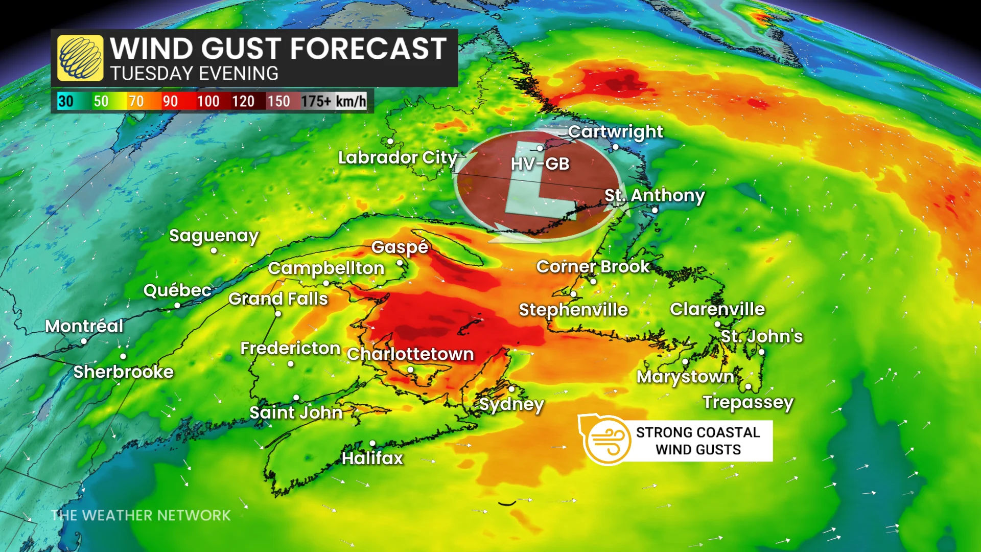
Major temperature tumble this week, significant snow over Labrador
Behind the system, temperatures will drop 5°C to 10°C below seasonal, driven by a chilly northwest airflow. For example, Ottawa is forecast to see a daytime high of just 11°C on Tuesday, the coldest since mid-May.
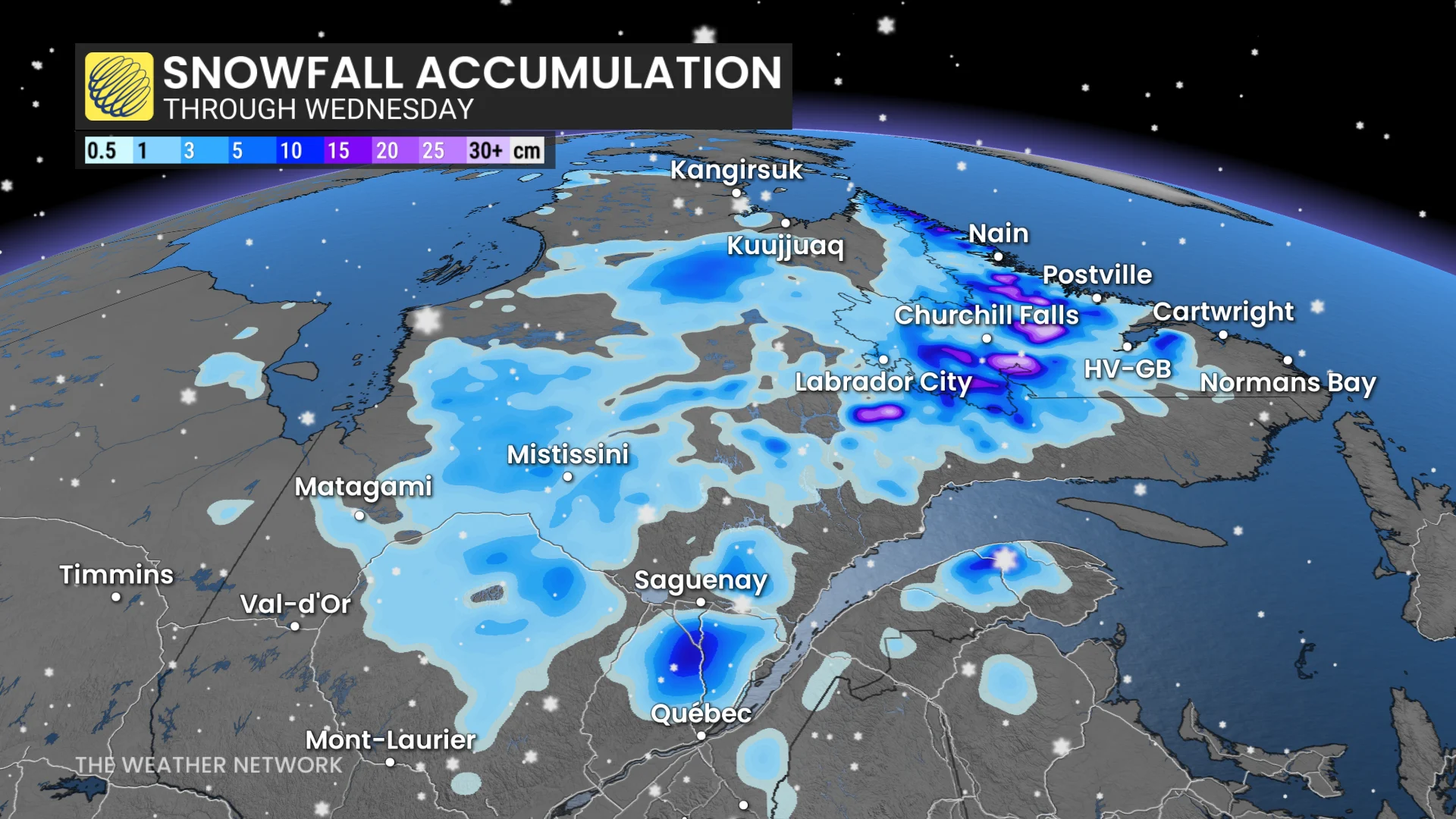
Meanwhile, Monday’s rainfall over the Atlantic provinces will taper off, transitioning to snow in parts of Labrador.
DON'T MISS: Canada scores its first -20°C of the season later than normal
Higher elevations in Labrador may accumulate over 30 cm, while communities like Labrador City could see a trace, and Churchill Falls less than 5 cm.
Stay updated on weather alerts and prepare for potential disruptions from gusty winds and localized snowfall.