Strong winds and snowsqualls hit Alberta hard, outages, closures rack up
Snow squalls and strong winds will persist across Alberta through Friday, bringing 5-15+ cm of snow to some areas, significant travel impacts, power outages, and highway closures
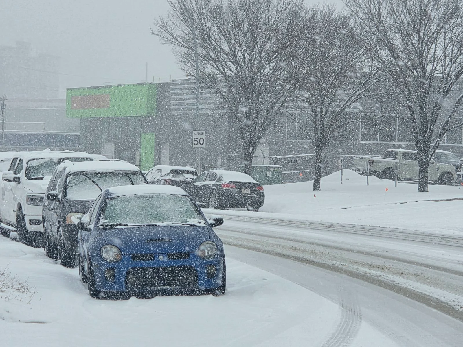
Snowsqualls and strong winds create significant travel disruptions and power outages in Alberta as a powerful, slow-moving storm lingers over the region through the weekend.
DON'T MISS: Summer Sneak Peek: El Niño may split Canada’s summer in two
Be sure to plan accordingly and check local updates for the latest weather alerts.

Snowfall
Intense snowsqualls will persist across central and eastern Alberta through Friday, with southeastern areas potentially seeing 5-15+ cm of snow if squalls stall over specific locations.
Snowsqualls are expected to ease into the evening, but widespread snowfall could spread across central and eastern Alberta overnight.

Flurries and lingering snow squalls will continue into Saturday before drier conditions arrive by Sunday. However, light flurries may persist near the foothills over the weekend.
RELATED: What turns a snowstorm into a raging blizzard?
Winds
Strong wind gusts are exacerbating travel challenges across Alberta on Friday.

Speeds of 70-90 km/h have been reported, leading to power outages, including over 30,000 customers impacted in the Calgary area by late morning. A wind warning for Calgary remains in effect, but gusts are expected to gradually weaken by Friday evening and overnight.
Over the weekend, wind conditions will significantly improve, with occasional gusts of 30-50 km/h.
Impacts
Hazardous weather has forced the closure of Highway 63 in northeastern Alberta, with reports of hundreds of stranded motorists and local emergency alerts issued.
Calgary and surrounding areas have experienced rising power outages, with more possible as strong winds remain throughout Friday.
Long-range outlook
A drier pattern is expected next week, as a building ridge over B.C. may shift into Alberta, bringing temperatures into the teens and low 20s by early May.

This warming trend could increase flooding risks across northern Alberta due to significant snowpack melt in those areas.
Stay tuned to The Weather Network as we continue to update the forecast for Alberta.