Strong thunderstorms sweep across Ontario, risk for flooding, damaging winds

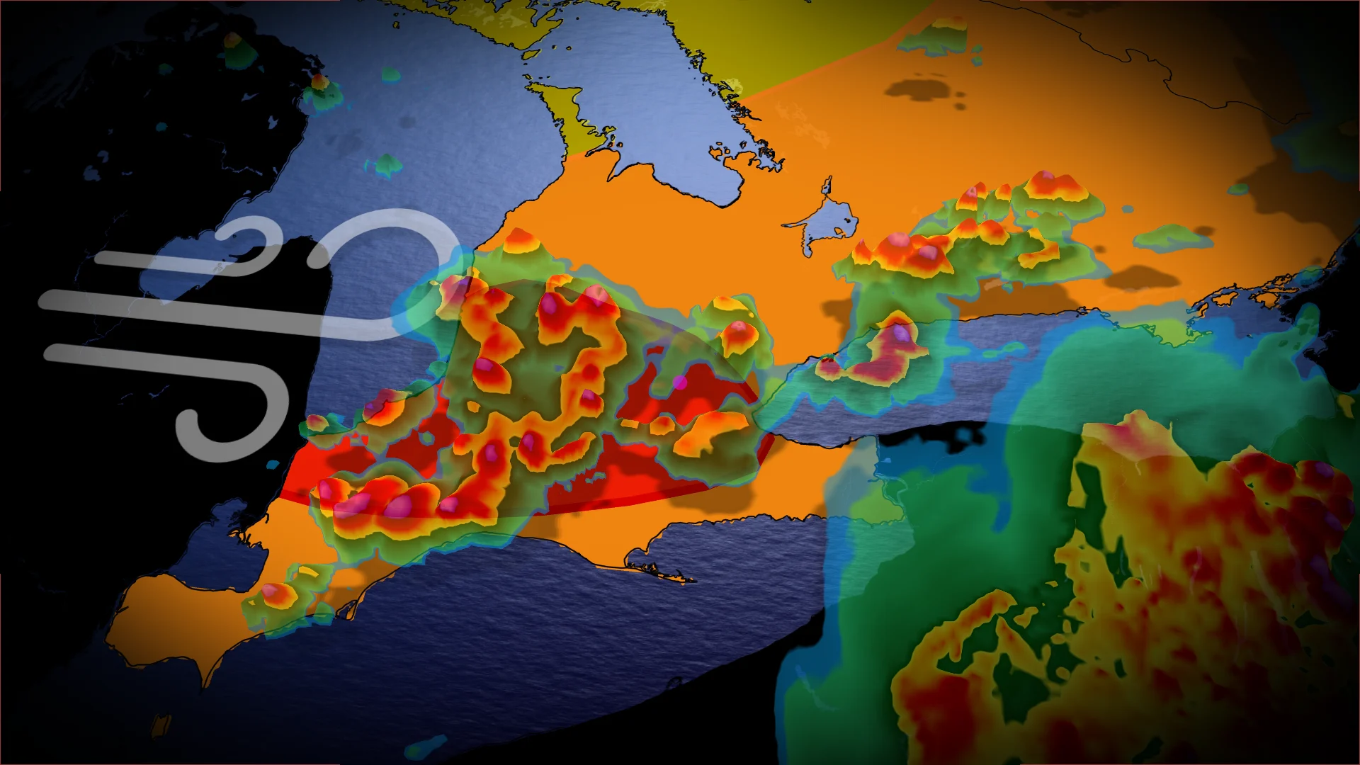
Stay alert: Rounds of severe thunderstorms will hit Ontario Tuesday, with the risk for flooding rains, damaging winds, and the chance for rotating storms
Early-morning storms set the stage for an unsettled day across southern Ontario on Tuesday, with multiple rounds of thunderstorms expected.
Risks include heavy rainfall, large hail, and damaging wind gusts over 90 km/h. Isolated power outages are a possibility in areas with the strongest thunderstorm activity.
DON'T MISS: Watch? Warning? How we communicate severe weather in Canada
Be sure to keep up with the latest watches and warnings in your area. Take immediate action if a severe thunderstorm or tornado warning is issued for your location.
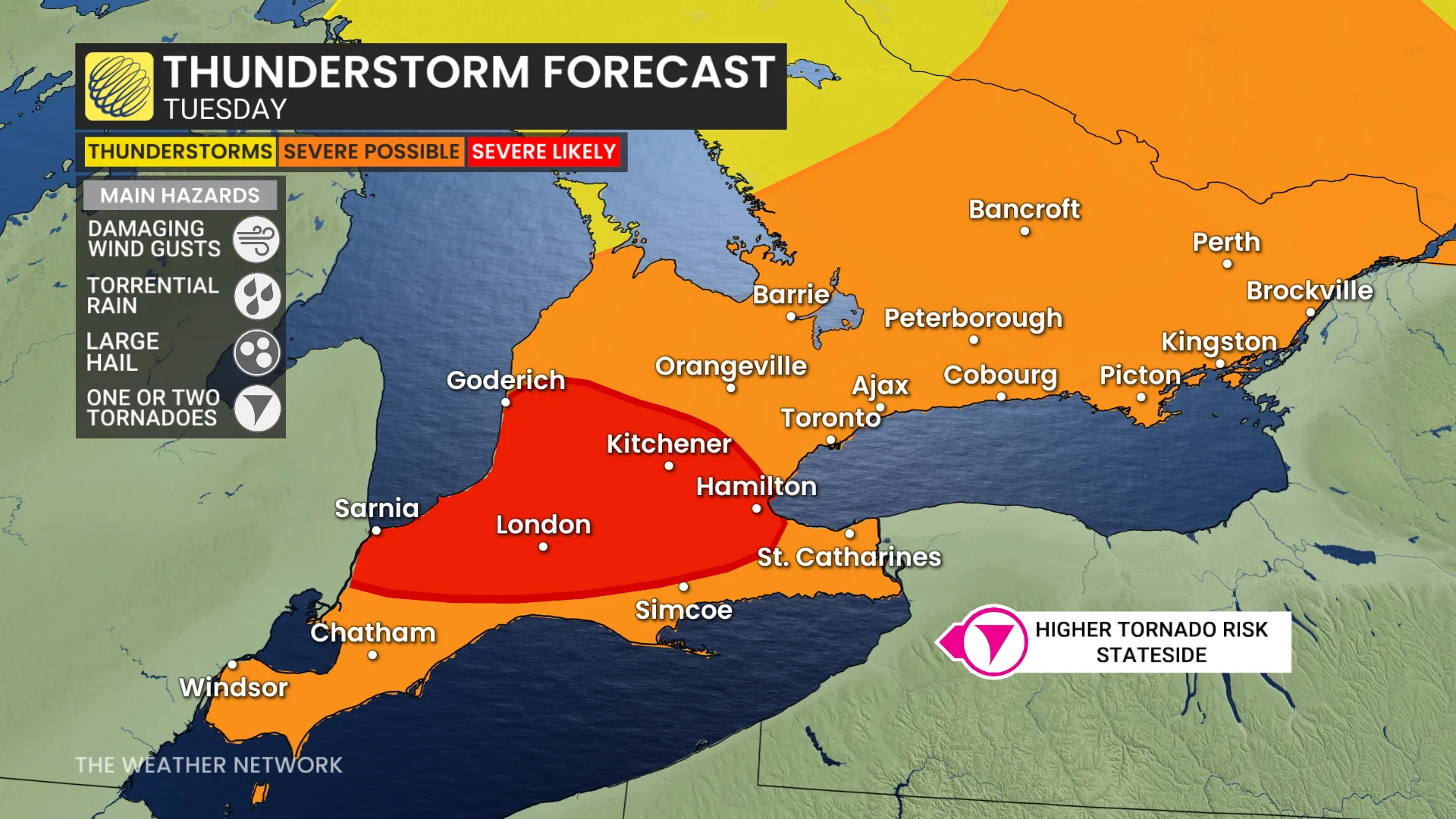
Rounds of severe thunderstorms move through on Tuesday
An associated frontal boundary has moved into southern Ontario. Breaks in cloud cover and daytime heating will trigger moderate-to-high instability levels, leading to the development of numerous thunderstorms by the afternoon.
These storms will form ahead of a trailing cold front, with isolated cells capable of producing localized flooding and rotation.
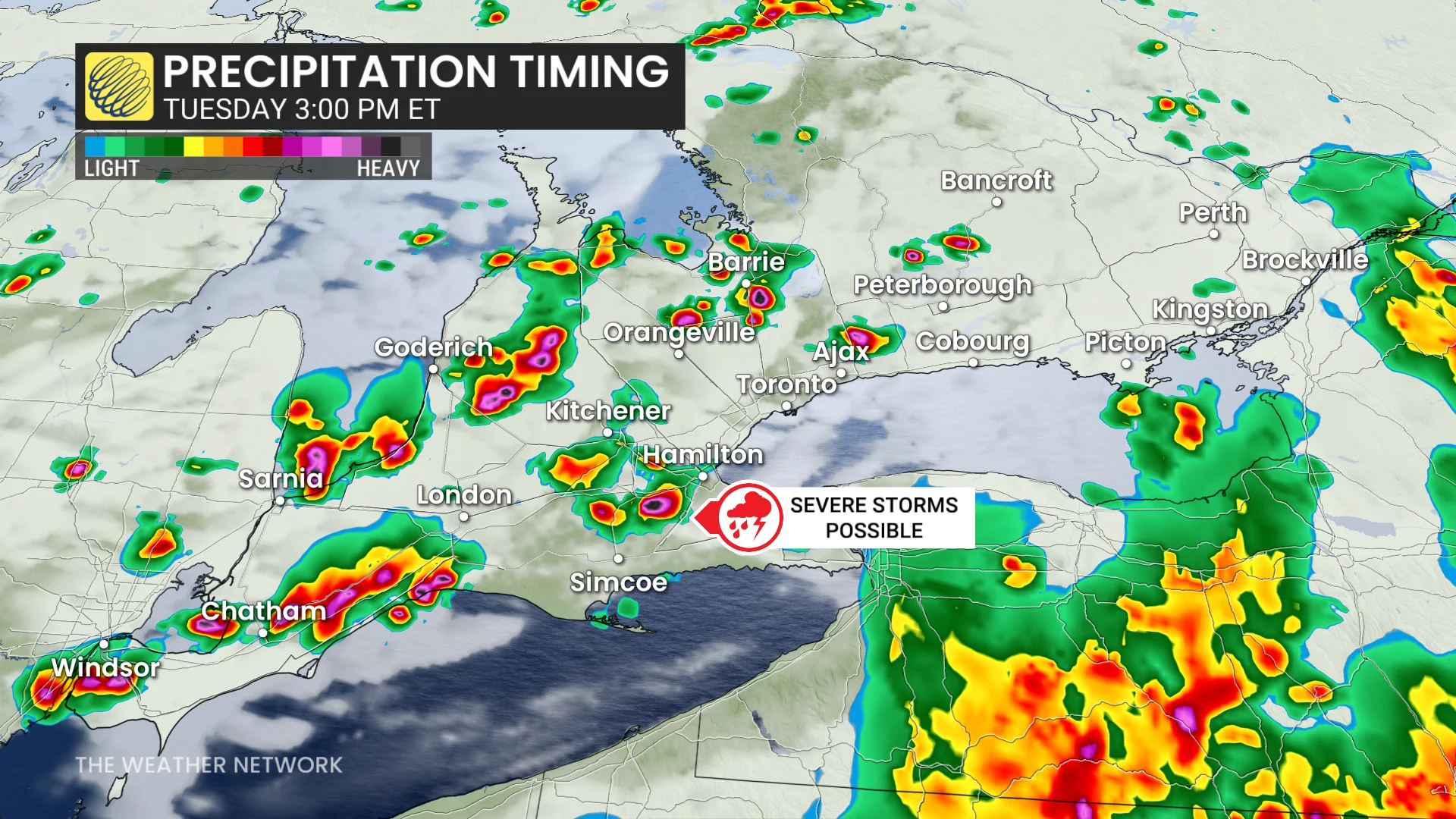
Western areas near the Highway 401 corridor could see isolated rotating storms during the evening. While the highest tornado risk is expected to remain stateside, southern Ontario's primary threats include heavy rainfall and damaging winds.
DON'T MISS: Showering during a thunderstorm: Risky business or just a myth?
Storms between Kingston, Brockville, and Cornwall may intensify further due to enhanced dynamics in the afternoon.
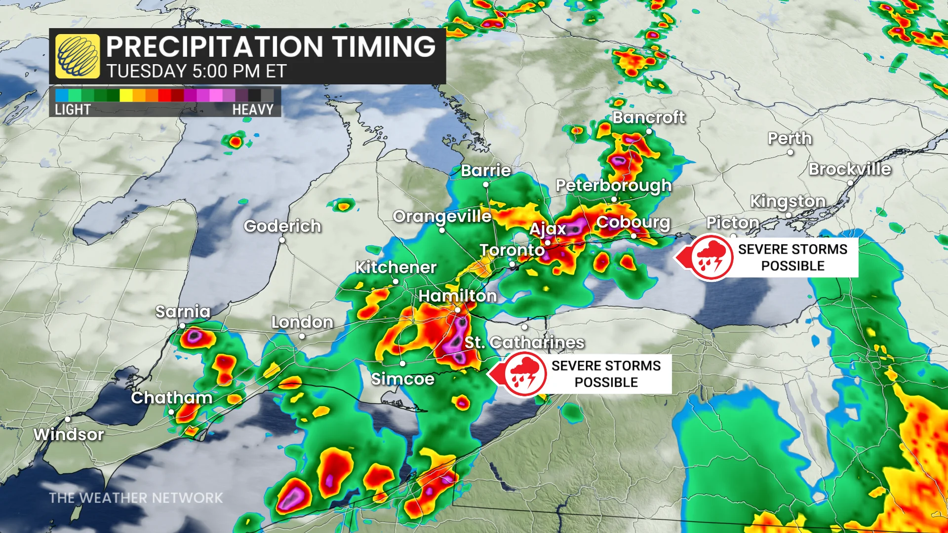
This rainfall will provide some beneficial moisture to parts of central and southern Ontario following recent dry conditions.
Stay weather-aware throughout the day and monitor alerts for updates.
RELATED: 'It's moving quickly': Update on northern Ontario wildfires, evacuations
A taste of early fall on Wednesday, and some cooler days ahead in August
Scattered showers will persist into Wednesday morning, gradually clearing to make way for mostly sunny skies. Temperatures will remain cooler than average for July, with daytime highs struggling to reach the low 20s in southern areas and only hitting the mid- to upper-teens in cottage country.
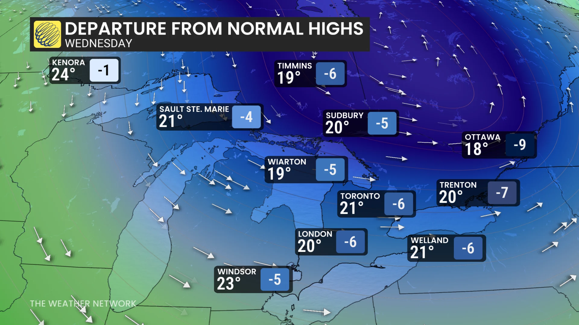
A gusty northwest wind will add to the cool conditions, bringing a brief reminder of early fall weather.
DON'T MISS: Ontario's 2026 Summer Forecast: A changeable and reactive season
For Thursday and Friday, expect plenty of sunshine paired with comfortable temperatures. Highs will range from the low to mid-20s on Thursday, warming to the mid-20s on Friday. By Saturday, near-seasonal conditions will dominate, with warm temperatures and mostly sunny skies anticipated.
Warmer weather is possible in early August, but the remainder of the month is expected to trend near seasonal or slightly cooler than seasonal.
Stay with The Weather Network for the latest on your weather across Ontario.