'Pineapple express' set to bring extreme rainfall to B.C.

More excessive rainfall amounts to impact the South Coast of British Columbia this weekend.
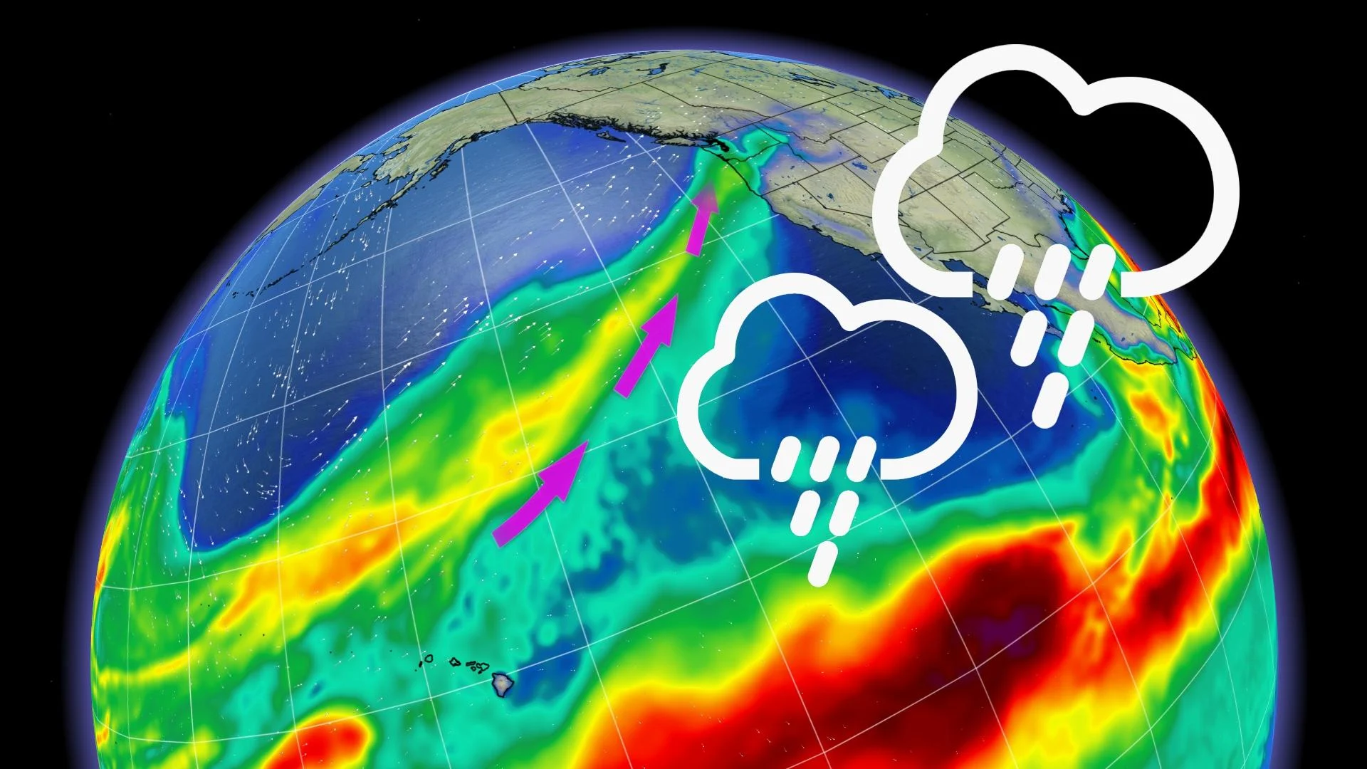
A moisture-laden atmospheric river is setting its sights once again on British Columbia. Dubbed a 'pineapple express' for its origins in Hawaii, this will be a very significant event, with parts of the Lower Mainland and Vancouver Island set for 100-200 mm of rain from Saturday evening to Monday evening. Special weather statements are already in effect as this will begin the series of moisture-laden systems that could result in high stream levels and some localized flooding. More on the timing and impacts, below.
WEEKEND: SERIES OF MOISTURE-LADEN SYSTEMS ASSOCIATED WITH ATMOSPHERIC RIVER PUSHES IN, BRACE FOR EXCESSIVE RAIN
After a largely unsettled week, there will be a brief lull in the stormy weather as high pressure moves into the area to begin the weekend, but then the focus quickly shifts to a series of moisture-laden systems once again.

"An atmospheric river will start to impact the coast by Saturday evening. In this particular case, we will be tapping into moisture originating from the Hawaiian islands, hence a Pineapple Express," says Jessie Uppal, a meteorologist at The Weather Network.
Freezing levels will soar above 2000 metres by Sunday and will coincide with the highest amounts of moisture, resulting in excessive rainfall for much of the Lower Mainland as well as Vancouver Island. Widespread special weather statements are already in place.

"Heavy rain in combination with the melting snow can result in high stream levels and local flooding," says Environment and Climate Change Canada in the statement.
Rainfall rates are expected to be at their highest through Sunday, with some lingering rain showers expected for Monday. Between 75-150+ mm of rain is forecast from Saturday evening through to Monday morning.
With freezing levels this high, most people won't experience this as snow, but travellers in the highest mountain passes should be mindful.

A drier pattern beckons for mid and late next week with cooler than seasonal temperatures through mid-week, then milder late week.
Be sure to check back for the latest updates on the ongoing parade of systems in B.C.


