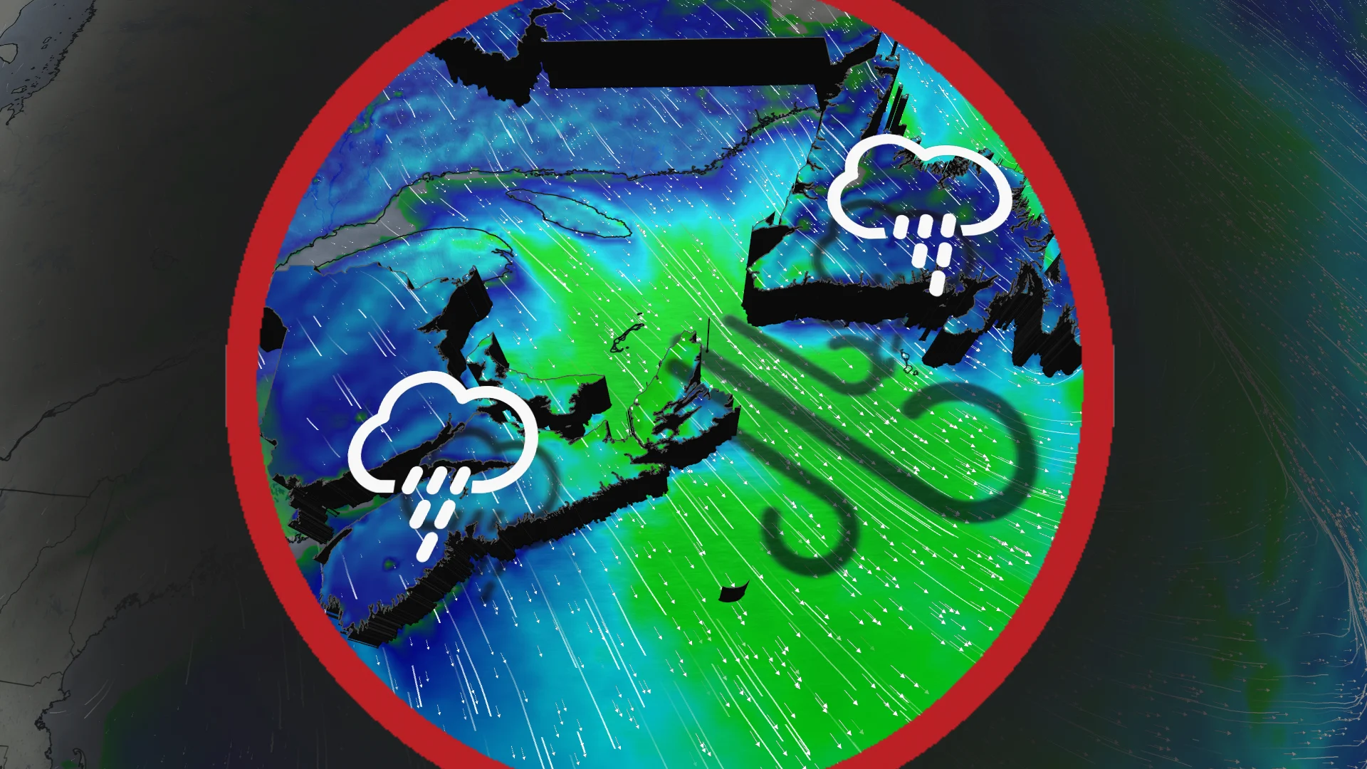
Stormy start to the weekend: More rain and wind hit East Coast

Colliding air masses trigger rain and strong winds on Canada’s East Coast this week
Clashing Arctic and Gulf air masses drive persistent rain and stormy weather across Atlantic Canada through the week's end.
A stalled high pressure system over the southeastern U.S. is funnelling moisture northward, while a cold high pressure system near Hudson Bay is steering an active storm track from the Prairies toward the region.
DON'T MISS: Canada's Winter Sneak Peek: El Niño puts record warmth in play
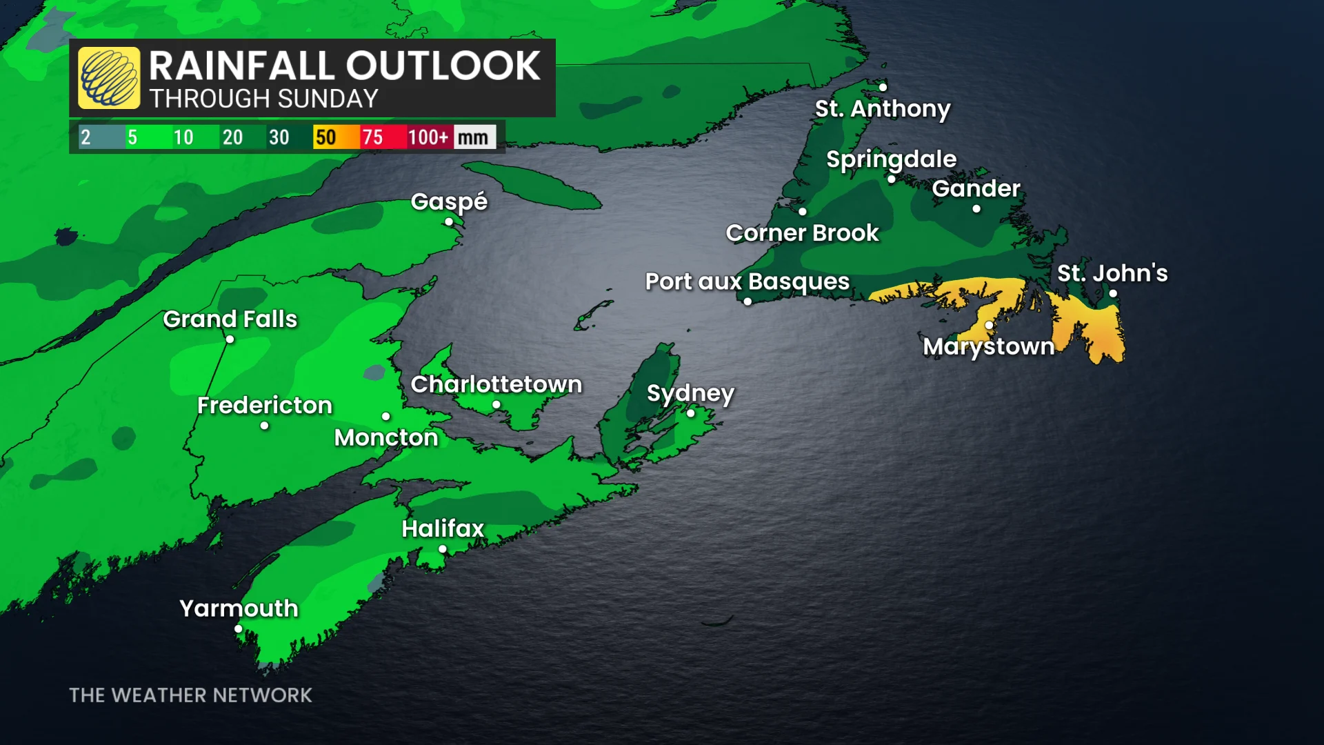
Rainfall amounts of 20-40 mm are expected across the Maritimes and Newfoundland by Sunday, with higher localized totals likely along southern Nova Scotia and Newfoundland’s coast.
Thursday: Lingering rain showers and gusty northwesterly winds
Rainfall will taper across Newfoundland from west to east in the afternoon. However, wraparound rain showers will persist through the day, reaching the Avalon region by evening and clearing overnight.
P.E.I and Cape Breton will also see morning showers, clearing by the afternoon.
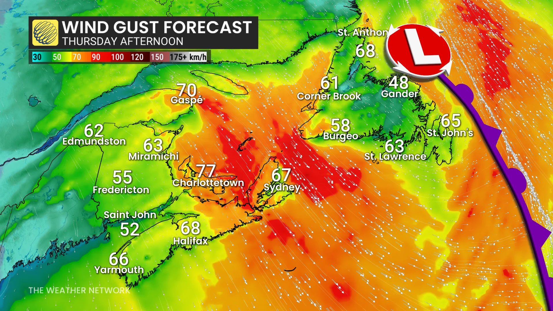
Gusty northwesterly winds will develop over Newfoundland and along parts of the Maritimes' eastern shores.
DON'T MISS: Winter has a few tricks up its sleeve for Eastern Canada this year
Friday-Saturday: Third and strongest storm of the week brings more rain
The final system of the week will bring light to moderate rain, beginning Friday afternoon in the Maritimes. Rain will spread across the region by evening and clear west to east by Saturday morning.
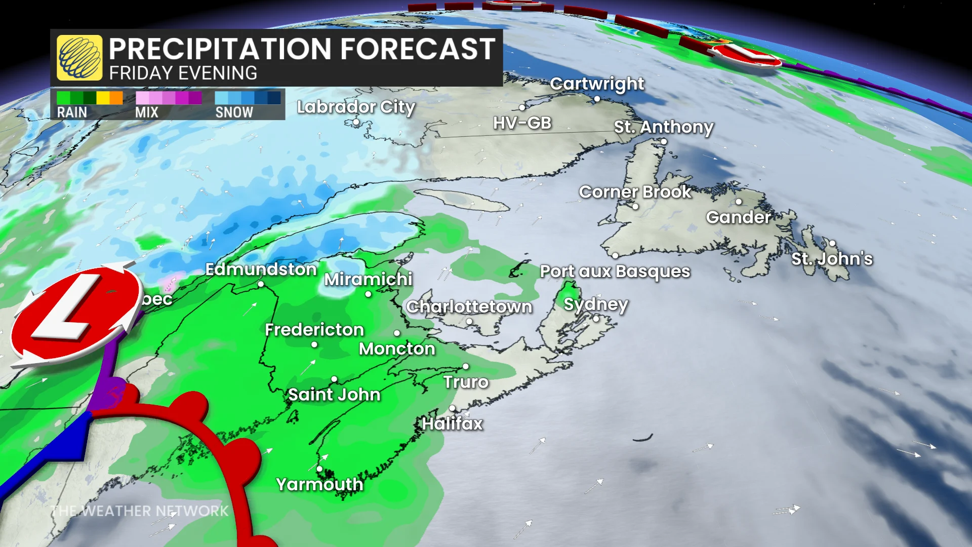
In Newfoundland, rain begins Friday night, intensifies Saturday morning, and clears north to south through early afternoon. Showers may linger over the Avalon Peninsula into Saturday evening due to a stalled front.
Stay with The Weather Network for the latest updates and information on your forecast across Atlantic Canada.