Storm turns to Newfoundland as effects wind down in the Maritimes
A disruptive storm will turn its attention to Newfoundland Tuesday after battering the Maritimes with heavy rain and powerful winds, causing numerous disruptions and widespread power outages
A powerful storm that came close to meeting the definition of a weather bomb certainly made its intensity felt across the Maritimes Monday. Power outages climbed into the tens of thousands across Nova Scotia, New Brunswick and P.E.I.
Going somewhere? Check out the current highway conditions before heading out!
At one point during the storm, there were more than 40,000 Nova Scotia Power customers had no power, and almost 31,000 customers in New Brunswick were in the dark. In P.E.I., nearly 10,000 customers had no electricity.
As well, at one point, all Northumberland Ferries crossings at Confederation Bridge in P.E.I. were cancelled on Monday, CBC News reported.
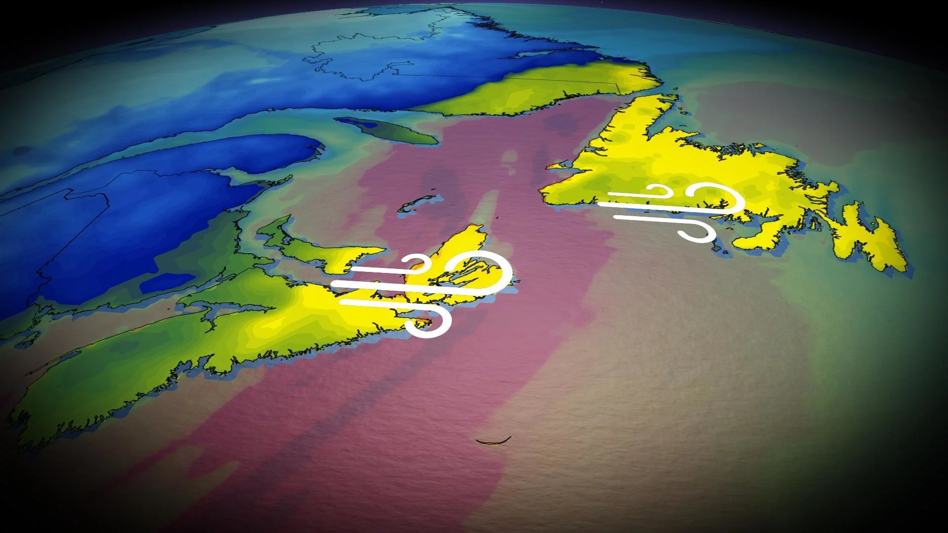
Come Tuesday, the storm will move into Newfoundland, but the magnitude of the effects will be on a smaller scale when compared to the Maritimes.
Tuesday: Lingering effects in Cape Breton as storm pushes into Newfoundland
Very warm temperatures, persistent rain and gusty winds swept over the Maritimes Monday. Of note, is that Greenwood and Cheticamp, N.S., exceeded 18°C on Monday –– enough to make them Canada's hot spots.

On Monday, Saint John, N.B., recorded a 104 km/h wind gust –– its strongest December gust since 2019. Greenwood, N.S., documented a 102 km/h wind gust.
Temperatures will drastically drop to below freezing in New Brunswick and into the low single digits in Nova Scotia on Tuesday, behind the system's cold front.
Rain and winds will continue Monday overnight into Tuesday morning for Cape Breton and Newfoundland, but at much less intensity.

On the high end, 30-50 mm of rainfall may be recorded across the Burgeo shores, with 70-90 km/h wind gusts expected over Newfoundland.
DON’T MISS: Staying safe during a power outage

Residents in Newfoundland, where the strongest wind gusts are expected to occur, are urged to ensure any outdoor holiday decorations were well-secured or brought inside. Inflatable characters and lightweight decor can take flight in winds half this strong, potentially causing damage, injuries, or even car accidents.
Remain mindful of large trees or tree limbs looming over homes, roads, and driveways, and take care to avoid those areas during the highest winds. Most wind-related injuries are caused by trees falling into buildings or vehicles.
Conditions will improve Tuesday evening.
Stay with The Weather Network for the latest on conditions across Atlantic Canada.