Nocturnal, severe storm and tornado threat for parts of NW Ont. and Manitoba
Southern Manitoba and northwestern Ontario faces a severe storm risk, with a tornado chance for the latter region, as well, through Monday overnight and into early Tuesday morning
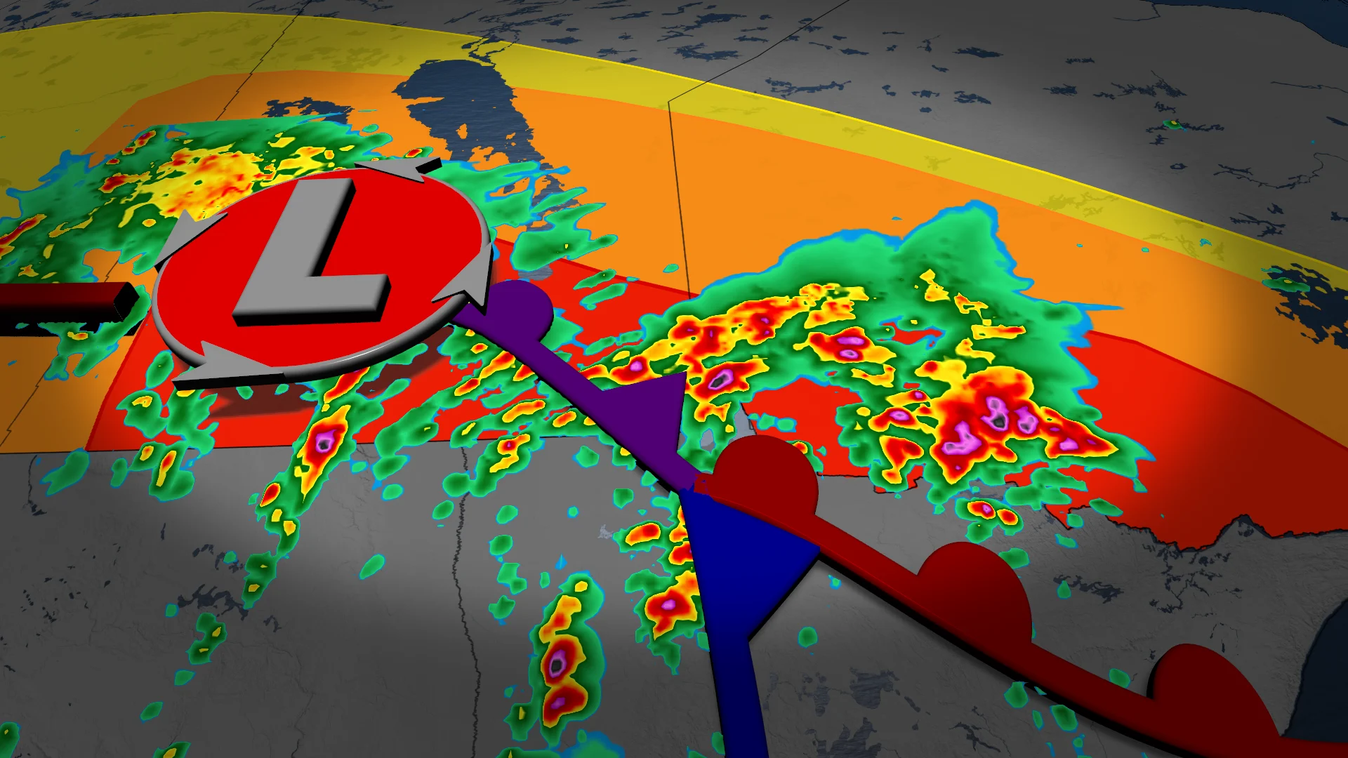
A volatile storm setup is once again threatening southern Manitoba, as well as northwestern Ontario, through Monday overnight and into early Tuesday morning.
A tornado watch was issued for parts of northwestern Ontario. Environment Canada and Climate Change (ECCC) warned of the potential development of tornadoes through the Monday overnight period for northwestern Ontario.
RELATED: Tornado warning safety. Here's what you should do
Strong winds, large hail and heavy rain are also possible with severe storms.
Residents should remain weather-aware Monday overnight and early Tuesday morning, and have a plan to take cover if/when severe weather strikes
Storm, tornadic threat continues Monday overnight in northwestern Ontario
Storms in northwestern Ontario will organize into a linear structure after sunset, risking large hail, embedded tornadoes and strong to damaging wind gusts near 110 km/h.

Models are indicating a possible MCS (mesoscale convective system) may impact northwestern Ontario Monday night.
CHECK OUT: How the weather could be influencing your music taste

With ample overnight heat and thunderstorm fuel available, severe thunderstorms are likely to persist overnight into early Tuesday.
Storms will track east into northeastern Ontario early Tuesday morning.
Residents should remain weather-aware Monday into Tuesday, and have a plan to take cover if/when severe weather strikes.
WATCH BELOW: Damaging tornado captured on camera in Saskatchewan
Stay with The Weather Network for the latest updates across Manitoba