
Storm rolls through B.C. with wicked winds, significant alpine snow

Winter is flexing its muscles across Western Canada this week, with a potent low powering across B.C. with heavy alpine snow and potentially damaging winds
B.C. and Alberta are getting a stormy start to the week, thanks to a powerful Pacific low, which will be followed by a blast of Arctic air.
The strong low will threaten power outages and heavy snow in B.C.
SEE ALSO: How to protect your garden during cold spells
Before the cold air is ushered in, B.C. has to contend with gusty winds and prolific high-elevation snowfall that will dampen travel.

The centre of the low will rush across the Interior Monday evening, promoting gusty winds along coastal B.C.
Victoria is susceptible to damaging, westerly winds in setups like these, with brief wind gusts up to 90 km/h Monday overnight. Even western sections of Metro Vancouver could gust to 70 km/h, leaving the risk for power outages.
The high-elevation snowfall will roll right through into Tuesday, giving us as much as 40 cm of snow to ski resorts in the Columbia and Rocky Mountains.
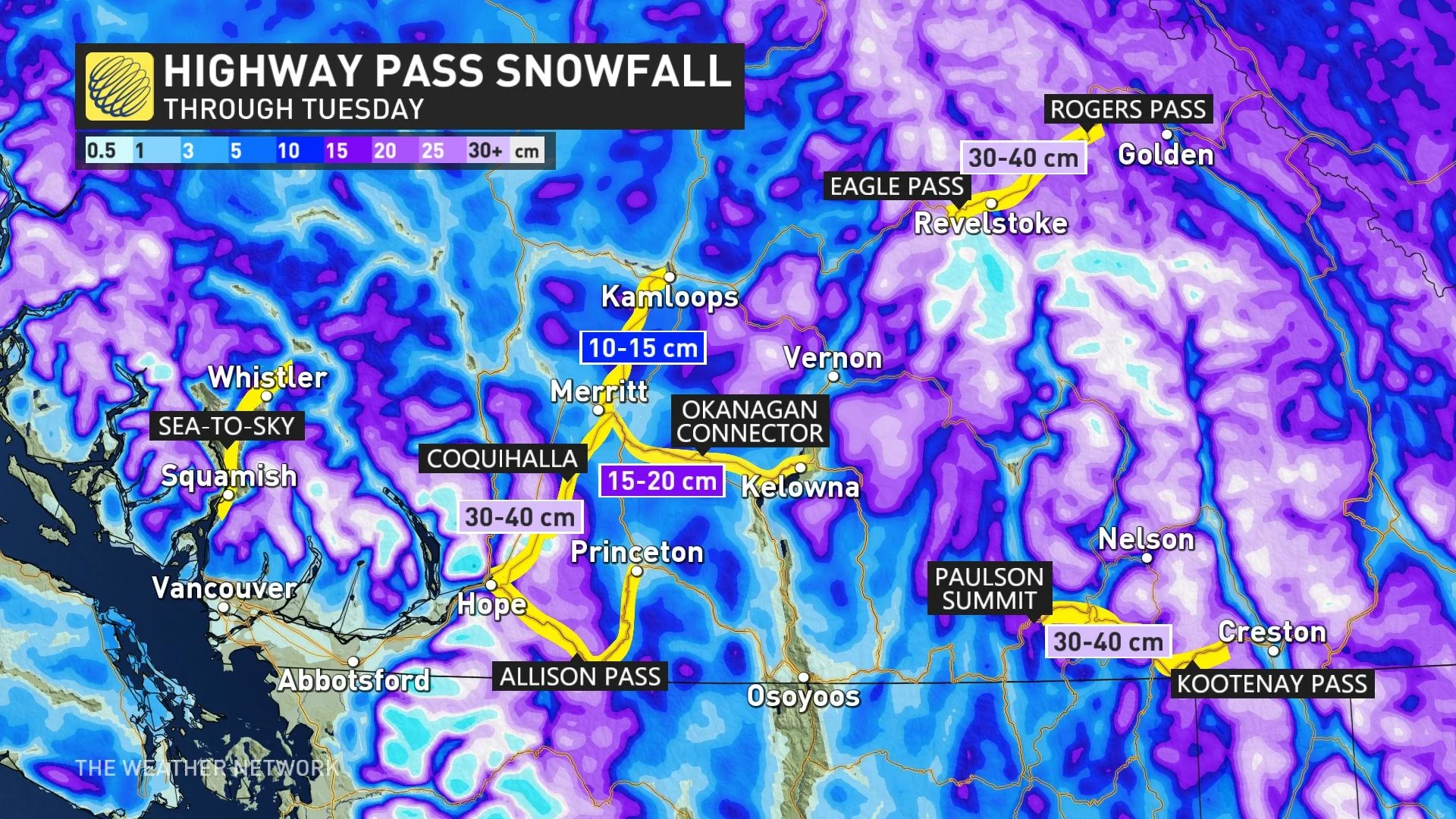
This poses highway pass travel hazards, with over 30 cm forecast for the Coquihalla Highway, between Hope and Merritt. Highway 3 across southeastern B.C. also poses some tremendous travel challenges with over 30 cm of snowfall forecast through Tuesday.
Stay tuned to The Weather Network for the latest forecast updates for British Columbia.