Storm risk with hot and muggy conditions in Ontario this week
Ontario faces a dual weather threat this week, with extreme heat and the potential for thunderstorms
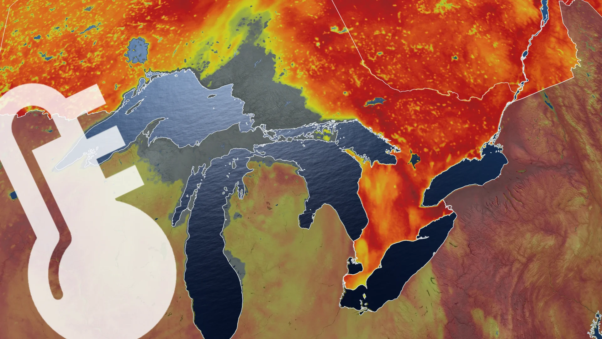
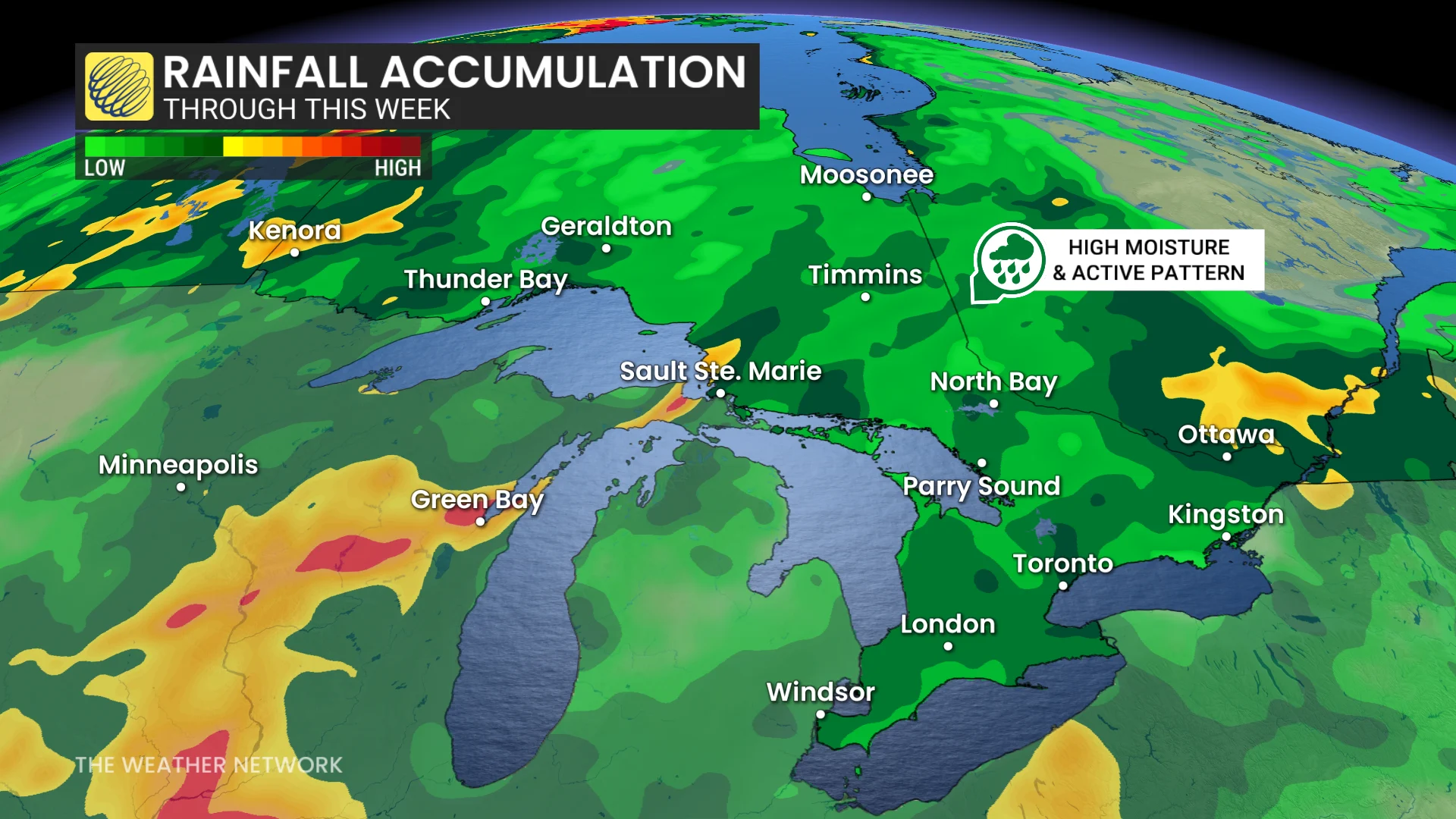
A heat wave is forecast to grip Ontario this week, accompanied by high humidity and stormy weather. Atmospheric moisture combined with low pressure systems will result in above-seasonal temperatures for much of the province.
DON'T MISS: Visit our complete guide to Summer 2026 for an in-depth look at the Summer Forecast, tips to plan for it and much more!
High heat arrives Tuesday, but with a thunderstorm risk across southern Ontario
Muggy weather arrives Tuesday and will persist through the week. Daytime highs will feel like the 30s across many areas, with humidex values approaching the 40s in southwestern Ontario.
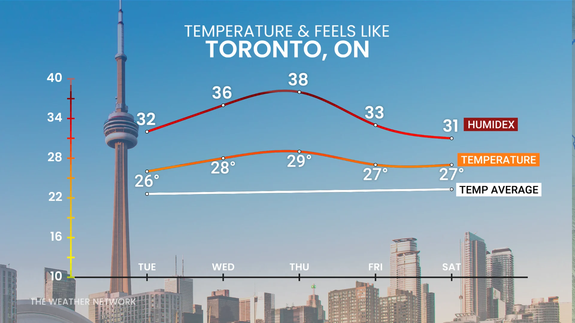
The warmest days of the week are expected on Wednesday and Thursday.
RELATED: 'Feel' miserable out? Humidex and wind chill are calibrated to your body
Thunderstorm activity begins Tuesday afternoon in the southwest, along the Huron shores, and stretches into cottage country before expanding to the Greater Toronto Area (GTA) by the evening and overnight hours.
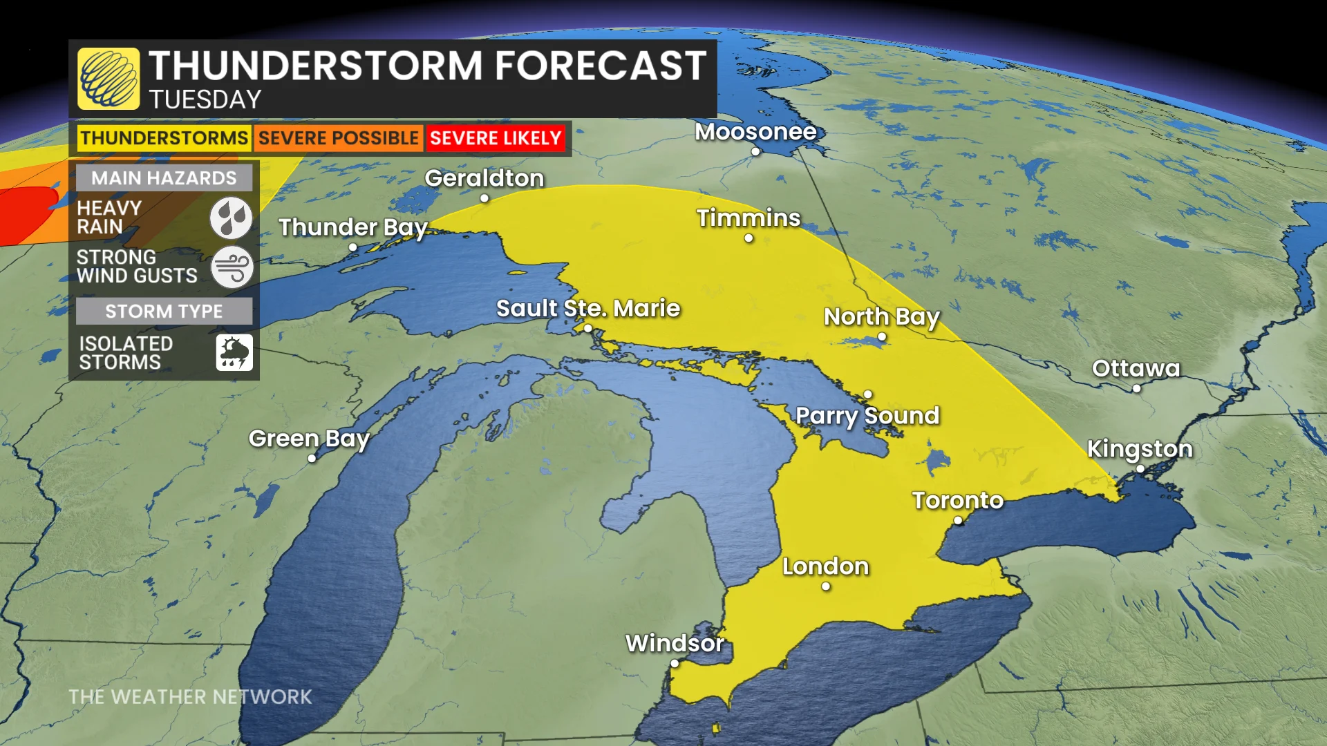
These storms bring the potential for heavy downpours.
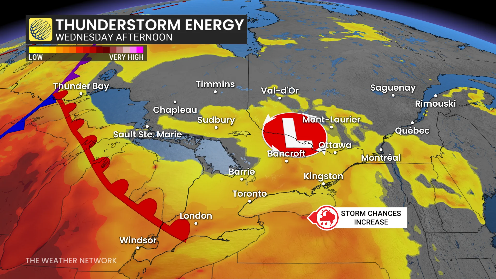
By Wednesday afternoon, the thunderstorm risk will shift into eastern Ontario.
DON'T MISS: Watch? Warning? How we communicate severe weather in Canada
Heading into late week, storm activity may increase as instability and moisture build further. The severity of potential storms remains uncertain at this time.
Residents are encouraged to remain informed about weather updates and alerts as the system evolves. Activities should be planned with caution, especially outdoors.