Lingering storm threat for the Prairies as wildfire smoke impacts air quality

Relief is in sight for folks tired of the severe thunderstorms on the Prairies.
A shifting pattern will reinforce a ridge of high pressure over the region, giving Saskatchewan and Manitoba a break while the activity shifts west toward Alberta.
RELATED: This ‘Omega block’ will dominate Canada’s weather this week
Strong to severe thunderstorms will graze portions of Saskatchewan and Manitoba on Friday, with calmer conditions arriving this weekend.
Friday
Areas: Southern Prairies
Weather: We’ll see a renewed risk for thunderstorms across portions of the southern Prairies on Friday as the pattern begins to shift heading into this weekend.
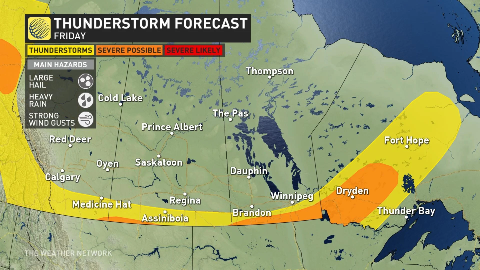
The greatest thunderstorm activity will be confined to the international border in southern Saskatchewan, with a swath of severe thunderstorms possible from extreme southeastern Manitoba into northwestern Ontario, including Dryden.
Friday’s strongest thunderstorms could produce large hail, up to toonie size, as well as heavy rainfall and strong wind gusts.
STAY SAFE: Stuck in your car during a tornado? Here’s what you should do
Saturday
Areas: Alberta Foothills
Weather: The pattern change will have shifted the thunderstorm activity west toward Alberta by the beginning of the weekend.
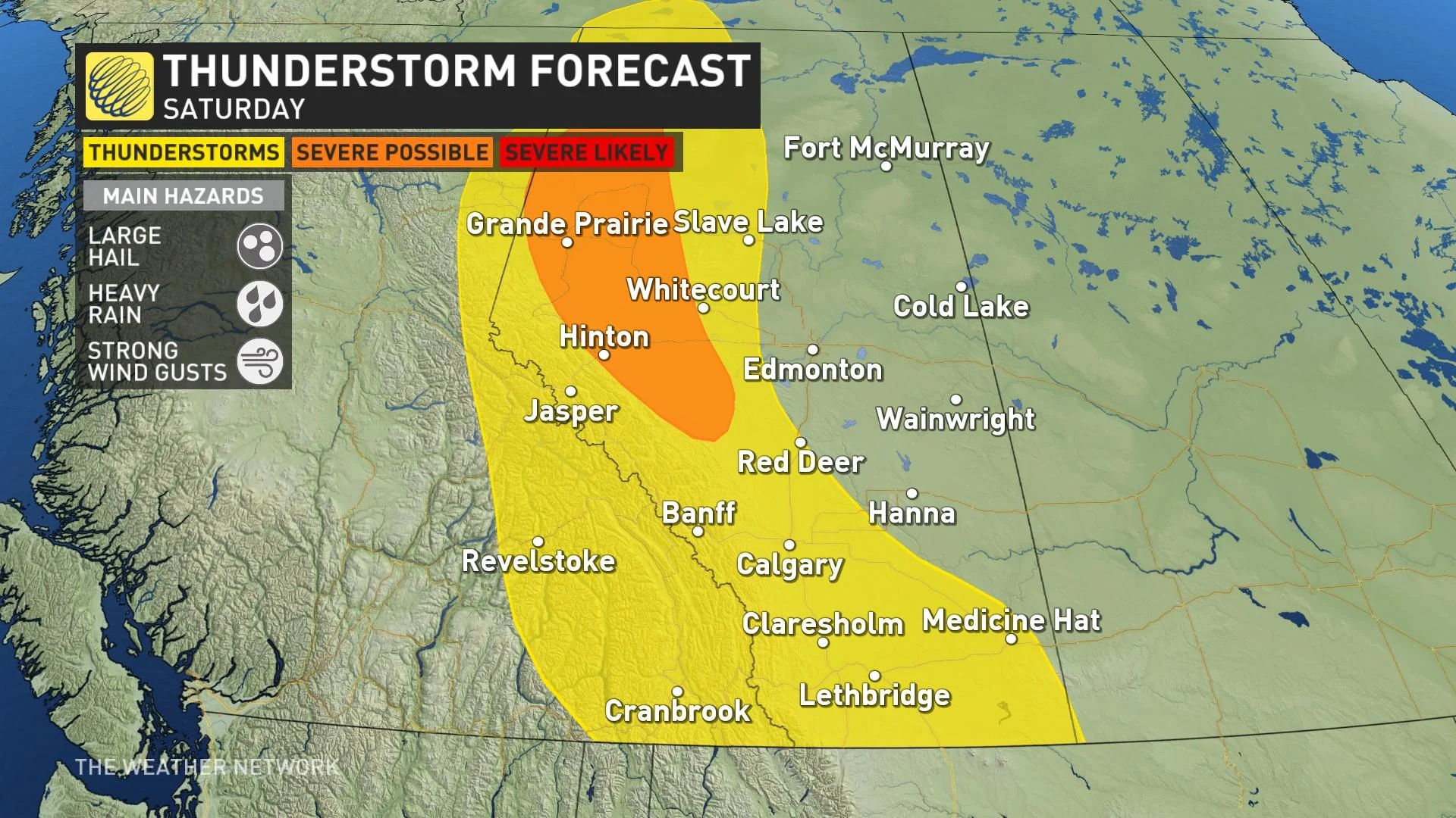
A boundary slicing down the length of the province will keep most of the storm energy bottled up to its west, leaving the greatest risk for thunderstorms west of the QE2 along the Alberta foothills.
The ridge of high pressure building over the Prairies will provide the stability needed to give the central and eastern Prairies a break from the storms, while also cranking up the heat across northern sections of the region.
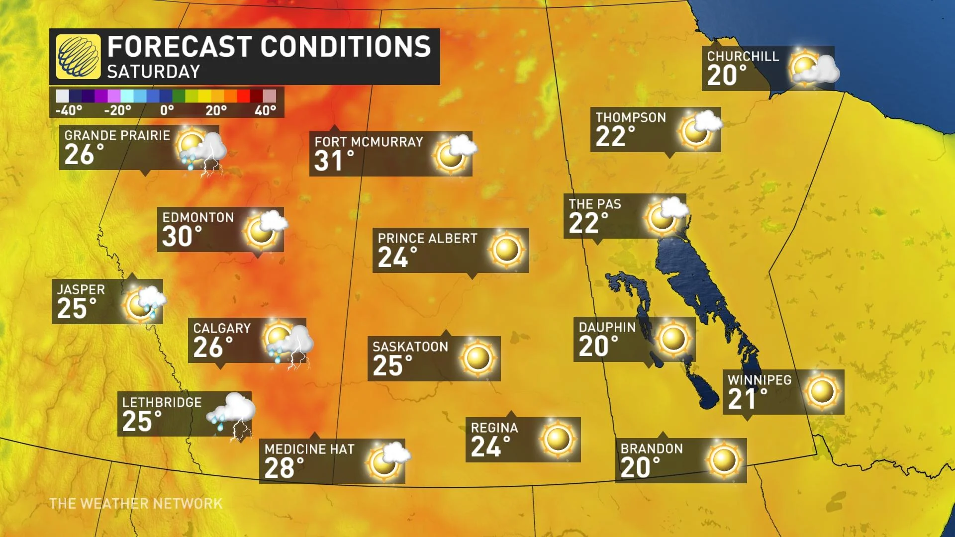
Forecasters expect the hottest conditions to spread over sections of northern Alberta and Saskatchewan, where daytime highs approaching 30 degrees will be a common sight through the weekend.
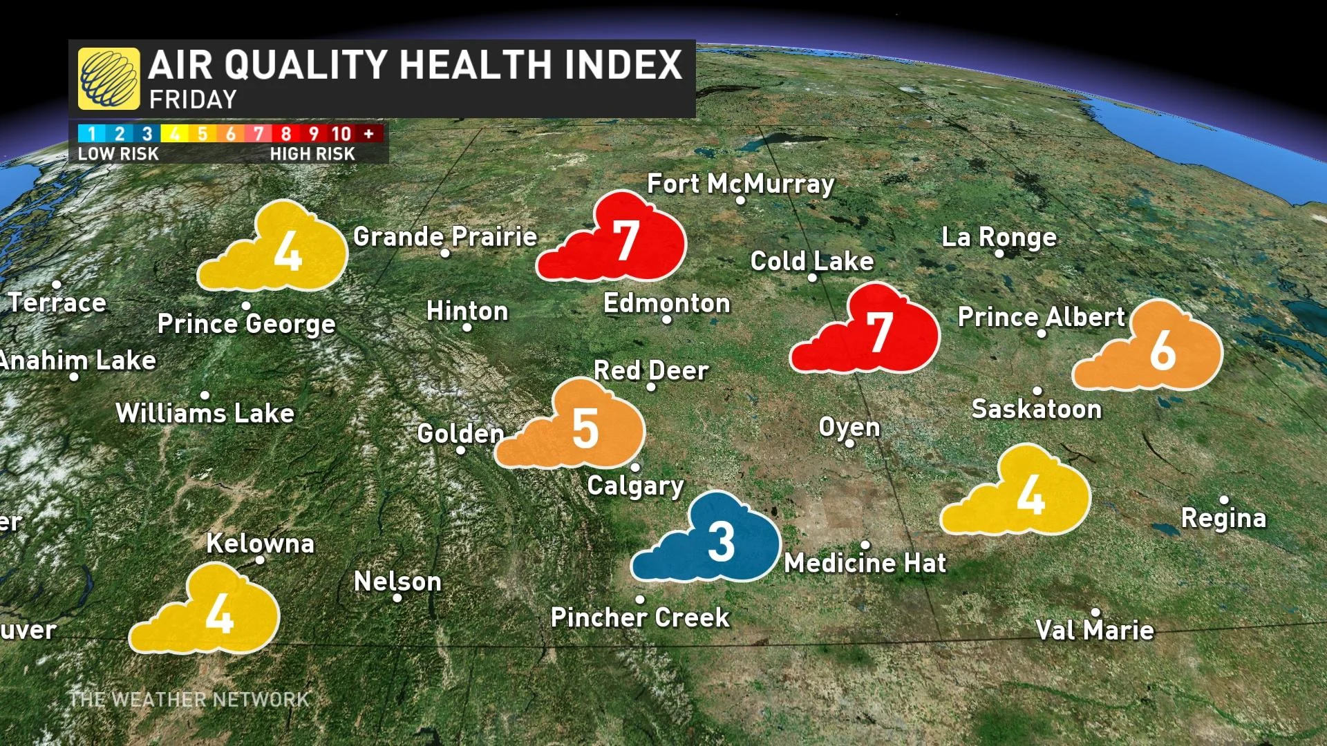
More wildfires are also starting over western Canada, which is reducing air quality in Alberta. Special air quality statements are in effect.
"Wildfire smoke can be harmful to everyone's health even at low concentrations," says Environment and Climate Change Canada (ECCC) in the statement. "Continue to take actions to protect your health and reduce exposure to smoke."
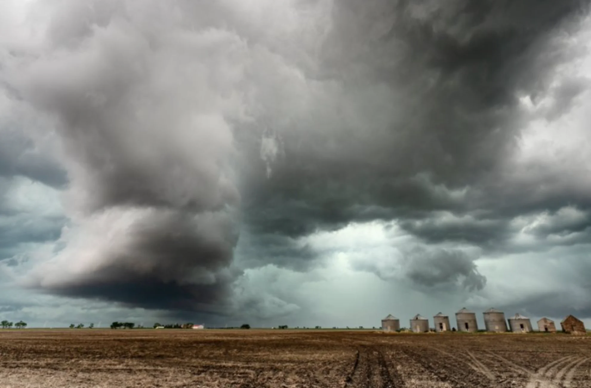
Thumbnail image courtesy of Mark Duffy/Twitter.
Check back for the latest on conditions across the Prairies.


