Stubborn pattern over Alberta sparks multi-day severe weather setup

Above-seasonal temperatures will fuel a daily risk for severe storms in Alberta heading into the beginning of the week
Saturday saw another round of severe weather across parts of Alberta as a disturbance over the western Prairies sparked thunderstorms that thrived amid above-seasonal temperatures.
It’s going to be a copy-and-paste kind of forecast for the next couple of days, unfortunately, as the risk for severe storms greets Alberta again on Sunday and Monday.
RELATED: Four simultaneous heat domes break major records across the globe
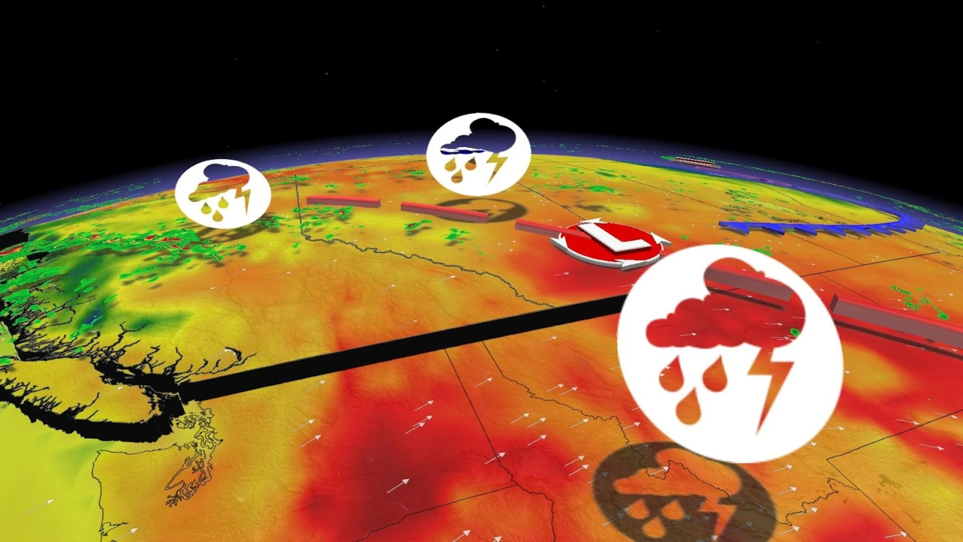
Sunday
Areas: B.C., Alberta, and the Northwest Territories
Weather: Forecasters expect significant instability to build over much of Alberta through the day on Sunday as a trough remains draped over the province. The trough will provide the lift needed to kick off thunderstorms in that unstable environment, some of which could easily surpass severe limits.
Severe thunderstorms are possible along and east of the foothills on Sunday, with a separate round of severe weather possible through far northeastern British Columbia, southern sections of the Northwest Territories, and northern Alberta stretching into Fort McMurray.

DON’T MISS: Nova Scotia’s historic rains would’ve smashed records in Florida
The strongest storms could produce large hail, strong wind gusts, and heavy rainfall. A few instances of very large hail are possible along the Alberta foothills.
Meanwhile, hot temperatures will continue on the southern Prairies as the edge of the heat dome roasting the southwestern United States nudges north of the border. Daytime highs should easily climb into the mid-30s for southern Alberta. This high heat will continue to put a lid on any storms across the region.
Monday
Areas: Northeastern B.C. and Alberta
Weather: Monday will feature a similar setup to Sunday, with ample instability fuelling storms triggered by a distinct trough over southwestern Alberta. This will place the focus for storm activity on communities north of the low, including Edmonton and areas toward the northwest.

Large hail, strong winds, and heavy rains are the greatest threat in severe storms that develop during the day Monday.
Monday afternoon looks like the hottest day of this stretch of heat for southern portions of the western Prairies. Extreme southern sections of Alberta could close in on the 40-degree mark, which would rank among the warmest temperatures measured in Canada so far this year.

Stay with The Weather Network for the latest on conditions across Western Canada.