Steep temperature drop could bring Ontario its first snowflakes

An incoming fall storm may bring the first lake-effect snowflakes of the year to parts of southern Ontario
Get ready for an abrupt change across southern Ontario over the next couple of days.
Temperatures that rose into the upper 20s earlier this week will plunge toward the freezing mark as we head into this weekend.
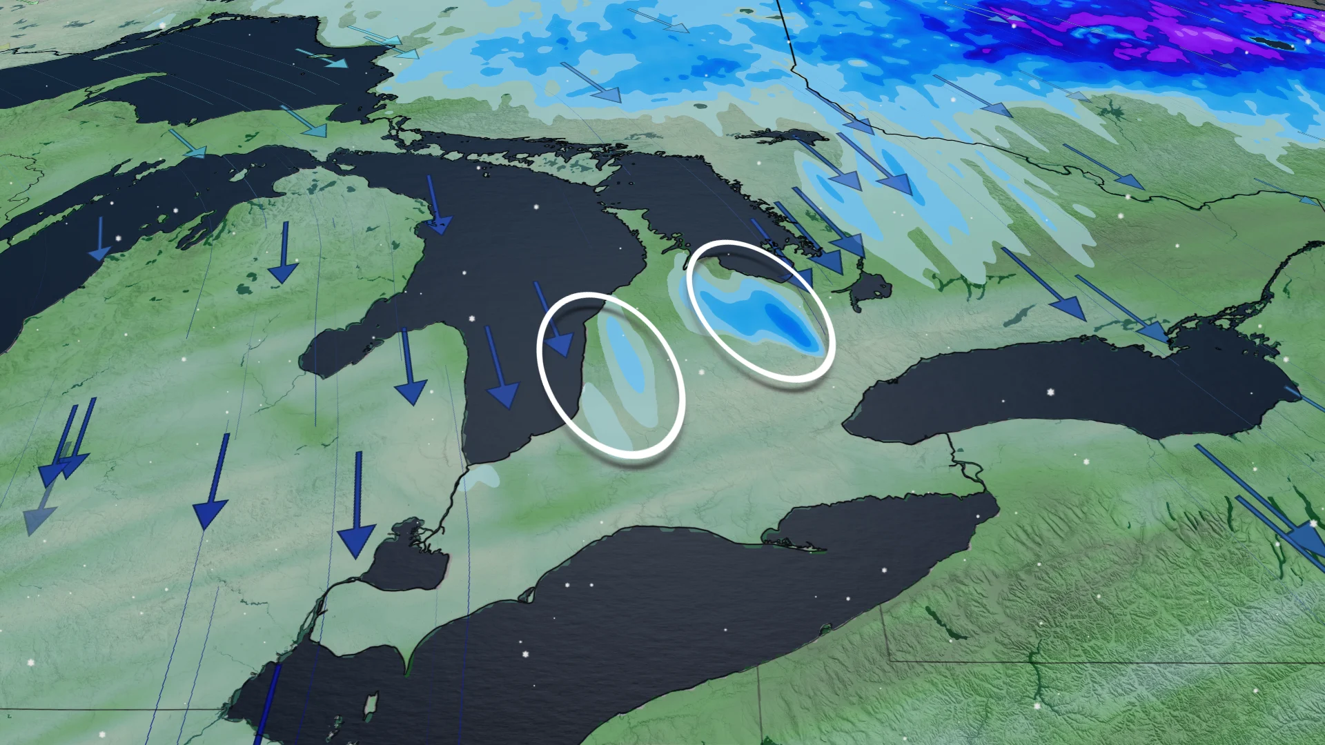
The setup behind an approaching system could even allow the season’s first taste of lake-effect snow for parts of the region.
DON'T MISS: Winter snowfall across Canada may fall victim to El Niño
A gloomy, rainy Friday storm on tap
A large low-pressure system set to traverse the Great Lakes will bring windy and rainy conditions to almost all of Ontario through the day Friday.
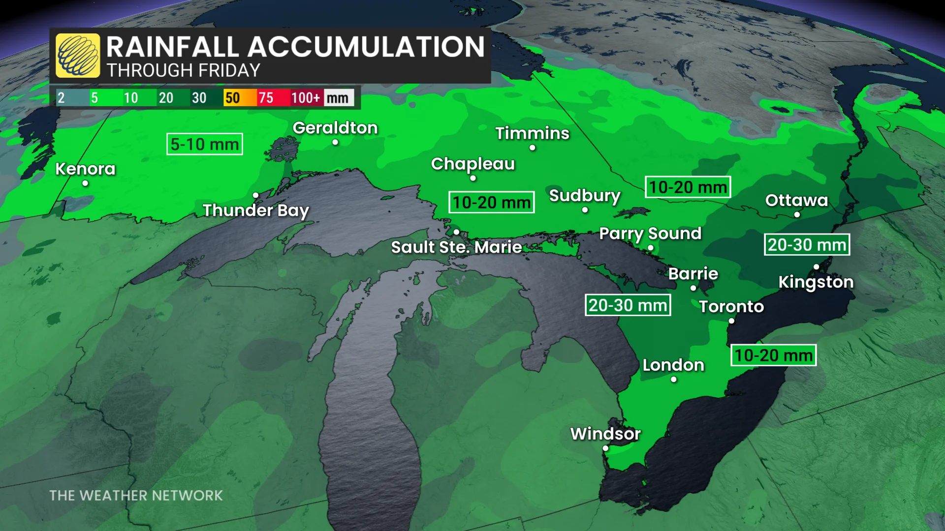
We may see a risk for embedded thunderstorms in parts of the southwest as a warm front lifts through the region during the morning hours. Rainy conditions will improve through the day, but scattered wrap-around rainfall is expected.
Expect general rainfall totals of 10-20 mm, with 20-30 expected for portions of eastern Ontario. Locally higher totals are possible beneath any thunderstorms.
Rapid temperature drop sparks snow potential
Winds will gust near 50 km/h later Friday as very cold northerly winds rush in behind the departing system. This will kick up higher-than-normal waves along the lakeshores.
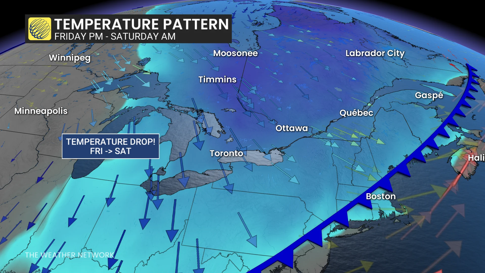
These brisk winds will usher in a rapid temperature drop, especially during the overnight hours Friday into early Saturday. Some inland communities may dip near or below the freezing mark.
A sharp contrast between the cold airmass and the warm Great Lakes will fuel lake-effect rain downwind of Lake Huron and Georgian Bay.
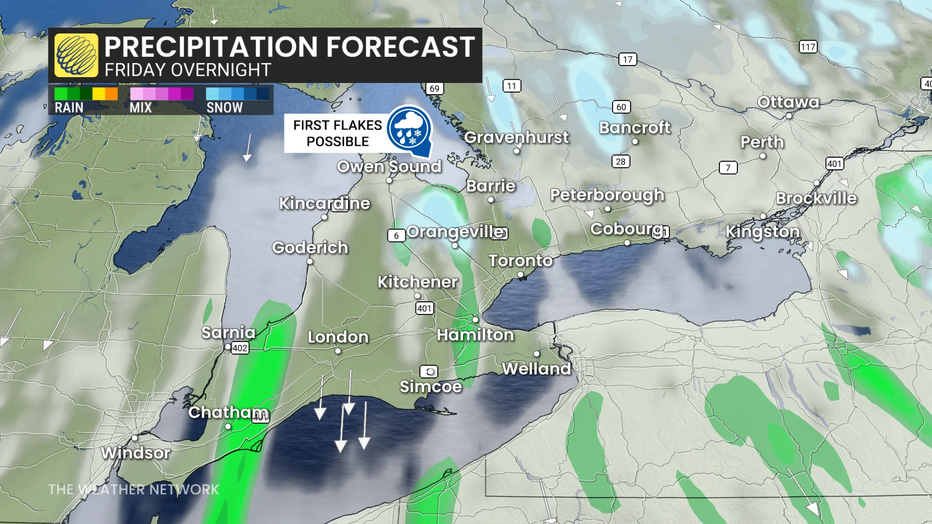
Some of this lake-effect rain may turn into a rain-snow mix for the snowbelts and parts of Algonquin, providing the season’s first opportunity for snowflakes.
Daytime highs on Saturday will only climb into the single digits, though conditions should settle back toward normal in time for the new workweek.
Stay with The Weather Network for all the latest on conditions across Ontario.