Storm risk peppered across Western Canada, poor air quality from fires

Numerous provinces in Western Canada are facing a thunderstorm potential on Tuesday amid an unsettled pattern in the atmosphere. Some areas are also experiencing poor air quality from wildfire smoke.
Another day of active weather is expect across British Columbia and parts of the Prairies Tuesday. As temperatures continues to trend above seasonal, lots of heat will help build thunderstorm energy for B.C., parts of Alberta, and extreme areas of southern Saskatchewan and Manitoba, as well as northwestern Ontario. The bigger concern will be the poor air quality for some resulting from wildfires in the West. More on Tuesday's storm threat, the drop in air quality and finally some relief from the heat in Alberta, below.
Tuesday: Storm risk encompasses parts of Western Canada, air quality poor for some with ongoing fires
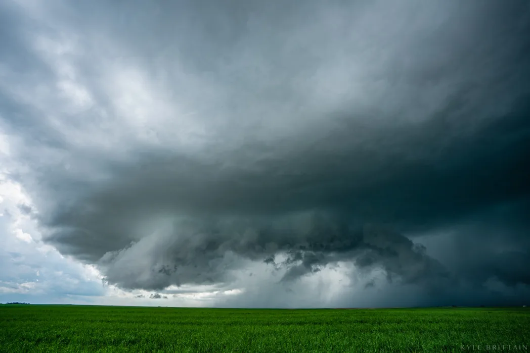
The threat for thunderstorms Tuesday comes as a frontal boundary contines to sink south across Western Canada. As temperatures continues to trend above seasonal, lots of heat will help build thunderstorm energy.
These storms are mostly going to remain scattered and non-severe in nature.
However, there will be a few areas across B.C., Alberta, southeastern Manitoba and northwestern Ontario that may see storms reach severe criteria, with the main hazards being strong winds and large hail.

MUST READ: Summer's not over yet! Here's what you need to make the best lemonade
There is quite a lightning threat, as well, so there are concerns over new wildfires being lit. Many areas across the Interior of B.C. and northern Alberta, Saskatchewan, and Northwestern Territories are under special air quality statements due to wildfire smoke.
Some areas in the vicinity of the fires could see smoke persist for the next few days. There are currently 314 wildfires burning in Western Canada, with most of them in B.C. (191).
Heat warnings remain in effect
Meanwhile, for the second week in a row, heat warnings remain locked in over Alberta and parts of southern Saskatchewan. However, they are expected to drop in southern areas of the former Tuesday as temperatures finally moderate.
Temperatures across southern Alberta will fall below seasonal on Tuesday, while the heat remains across northern areas of the province and B.C., as well, even extending into N.W.T. where temperatures are into the mid/high 20s

While the heat finally relaxes this week across southern Alberta, above seasonal temperatures will continue to dominate in late August and into early September. Meanwhile, hot and mostly dry conditions expected across northern Alberta and into northern Saskatchewan, extending into southern N.W.T., as well. Wednesday through Friday will highs in the upper 20s to lower 30s.
A brief cooldown and more unsettled weather is expected across the region during the weekend, then the heat will return to western areas next week, but remaining cooler in the east.

Meanwhile, scattered showers and thunderstorms are expected for the B.C. Interior on Wednesday and Thursday but overall a dry pattern continues. Heat builds again for a couple days early or mid-next week. A warm and dry pattern is expected to dominate through early September, so the heightened risk for wildfires will continue.
Be sure to check back for the latest weather updates across the Prairies and B.C..