MAY: Disappointing outlook, but one province lucks out

With May now here, we review how the spring forecast across Canada has played out and what Canadians can expect for the rest of this month
GRADING THE SPRING FORECAST
Our spring forecast highlighted several storylines for the season. Before looking ahead to the month of May, here is a quick recap and evaluation of the spring forecast so far.
First, we highlighted a “furious finish to winter." That part of the forecast verified very well – actually too well. Not only did we have frigid weather from coast to coast during the first two weeks of March, but parts of Canada are still seeing wintry weather deep into spring.
SEE ALSO: 2X Faster - More flooding, rapid sea level rise in Canada
We then highlighted a “strong start to spring” for the second half of March and into early April. That worked out very well across Western Canada where the pattern reversal was dramatic. However, from the Great Lakes to Atlantic Canada, that part of the forecast failed. We did snap out of the frigid pattern by mid-March, but no one would describe what followed as a strong start to spring.
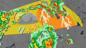
Our spring forcast also discussed the heightened threat for spring flooding, and unfortunately that threat has become a reality in many regions.
Finally, after the expected strong start to spring, we wrote that we would have “chilly interruptions” well into April and May. Those interruptions have actually taken over the pattern across much of Canada.
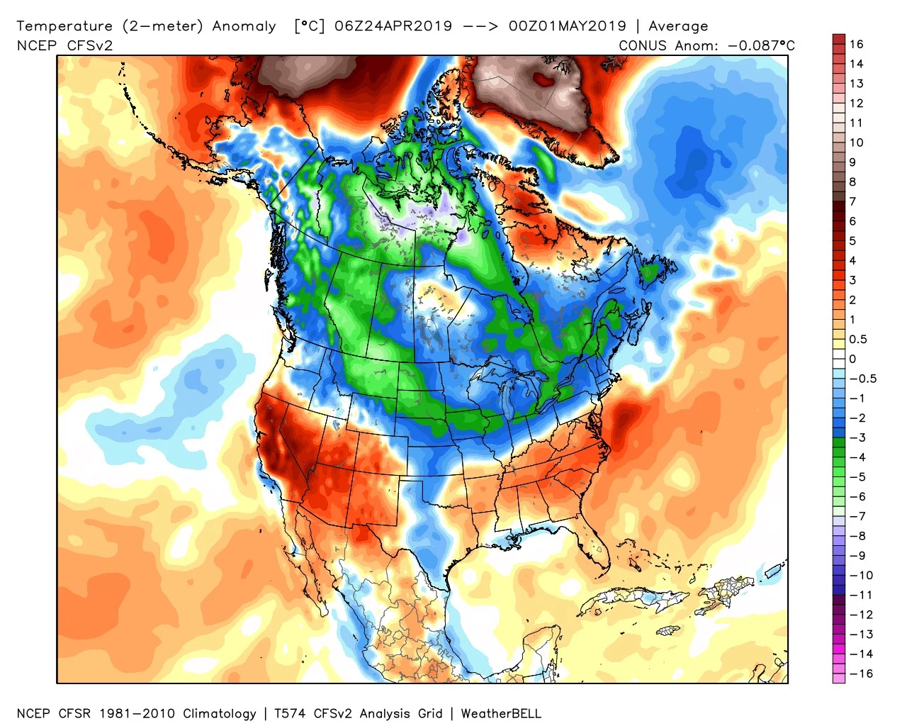
The map below shows temperature anomalies for the final seven days of April. The various shades of blue and green highlight the colder than normal temperatures that were found from coast to coast.
How long will this pattern last? Please read on.
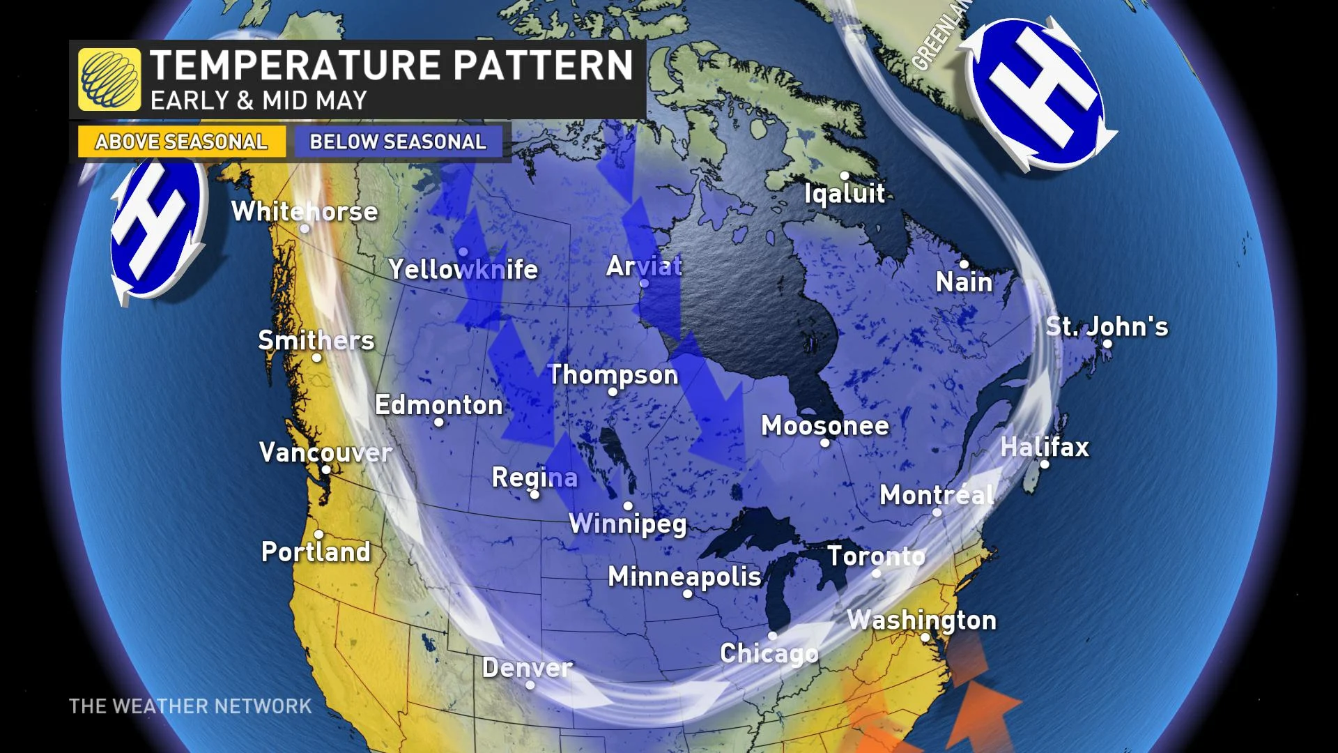
CHILLY PATTERN CONTINUES THROUGH EARLY MAY
We expect that the national pattern for early and mid May will be a familiar one – quite similar to how we ended April. One key difference is that we expect most of B.C. and the Yukon to be above seasonal. In fact, southern B.C. will see some summer-like heat later next week. But, from the Rockies to Atlantic Canada, colder than normal temperatures will continue to dominate.
However, keep in mind that “seasonal” is increasing by 1°C to 2°C per week and this doesn’t mean that every day will be colder than normal. Warmer than normal weather across the southeastern U.S. will attempt to surge north at times.
Unfortunately, the close proximity of the colder than normal weather in contrast to the early summer-like warmth just to the south means that we should continue to see an active storm track and above normal rainfall from southern Ontario to the Maritimes, including many of the regions that are experiencing historic flooding.

This also starts to raise concerns about whether fields will be too wet to get crops planted on time, especially if this pattern persists into late May.
LOOKING AHEAD TO THE SECOND HALF OF MAY
When we look back at years that had a similar global pattern with widespread cold weather during April and into early May, we find that most of those years featured a pattern reversal that bought early summer-like warmth during the second half of May.
However, at this point, we are not able to see any indications that give us confidence as to when such a pattern change will occur. In fact, there are models that show this pattern persisting into June. But, I should also point out that these models have been terrible throughout the spring.
So, we do expect that the chilly pattern will relax somewhat during the second half of May, but it is becoming increasingly doubtful that any warmth during the end of May will be able to fully offset the cold start to the month. However, if anything changes, we will post an update at the first signs of a pattern reversal.