
It's officially spring and this Canadian coast is getting 50 cm of snow

Spring officially arrived, but with a winter blizzard on Canada's East Coast. Over 50 cm of snow could stack up for some
It's officially the first day of spring, but winter just won't quit on Canada's East Coast. Newfoundland and Labrador marked the arrival of spring with a full-fledged blizzard and blowing snow, as a potent Atlantic low dumps up to 50 cm of snow for some.
Visit our Complete Guide to Spring 2023 for an in-depth look at the Spring Forecast, tips to plan for it and much more!
Blizzard warnings are in effect for Labrador's coastline as this strong low-pressure system spills high snowfall rates and gusty winds across the region.
Winds were forecast to gust between 90-100 km/h throughout the day Monday.

"Travel is expected to be extremely hazardous due to reduced visibility," says Environment and Climate Change Canada (ECCC) in the blizzard warning posted for Nain, Hopedale and Cartwright. "Travel is not recommended."
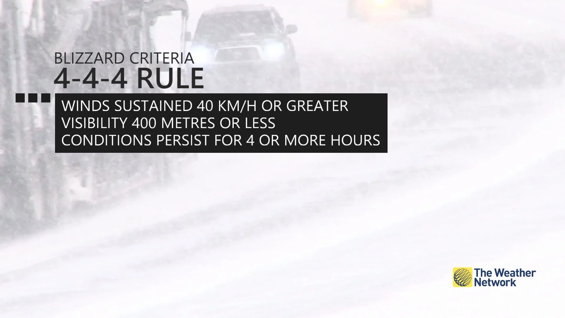
Blizzard warnings are issued when widespread reduced visibilities of 400 metres or less are expected for at least 4 hours.
Much of Labrador's coast will also see heavy snowfall, with impressive snowfall rates of 3-5 cm an hour at times. The rapidly accumulating snowfall and near zero visibility will make travel extremely difficult and dangerous in these areas.
In all, between 30-50+ cm of snow is expected in the hardest-hit places through Tuesday.

Western sections of Newfoundland may also experience snow and blowing snow conditions. Higher elevations of the Northern Peninsula could see over 30 cm of sea-effect snow.
Conditions are expected to gradually improve into Tuesday.
WATCH: Spring is officially underway, here is what Canada can expect this season
Be sure to check back for the latest forecast updates across Atlantic Canada.
Thumbnail image courtesy: Peter Smith/Twitter