Rain, fog continues for southern Ontario ahead of snow threat this weekend
Expect another dreary morning commute Friday as fog and rain blanket southern Ontario through the first half of the day
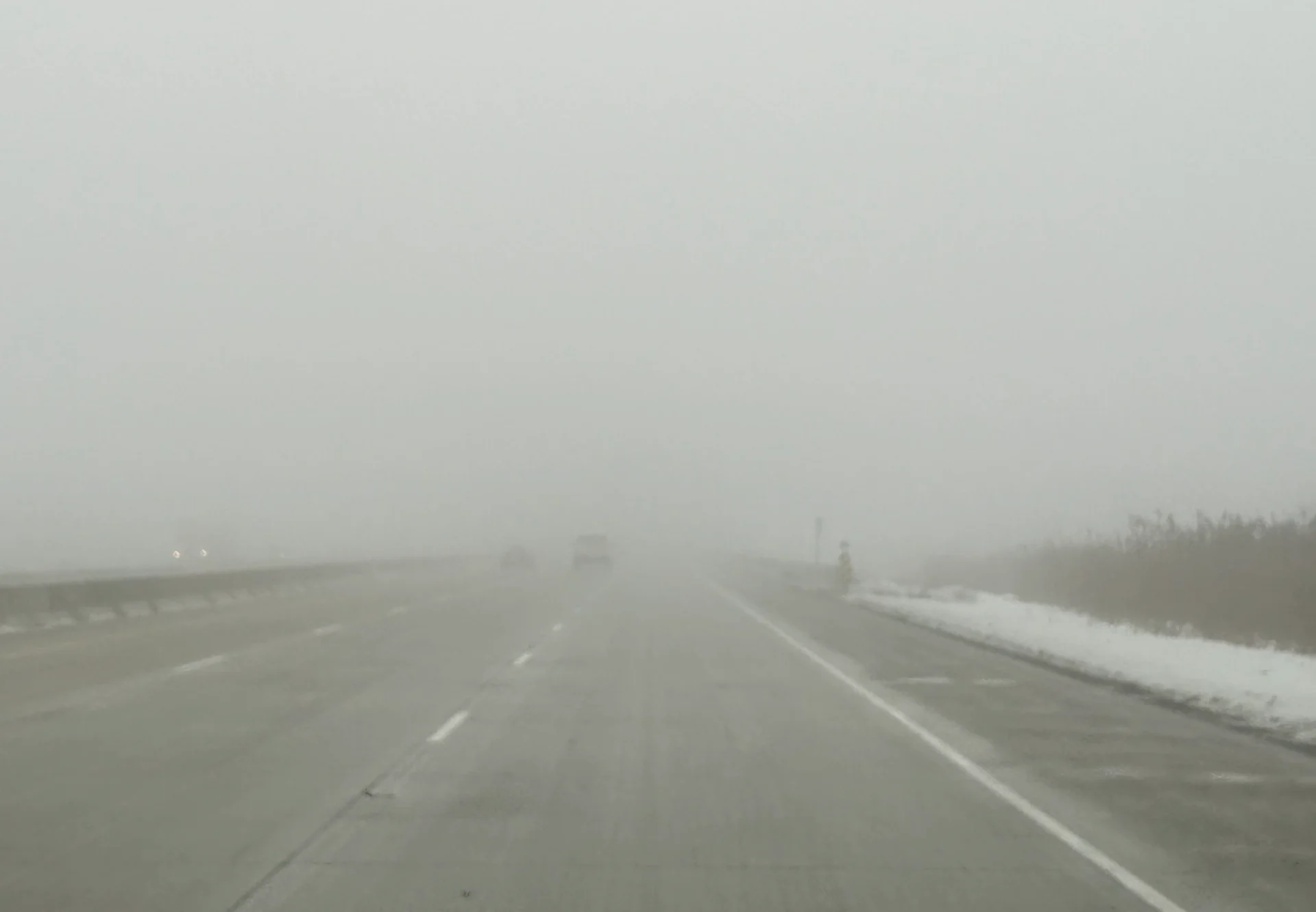
The great January gloom continues on Friday as another system approaching southern Ontario threatens a spell of soaking rains and thick fog through the morning commute.
Use extra caution on Friday morning as slick roads and poor visibility will increase stopping distances and make travel a little rougher than usual.
DON’T MISS: Follow these tips for staying safe while driving in thick fog
Even as temperatures rise and the foggy conditions persist, forecasters are looking ahead to the potential for wintry weather to return once again this weekend.
Through Friday: Widespread fog advisories and another round of rain
An extended January thaw continues across southern Ontario as an unusual pattern drags above-seasonal air and high humidity north of the border.
This mild and moist environment is the perfect setup for thick fog, which we’ve seen in abundance throughout the week. Fog advisories continue for a large swath of southern Ontario, including in Windsor, London, Hamilton, and up the Bruce Peninsula. This will likely persist through Friday and into Saturday, as well, so be sure to drive with caution and prepare for changeable weather and visibility conditions.

Rain will spread over southern Ontario into the pre-dawn hours Friday as a new system tracks into the eastern Great Lakes.
This system will drag even milder air north across the region, bringing the rain and relative warmth even farther north into cottage country.
Folks throughout the Greater Toronto Area (GTA) can expect about 15-25 mm of rain by the time the system pulls away Friday afternoon. The rainfall will clear up in time for the evening commute, but the mild, moist environment remaining may trigger fog Friday evening.

Beware of ponding on roads in areas that see persistent heavy rainfall.
MUST SEE: Winter takes a breather in major Canadian cities with January thaw
Temperatures will continue to be mild into the weekend, continuing the threating of fog. While it’s still chilly enough for jackets, this is firmly above-seasonal for the final full week of January.

Another round of freezing rain will target eastern Ontario and portions of southern Quebec through Friday morning and afternoon. This will lead to hazardous road conditions once again on Friday.
RELATED: Hours of ice cancels schools, buses in eastern Ont., Quebec, still more to come
Sunday: Fog finally breaks, but with a chance of snow
While it's too early for specifics, another system tracking south of the border may bring a return to seasonal temperatures and the potential for a rain/snow mix Sunday.

A low tracking through the U.S. Northeast could come just close enough to spill precipitation north of Lake Erie and Lake Ontario, bringing precipitation along and south of the 401. However, there’s also the chance this system could remain too far off the coast to have any impacts.
Winds shifting around to the northwest behind that system will allow more seasonable temperatures to flow into southern Ontario, finally breaking the fog cycle we’ve been mired in lately.
A couple days of colder weather are forecast early next week, especially for eastern Ontario, but much milder weather and early spring-like temperatures are forecast for the second half of next week, and continuing well into the first week of February, as well.
However, winter is not over. We are watching the potential for an extended stretch of colder winter weather from mid-February through early March.
Be sure to check back on Feb. 1 for an extended look at what the month ahead has in store in our official monthly outlook.
Stay with The Weather Network for the latest on your forecast across Ontario.