Southern Ontario faces new round of snow squalls before weekend storm
Lake-effect squalls and a weekend system will bring rapidly changing conditions across southern Ontario.
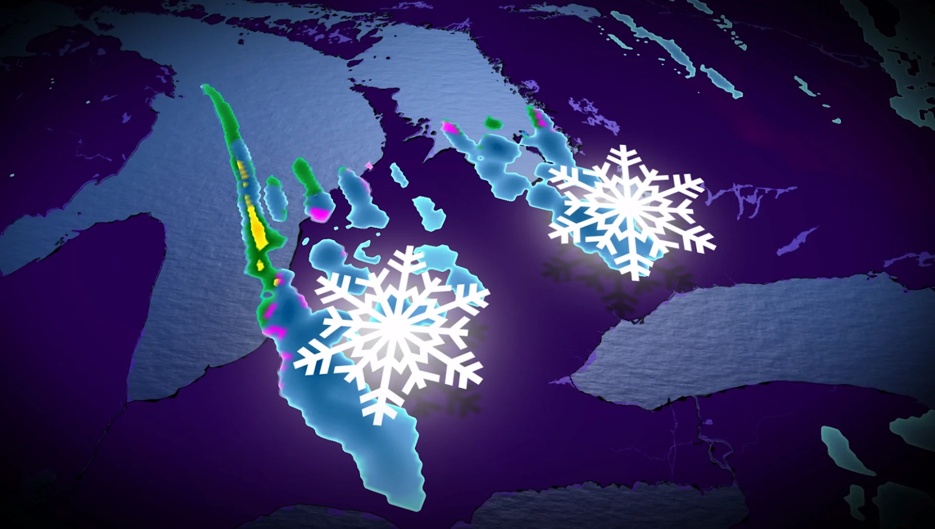
Lake-effect snow bands are not going away anytime soon. After another night of scattered bursts across southern Ontario, the bands are expected to merge into stronger, more organized squalls before the Friday morning commute.
Northwest gusts of 40-60 km/h will add a punch, kicking up blowing snow and keeping wind chills sharp. Forecasters anticipate two dominant squalls to form by early Friday, each targeting a different part of the region.
CHECK OUT: How one bad parking job can paralyze a city — and why Toronto is cracking down
Squalls set to fire up Friday morning
One of the main bands is going to build off Lake Huron, crossing Highway 21 near Goderich and heading southeast toward Kitchener-Waterloo, Cambridge, Stratford, Woodstock and Brantford.
Drivers on the 401 and 403 should prepare for sudden whiteouts and accumulating snow.

Farther north, a second strong band will form off Georgian Bay, targeting directly at Barrie, Lake Simcoe and the 400 corridor into the northeast GTA. Even areas outside the main bands will experience scattered flurries throughout the morning.
DON'T MISS: Holiday Survival Guide: Staying warm during Canada's cold shopping season
Conditions ease Friday night, before another system rolls in
The squalls will wobble throughout the afternoon, eventually breaking apart by Friday evening. A few lingering bursts may continue into early Saturday, but the attention soon shifts to the next incoming system.
A Colorado low is projected to sweep across southern Ontario Saturday night and Sunday, spreading a more uniform layer of snow across the region.

While not as intense as lake-effect bands, it will be widespread. Forecast totals range from 5 to 15 cm, which should result in another slick round of travel impacts to cap off the weekend.
Stay with The Weather Network for the latest updates across Ontario