Southern Ontario faces a significant thaw, white Christmas hopes are at risk
While Ontario can experience strong winter patterns in December, it's uncommon for them to persist this long. A brief but significant warm-up is now underway
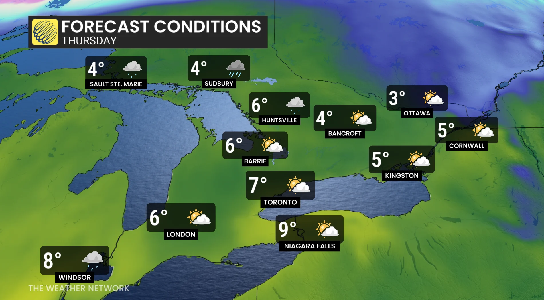
Shed the layers--a brief but notable thaw is spreading across southern Ontario this week.
While colder air moved in briefly Wednesday night, temperatures will rise into the mid- to upper-single digits by Thursday and Thursday night.
DON'T MISS: La Niña to continue into 2026, leaving thumbprint on winter weather
Expect some sunshine Thursday before clouds thicken later in the day. Rain is forecast to develop west to east by the evening and continue overnight.
Thursday will perhaps feature the warmest temperatures of the month so far.
Remarkably, though, Toronto hasn’t gone an entire December without surpassing 5°C in 20 years.
Here’s the average number of December days with highs above freezing:
Windsor: 22
Toronto: 20
Ottawa: 12
Why has December been so cold up until this point?
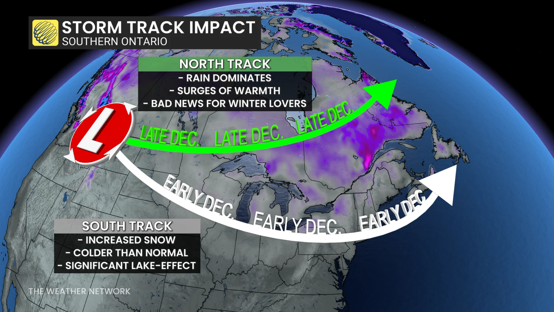
A typical La Niña winter often brings persistent Arctic air to Central Canada and directs storms closer to the Atlantic coast, either south or near the Great Lakes. This pattern has dominated the first half of the month. When storms track over or south of the Great Lakes, warm, southerly air struggles to reach Ontario. However, when storms track north of the lakes, it allows warmer air to push farther north.
SEE ALSO: Powerful winter storm hits northern Ontario with major snow, winds
The shift to a more northerly storm track is underway, with this week’s Alberta clippers staying north of the Great Lakes.
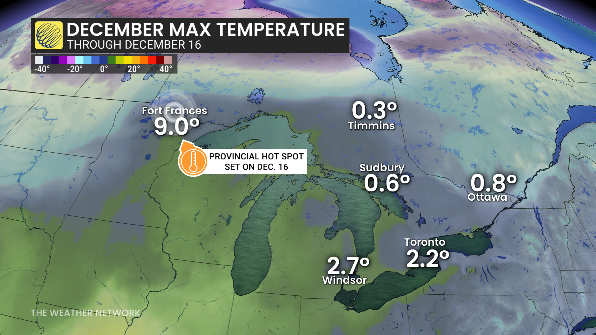
This trend allowed Fort Frances in northwestern Ontario to hit 9.0°C on Tuesday, marking the province's temperature high so far this month.
Lower confidence for a white Christmas with the current trend developing
This trend is expected to continue through the rest of the month, making storms south of the Great Lakes less likely and limiting lake-effect snow events.
While the snowbelts already have enough snow to ensure a white Christmas, confidence is much lower for the GTA and the 401 corridor from Windsor to Cornwall.
RELATED: You asked for a white Christmas, and you may just get it!
A few clipper systems are expected next week and into late December, bringing fluctuating temperatures and windy conditions.
For regions outside the snowbelt, the chance of a white or green Christmas will depend on the clippers' paths. They could either bring a last-minute snow coating or dash hopes with additional rain that melts away existing snow.
Be sure to check back later this week for the official 2025 holiday snow report.
WATCH: Why it could be a 'December to remember' for Ontario's snowbelt
Thumbnail image courtesy: Getty Images