Snowfall, cold warnings span the Prairies; 20 cm of snow brings travel risk
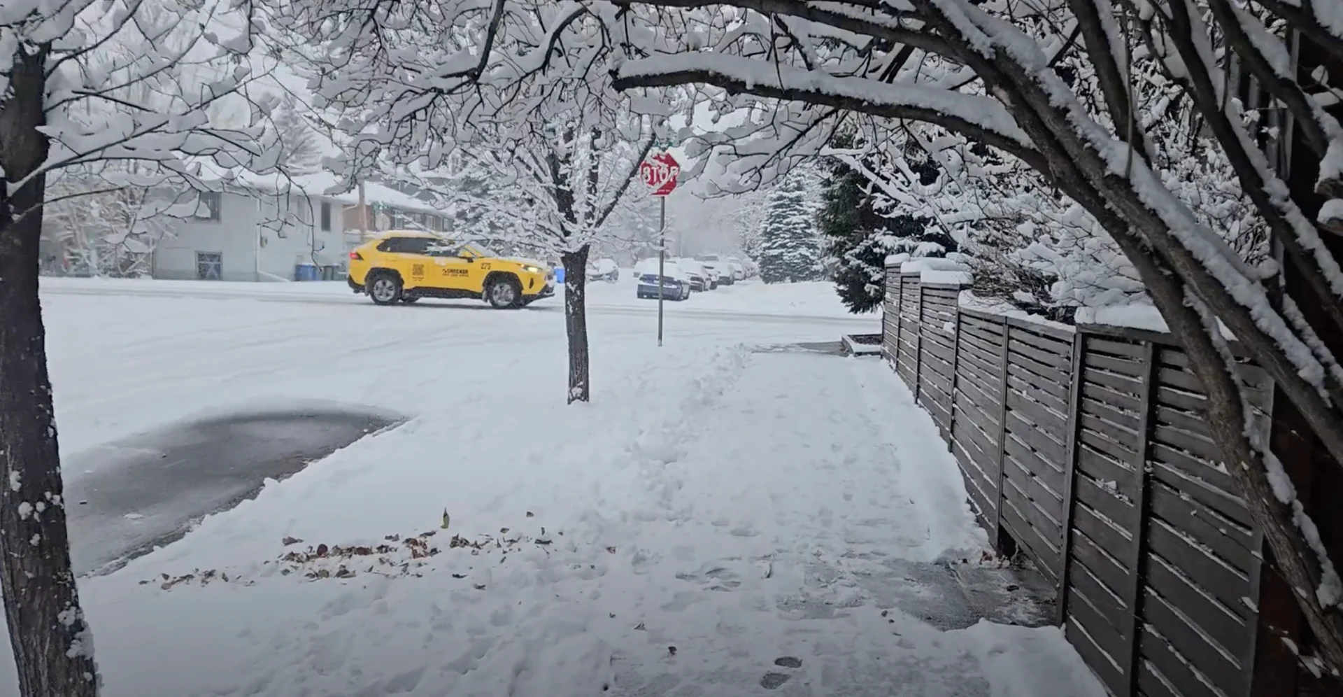
Snow will continue to pick up in intensity across the Prairies through Wednesday, threatening as much as 20 cm across some of the harder-hit areas. Driving conditions will be dicey
Snowfall warnings span the Prairies, with difficult travel likely as conditions deteriorate across the region through Wednesday. Localized totals could surpass 20 cm into Thursday, and visibility may be suddenly reduced at times in heavy snow.
Drivers are urged to plan ahead based on the changing road conditions. Holiday travel plans are also likely in motion, so it'll be important to stay weather-aware, and up-to-date on all of the warnings in your area. The snow is expected to be at its heaviest throughout Wednesday afternoon and evening.
Luckily, the strongest wind gusts will be in southern Alberta and southwestern Saskatchewan, south of where the heaviest snow will fall. Still, gusts between 40-60 km/h will help to blow the snow around, as it'll be light and fluffy as the temperatures are so cold.
RELATED: Want a white Christmas? These Canadian cities have the best odds
Wednesday through Thursday:
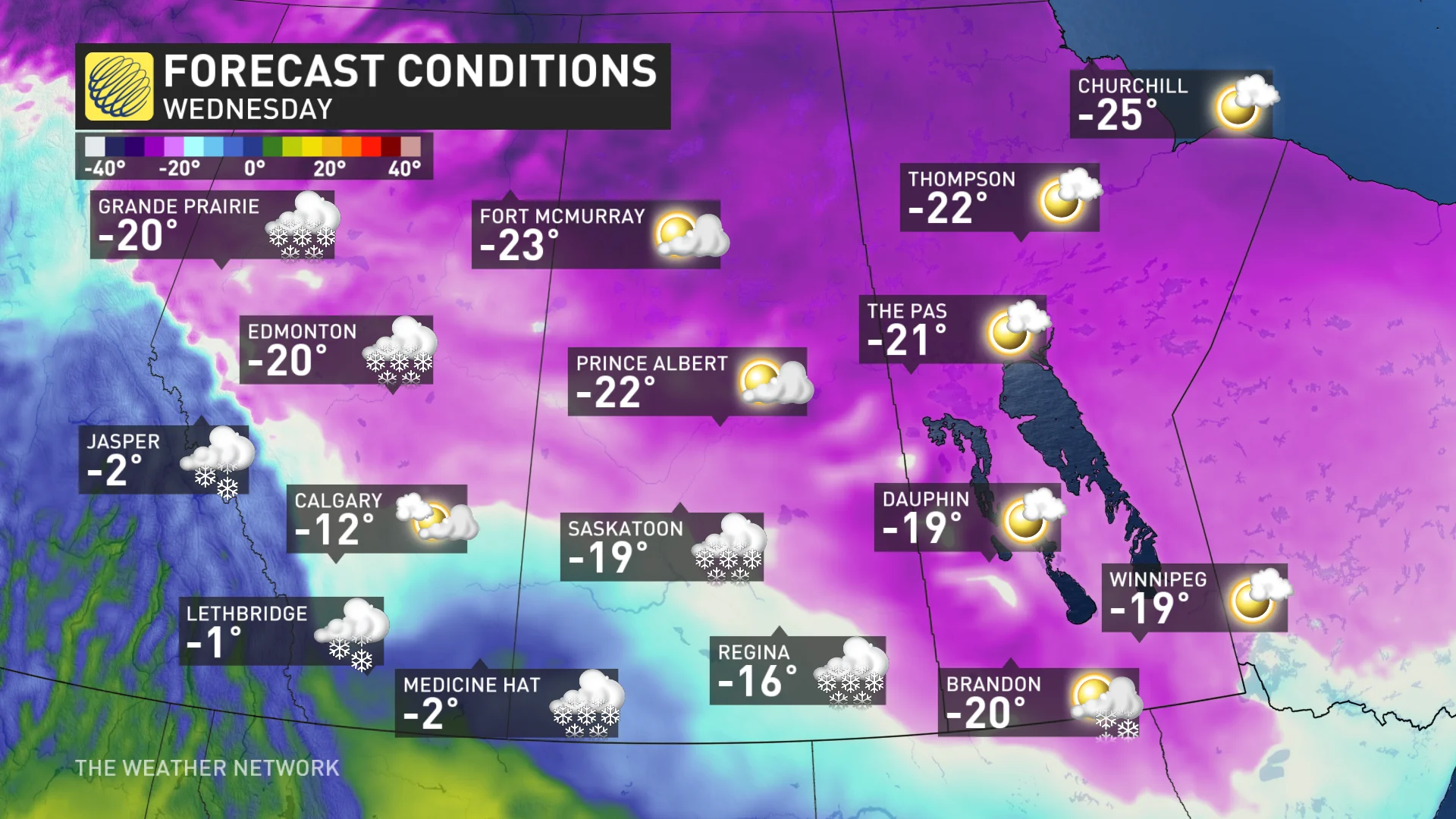
Snow will start along Alberta's foothills Wednesday, quickly bringing a couple of centimetres of snow to Calgary, and adding to the first bouts of accumulating snow the city has seen this month. A couple of centimetres was reported early Tuesday morning, as well.
A clipper developing over southern Alberta will prolong the snowfall on Wednesday afternoon, but will move south into Montana by the overnight, taking the snow with it.
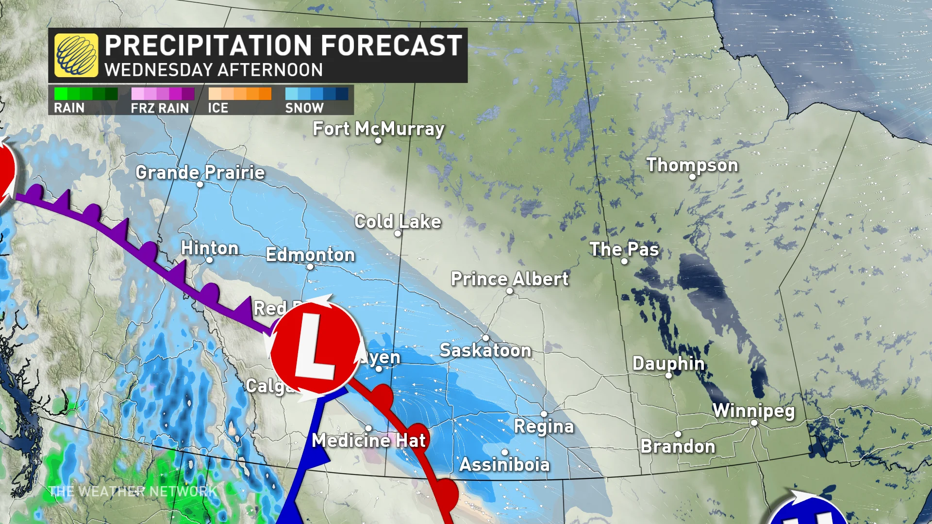
Snow fuelled by the Pacific moisture from B.C. will continue however, to move through central Alberta and into southwestern Saskatchewan throughout Wednesday, picking up in intensity during the afternoon. A swath of heavy snow will fall around the Edmonton area, and towards the Saskatchewan border.
Snow will end for all of Alberta by Wednesday evening as the snow fully moves into Saskatchewan.
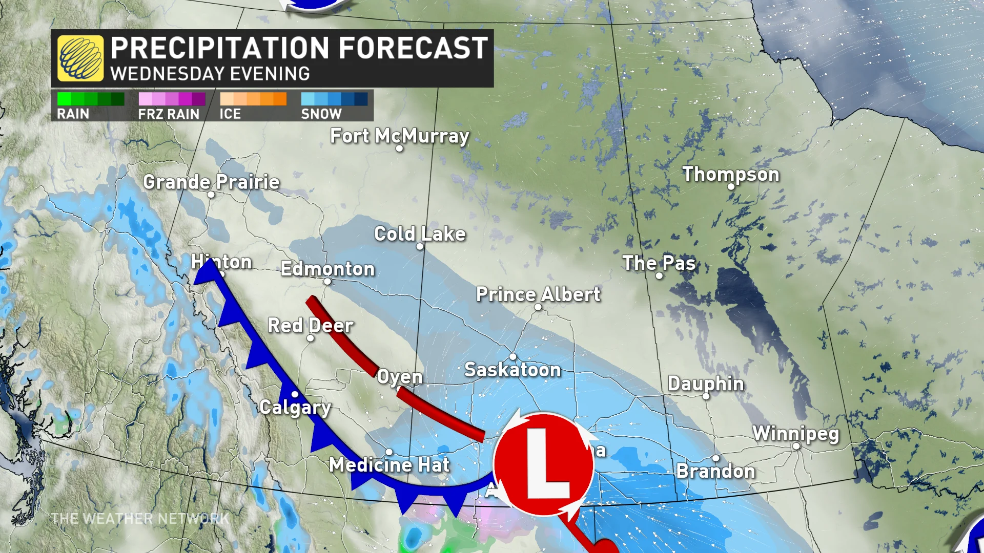
Heavy snow is expected for the province south of Prince Albert, including Saskatoon. The heaviest of the snow will fall in a swath from the western border, around Kindersley, towards Brandon, Man. Regina will be in the direct path of this snow, as well. In all, between 15-25 cm of snow will fall across the hardest-hit areas of Saskatchewan, with parts of central Alberta and Manitoba seeing closer to 10-15 cm.

"Rapidly accumulating snow could make travel difficult over some locations. Visibility may be suddenly reduced at times in heavy snow," says Environment and Climate Change Canada (ECCC) in the warning. "Be prepared to adjust your driving with changing road conditions."
Blowing snow and whiteout conditions
Wind gusts of 40-60 km/h will blow the snow over open highways and roads, reducing visibility to whiteout conditions at times. The highest wind gusts of up to 80 km/h will be limited to southern Alberta and southwestern Saskatchewan, where the clipper tracks south.
Folks can expect hazardous evening commutes on Wednesday as the early sunset will reduce visibility in the blowing snow even more. Remember not to drive through the snow with high-beams on at night as it will blind yourself and others.
SEE ALSO: 'Common sense' driving tips to help steer through Canada's winter
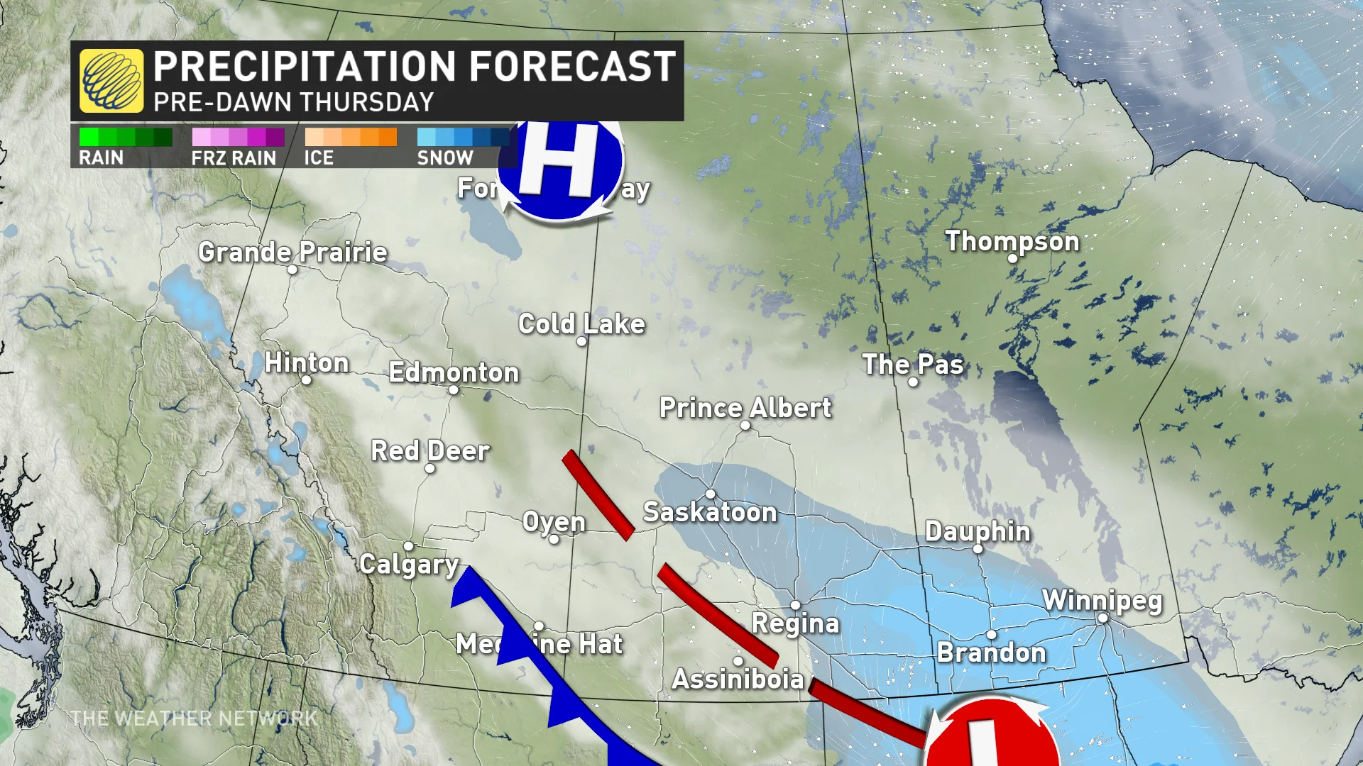
The snow will end in Saskatchewan by Thursday morning, having moved into southern Manitoba overnight.
Arctic air and daytime highs in the -20s
Arctic air moving in could cause readings to bottom out on Wednesday with highs around -20°C, and lows well into the -30s.
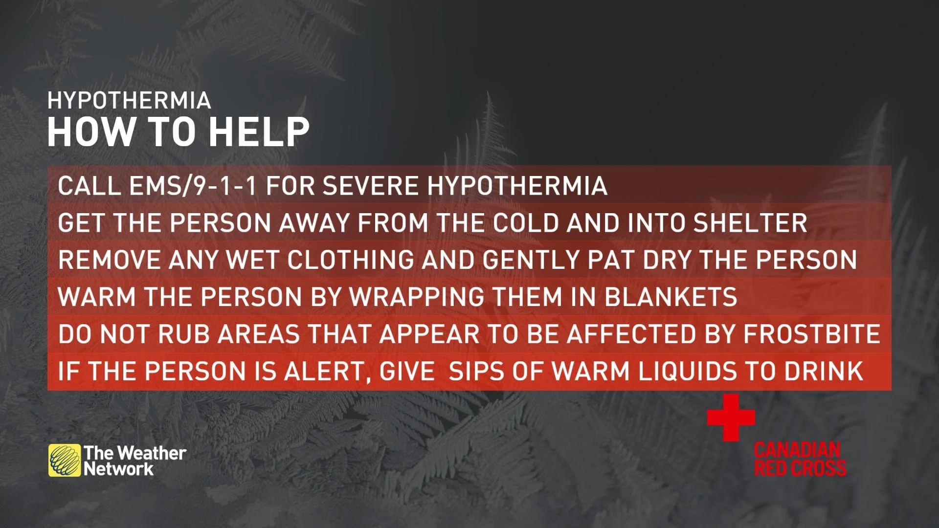
ECCC has issued an extreme cold warning across parts of Alberta, Saskatchewan and Manitoba Wednesday, where forecasters are reminding residents to take extra precautions if going outdoors.
"Watch for cold related symptoms: shortness of breath, chest pain, muscle pain and weakness, numbness and colour change in fingers and toes," the statement says. "Dress warmly. Dress in layers that you can remove if you get too warm. The outer layer should be wind resistant. Cover up. Frostbite can develop within minutes on exposed skin, especially with wind chill."
Additionally, it's important for pet owners to take the proper precautions to keep their animals snug and safe throughout chilly periods. When it comes to managing your pet's health, a good place to start is looking at your dog or cat as an individual. You can find more tips on how to protect your furry friends, here.
Brief reprieve
The temperature dive will be followed by a brief warm-up before another dose of Arctic air arrives in time for the weekend. Conditions will then trend much milder before Christmas and beyond.
A couple of systems will bring snow to northern areas for the duration, but no major storms are on the horizon—only a few opportunities for snow at times along the warm and cold fronts as they track across the region.
A much colder pattern looks to return for the first half of January, at least.
WATCH BELOW: Explosive 'cheetah trees' appear in Jasper National Park
Stay with The Weather Network for all the latest on conditions across the Prairies.