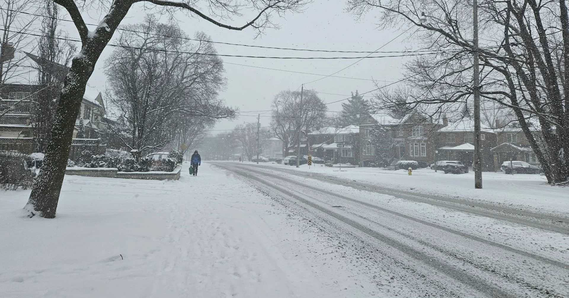
Traffic issues mount as snow covers roads in southern Ontario
It's officially spring, but Friday's snow across southern Ontario could bring one of the largest one-day snowfall totals of the year
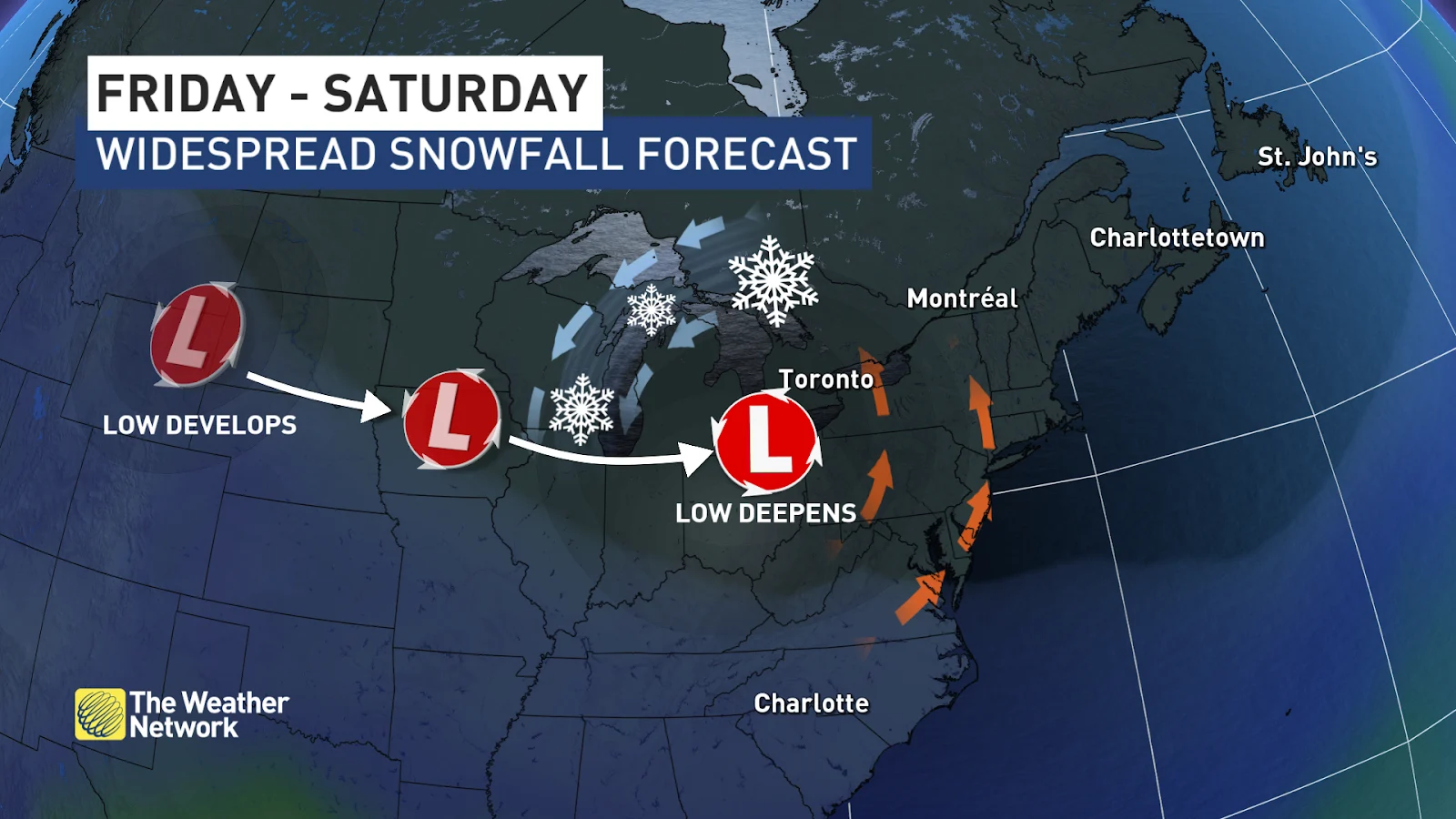
Bands of snow will continue trekking across southern Ontario into the overnight hours Friday as a low-pressure system moves across the region.
By the time the snow ends in the wee hours of Saturday, totals could end up among the biggest one-day snowfalls of the year for some areas, with 10-15 cm forecast into Saturday.
Slow traffic and slippery roads were reported across southern Ontario by early Friday evening as the snow intensifies around the evening commute for many areas, including Toronto and Hamilton. Stay aware of your local road conditions before heading out, and be wary of rapidly deteriorating roads.
Widespread special weather statements, snowfall warnings, and winter travel advisories are in effect as heavy snow affects road conditions and travel times.
SEE ALSO: April 8 solar eclipse is the must-see celestial event this spring
Through Saturday AM: Widespread snow continues overnight
A Colorado low moving across the Great Lakes is responsible for this spell of winter weather across southern Ontario.
Snow that began during the day will continue into the nighttime hours across southern and eastern Ontario.
Easterly winds blowing off Lake Ontario could enhance snowfall rates a bit in the Golden Horseshoe, helping to slightly increase snowfall totals around Toronto and Hamilton.
Snow will taper off for most of southern Ontario into the wee morning hours on Saturday. Some flurries will linger into early Saturday morning for folks in eastern Ontario.

DON'T MISS: Mild winter to blame for early pollen release in southern Ontario
Widespread snowfall totals of 5-10+ cm are expected from Windsor straight up Highway 401 toward Cornwall. Accumulations of about 10 cm are likely right around the Golden Horseshoe, which could bring Toronto its largest single snowfall of the season.
Drivers beware: This snow could greatly hamper travel
5-10 cm of snow isn’t much in the grand scheme of weather hazards. But it’s plenty to make roads slippery, especially as the sun goes down. Add in increased traffic, as well as the fact that many drivers have removed their winter tires for the season, and this setup raises the risk for slowdowns and accidents throughout the region.
By this time of year, we're usually used to the snow by the end of the cool season—but Canada’s warmest winter on record did a number on Toronto’s snowfall totals. We’ve only seen about 55 cm of snow since November, and it’s been pretty evenly spread out.
Toronto’s largest one-day snowfall this season was a paltry 6.4 cm that fell on February 15, with the city’s greatest two-day snowfall was 7.6 cm that fell between January 11-12.

The relative lack of impactful snow we’ve seen in the GTA this season will increase the risk for travel issues from this bout of snow.
Looking ahead, calmer conditions will prevail across southern Ontario this weekend as below-seasonal temperatures settle over the region. Forecasters are watching a potential warm-up next week as southerly winds blow ahead of our next low-pressure system expected to approach the Great Lakes.
Stay with The Weather Network for all the latest on your forecast across Ontario.