Snow possible as cooler weekend pattern sweeps B.C.
Freezing levels will fall as a cooler, unsettled pattern sweeps into the West Coast this weekend
We’re in for a cooler and unsettled weekend across British Columbia as a quick series of upper-level disturbances moves into the region.
This pattern will bring some beneficial precipitation to the region, including some wet snow for higher elevations and some highway passes as freezing levels take a dip.
Expect temperatures to remain on the cooler side of seasonal into next week.
DON'T MISS: Canada’s weather whiplash calms in June, but it’s not smooth sailing
Weekend sees showers, maybe a rumble of thunder
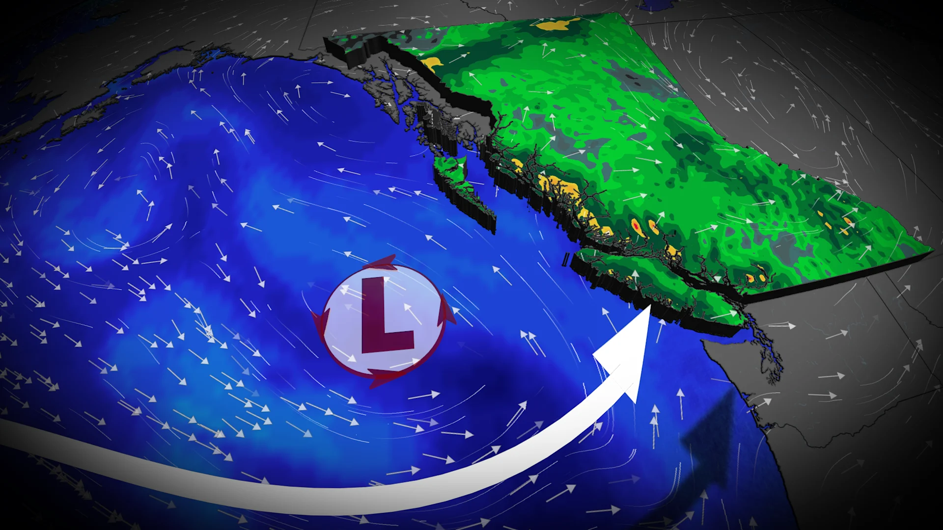
A low-pressure system sinking south will bring some showers to coastal communities through the day Friday.

This is beneficial rain for the region, but still not enough for an area that’s seen less than 40 per cent of its normal precipitation over the past 60 days. How bad is it? Vancouver averages 59.1 mm of rain during a typical May, but only saw 17.1 mm of accumulation last month.
Temperatures will fall, as well, with Saturday’s readings coming in 5-6 degrees below seasonal for early June.
Freezing levels will fall across the coastal mountains as this upper-level trough pushes into the region. We’ll see the freezing level fall to around 1300 m on Saturday, low enough to allow for some wet snow along the highway passes.

SEE ALSO: Earth's nighttime lights are rapidly changing, study shows
The Sea to Sky, Allison Pass, and Rogers Pass may see some wet snow and mixed precipitation from this event.
Cold air aloft will also provide the instability needed for a storm threat across the Interior, where we’ll see the potential for non-severe thunderstorms on Friday and Saturday.
Don’t expect a warmup anytime soon. Southern B.C. can expect near- to below-normal temperatures for the next week, as well as a secondary round of rainfall arriving into early next week.
Stay with The Weather Network for the latest on conditions across British Columbia.