Days of intense snow squalls could bring 30-50 cm to parts of Newfoundland
A departing system will leave snow squalls and a notable wind chill across Newfoundland through Thursday. Up to 30 cm of snow could accumulate
As snow and rain wraps up in parts of the Maritimes, messy weather is spreading across Newfoundland through Wednesday and Thursday.
Arctic air will spill over the East Coast for the latter half of the week, as well, with the coldest air of the season wrapping around the back side of the departing system.
With this colder air in place, conditions will be conductive for the development of persistent snow squalls in Newfoundland, bringing reduced visibilities and difficult travel for parts of the province.

Drivers are urged to plan ahead and to be prepared for the quickly changing travel conditions. Between 15-30+ cm of snow could accumulate in the hardest hit areas by Friday.
Thursday - Friday
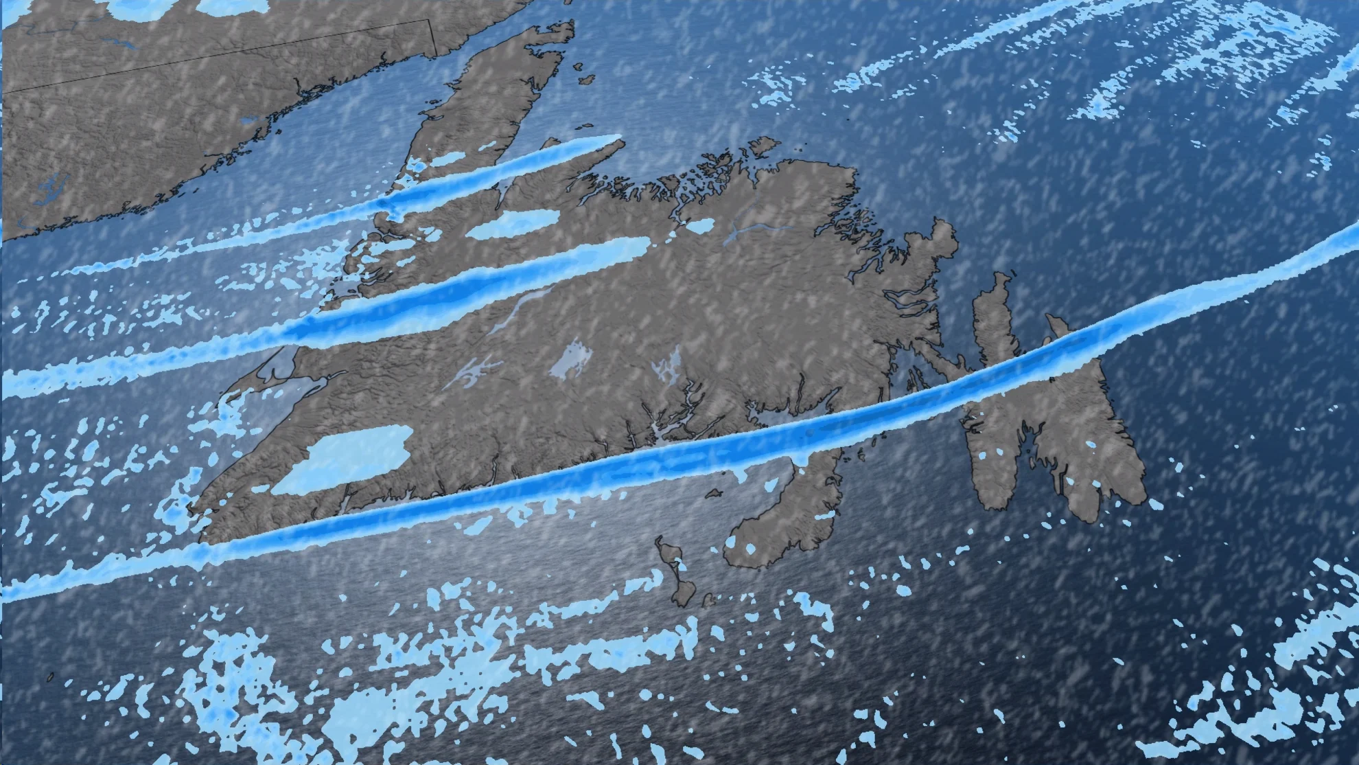
Wednesday overnight, sea-effect snow squalls start to develop, ramping up through the day on Thursday and continuing into Friday.
The strongest snow squalls will set up for western Newfoundland, from Port-aux-Basque through Stephenville, Corner Brook, Deer Lake, and into the Northern Peninsula. Upwards to 50 cm of snow is possible in the heaviest bands.
PHOTOS: Powerful snow squalls bury communities with knee-high totals
Another sea-effect snow band is forecast to set up on the Burin Peninsula and push into the southwestern sections of the Avalon. Snow won't be as heavy for these regions, but will still be persistent and blustery. Up to 30 cm of snow is likely.

Widespread snow squall watches are in place, with the threat for whiteout conditions and difficult travel into Friday.
"Snow squalls cause very changeable weather conditions; it's not uncommon to go from clear skies to an area of heavy snow in just a few miles," says Environment and Climate Change Canada (ECCC), in the advisory. "Travel could be dangerous due to a sudden change in weather conditions."
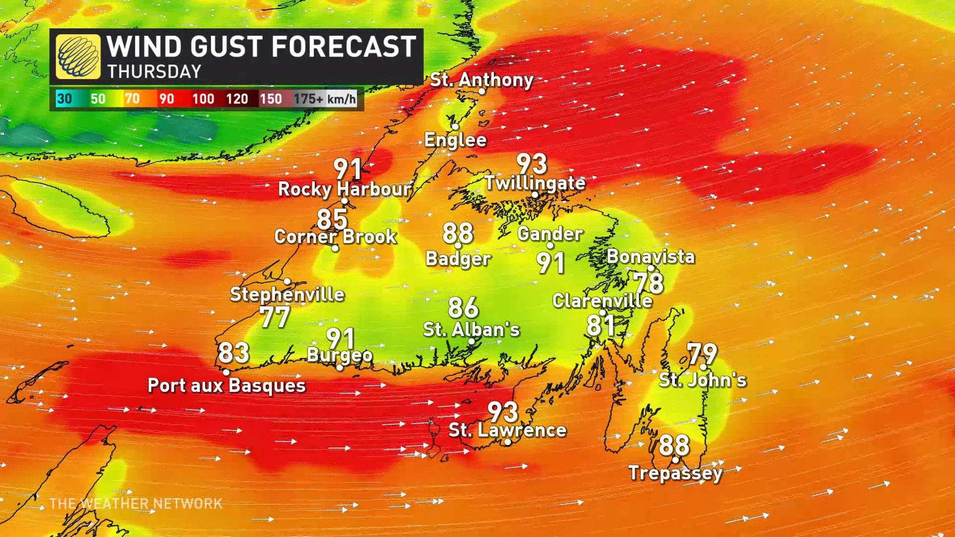
On top of the snow squalls, strong winds are expected throughout Newfoundland from Thursday to Friday. Wind gusts of 70-90 km/h are expected to bring blizzard conditions in these snow squalls, creating zero visibility and treacherous travel.
Much colder temperatures will settle into the region to end the week, and will be exacerbated due to the wind. Frigid wind chills in the -10 to -20 range are forecast.
Changeable temperatures are expected next week as milder conditions will attempt to spread into the region. A couple of arctic highs however, will bring shots of very cold temperatures.
Check back for all the latest on your forecast across Atlantic Canada.