Snow chances spread across several provinces this week
Mid-May snow chances spread across Canada this week, with several provinces at risk of seeing the white stuff
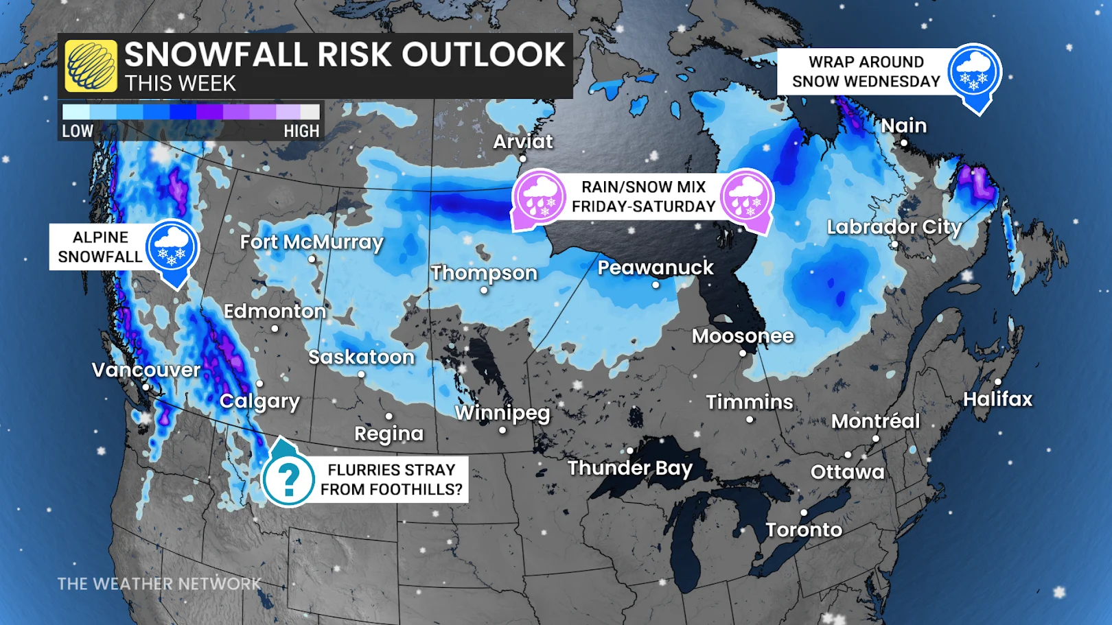
A shift in the weather pattern this week may lead to late-season snowfall across several Canadian provinces as cold air pushes south alongside active weather systems. While the May long weekend is often considered the unofficial start of summer, this year, it could come with an unseasonable dose of snow.
DON'T MISS: Canada's May long weekend hopes hang on looming pattern change
British Columbia:
A noticeable cooldown is on the way. Freezing levels are set to drop to 1500 metres on Thursday and lower by Friday. This could result in 10-20 cm of alpine snow across the Coastal, Kootenay, and Rocky Mountains.
Wet snow and rain mixes may impact mountain passes, although chains are no longer required.
RELATED: May can bring Canada 30-degree heat and late-spring snows
Prairies:
A similar cooldown is expected across the Prairies. Freezing levels in Alberta's Rockies may hover near 2000 metres. Late-week flurries are possible near Jasper and Banff, with a chance of additional snow over the weekend.
Rainfall is forecast across the Prairies on Thursday, transitioning to snow in northern Alberta and Saskatchewan by Friday morning.
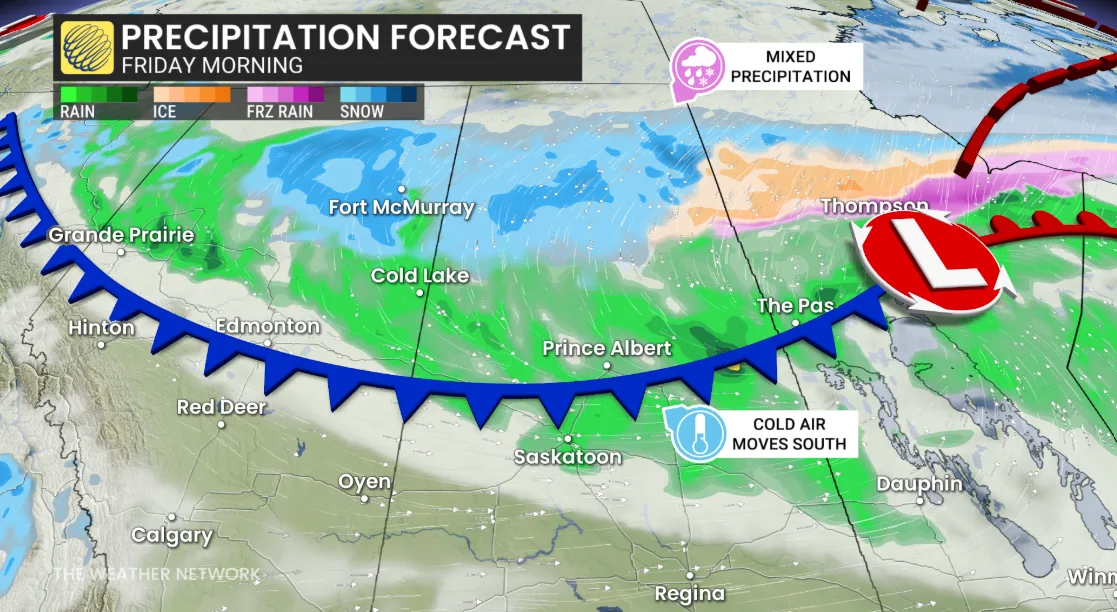
Mixed precipitation may extend into northern Manitoba, Ontario, and Quebec.
RELATED: Potholes and sinkholes: Uncovering the hidden dangers beneath our roads
Farther south, cold temperatures could bring flurries to parts of central Saskatchewan and Alberta by Saturday.
Labrador:
Special weather statements are in effect in western Newfoundland and southern Labrador. Colder air behind a rainy system may generate snow Wednesday morning.