Slow-moving front to soak Ontario and Quebec with rain, gusty winds
Warm air comes in on Monday, followed by showers, storms and soaking rain throughout the week
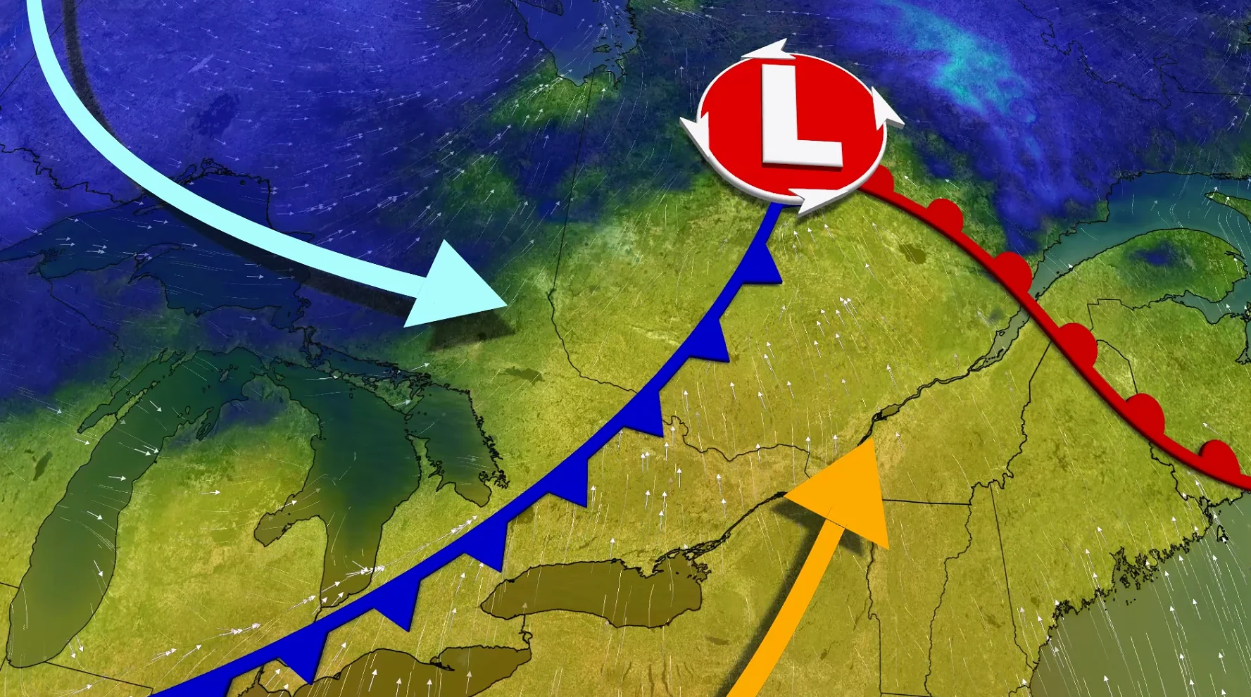
A slow-moving cold front is preparing for a wet stretch across southern Ontario and Quebec, with heavy rain, a few thunderstorms and breezy conditions through midweek.
Monday night could end up stormy in southwestern Ontario where there will be a risk of nocturnal storms, some of which could be of severe criteria. The main hazards will be torrential rainfall, hail and strong wind gusts.
CHECK OUT: How the weather could be influencing your music taste
The risk of thunderstorms will continue on Tuesday with the cold front continuing to slice through Central Canada.
Monday night storm risk in southwestern Ontario
By Monday evening, the pattern starts to shift. Showers will move into extreme southwestern Ontario, with a chance of thunder at the end of the day.
In fact, there will be a chance of severe thunderstorms in the aforementioned region through the overnight.

Models have kept a line of storms north of Lake Erie, threatening the Windsor-Chatham corridor with torrential rain, strong winds and hail.
The system will fully ramp up on Tuesday as the cold front moves through. Showers will become more widespread and consistent, with moderate rain developing in the GTA, eastern Ontario and southern Quebec throughout the afternoon and evening.

Warm, unstable air ahead of the front may also produce a few stronger thunderstorms, especially in Quebec's Eastern Townships. Heavy downpours, small hail and strong winds are all possible in these areas.
Elsewhere, including Niagara and parts of eastern Ontario, there is a slight chance of embedded thunderstorms, but for the most part, it will be a steady downpour. As the front moves east, winds will continue to gust.
SEE: This Ontario getaway saves summer from over-planning
More rain and cooler temperatures this week
This system will not rush to leave.
A blocking high over Atlantic Canada will slow the front's progress and allow more moisture to enter the system. This means more rain in southern Quebec on Wednesday, adding to the already wet conditions.

Rainfall totals in southern Quebec could reach 50 to 60 mm by the end of the season.
Behind the front, cooler, below-seasonal air will settle in, signalling a significant departure from the early-week warmth.
WATCH BELOW: Midge swarms are back! Why you should leave this tiny pest alone
Stay with The Weather Network for the latest across Ontario and Quebec