The Prairies' week continues with ongoing scattered storm risk

Possible thunderstorms for most of the week for most of the Prairies, while people in Alberta can look forward to its warmest day of the year.
The Prairie region will see some thunderstorm risk in one area or another for most of the week. Wednesday's storms looking most likely in Alberta around Red Deer and Drumheller. The warm spell blooming in that province will spread to most of the rest of the region throughout Wednesday and Thursday, but a cold front will bring temperatures back down somewhat by Friday, except in Manitoba. A closer look, below.
Visit our Complete Guide to Summer 2020 for an in-depth look at the Summer Forecast, tips to plan for it and much more
WEATHER HIGHLIGHTS
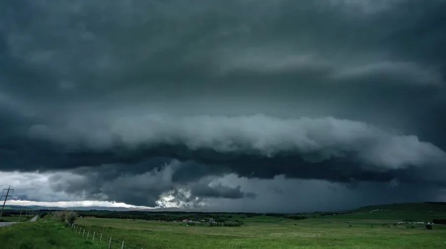
Wednesday storms in Alberta and central Saskatchewan
Warming trend sees temperatures peak in Alberta Wednesday until a late-week cold front brings them down
Supercells possible around Red Deer and toward Drumheller
Keep an eye on severe weather ALERTS in your area.
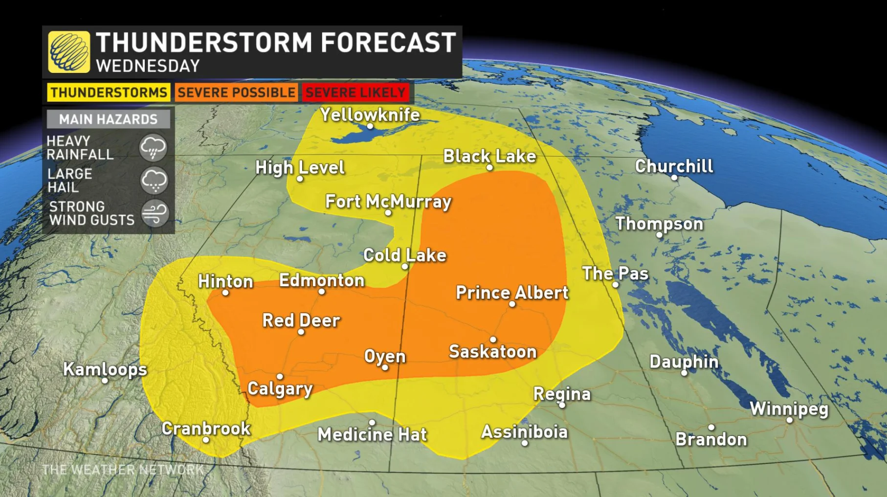
WEDNESDAY STORM RISKS FOR PARTS OF ALBERTA AND SASKATCHEWAN
A few rounds of storms are expected across the Prairies for the next few days. These storms do come with warmer temperatures for Alberta, which may be welcomed after lower than seasonal temperatures.
These storms risks are caused by one low in Southern Alberta and another low throughout northern areas of the Prairies. The boundaries and fronts are giving enough instability to create thunderstorms.
These storms could start around 2 to 4pm at the base of the foothills of the Rockies and then head eastward. Some supercell potential around Red Deer and toward Drumheller in the afternoon, the energy should taper off in the evening.
Saskatchewan has a lot more storm energy across the province. Storm risks in central Saskatchewan, with possible heavy winds and hail.
Meanwhile, though Alberta has largely missed out on true summer-like heat, that won't be true this week. Temperatures are on the up, and Wednesday looks to be the hottest day of the year for southern Alberta, with 30-degree temperatures in some areas. Southern Saskatchewan could also see daytime highs approaching the 30s.

BEYOND: STORM RISK AND HEAT ENDURE
Wednesday looks to be the peak of Alberta's heat, but by Thursday, the southern tips of all three Prairie provinces will still see temperatures into the low 30s but will feel more like the mid- to upper-30s with the humidity. Thursday also sees some storm risk for Alberta and Saskatchewan.
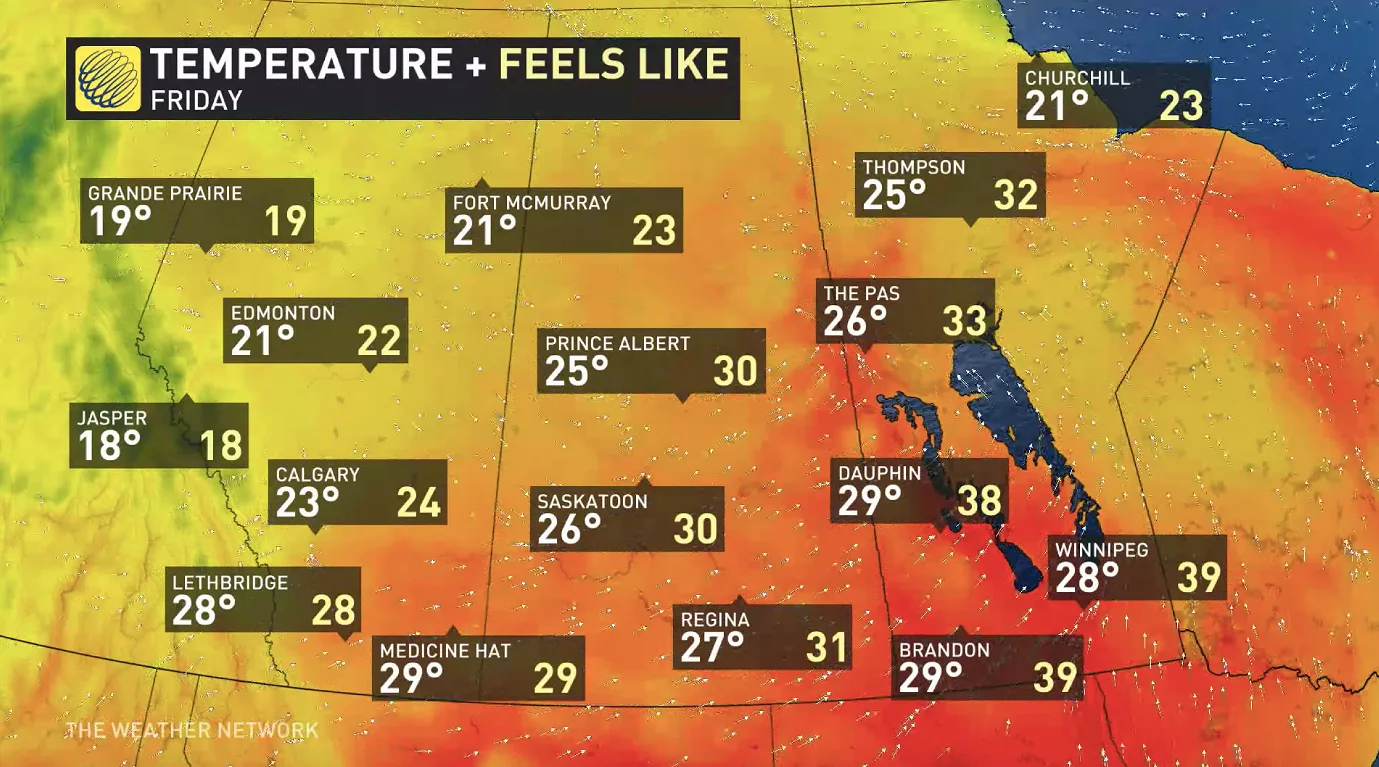
By Friday, however, a passing cold front will have cooled the western Prairies down to something more seasonal, but the warmth will hang on for a little longer in Manitoba.
WATCH BELOW: ALBERTA IS HOME TO CANADA'S 'HAIL ALLEY'
Check back for updates as the week unfolds