
Stay alert: Severe storms threaten Canada Day in Ontario and Quebec
A stiflingly hot Canada Day is in store for Ontario and Quebec, with daytime highs in the 30s and humidex values in the 40s. The heat and humidity are creating the perfect conditions for severe thunderstorms to develop in some areas
The heat is on in southern Ontario and Quebec this week, as are the chances for severe weather.
With daytime highs approaching or surpassing the 30-degree mark, the heat will help to fuel a risk of thunderstorms in Ontario and Quebec again on Wednesday.
DON’T MISS: Why extreme heat is one of the world’s deadliest weather disasters
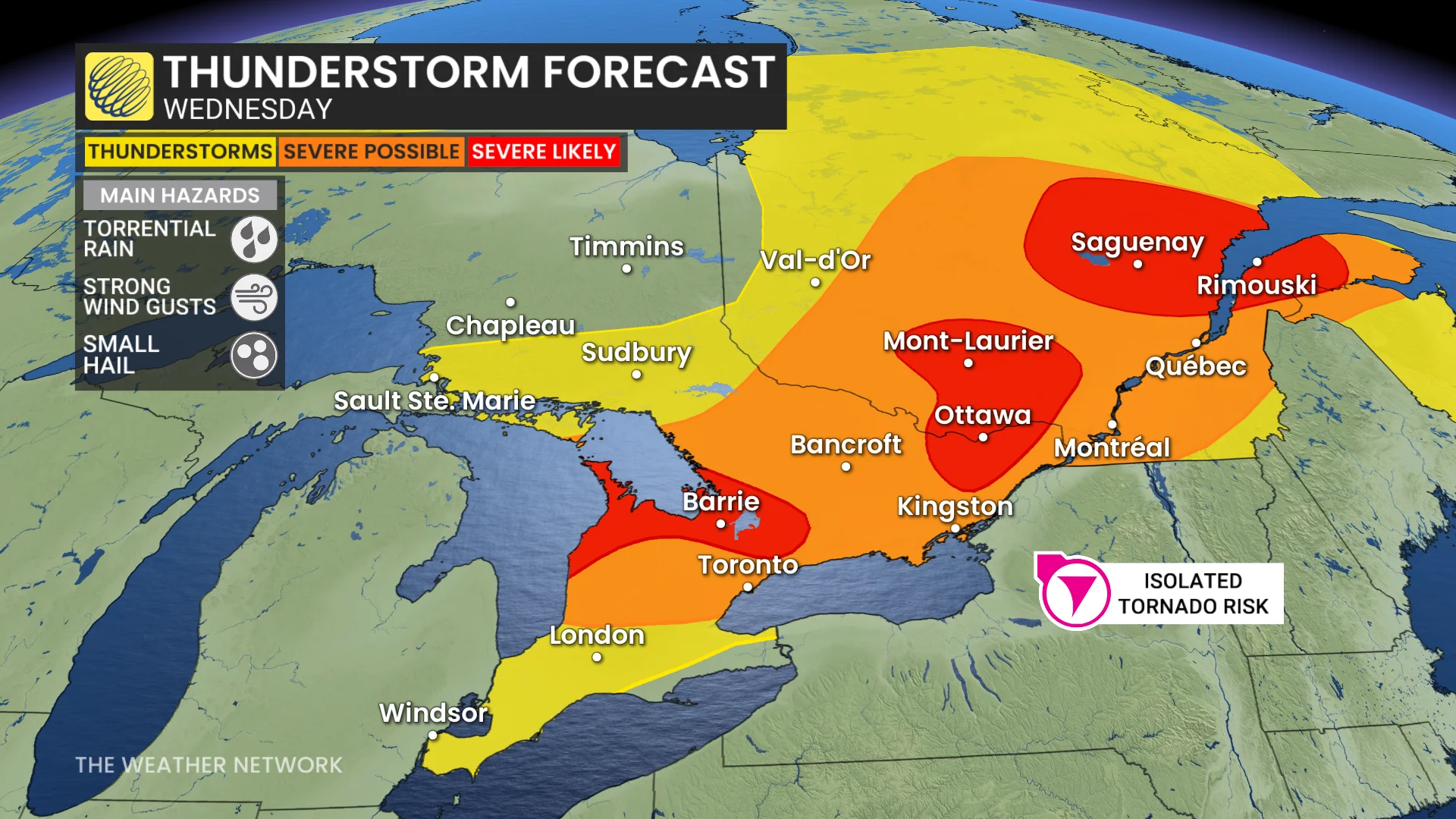
Many folks have outdoor plans for Canada Day, which will feature a threat of thunderstorms in both provinces. Residents should remain weather-aware on Wednesday, be on guard for rapidly changing conditions, and have a plan to take cover if/when severe weather strikes.
Canada Day plans in jeopardy with severe storm potential
The building heat in Ontario and Quebec this week has created an increasingly unstable atmosphere, which will provide plenty of fuel for thunderstorms.
SEE ALSO: Ontario's first extreme heat event of the summer will invade this week
Widespread heat warnings are still in place, with feels-like values into the 40s Wednesday afternoon across southern and eastern Ontario, including Ottawa and the Greater Toronto Area (GTA), as well as across Quebec and parts of the Maritimes.
Also on Wednesday afternoon, severe thunderstorms are possible near Peterborough and areas east towards Bancroft and Ottawa, and will track towards Lake Erie and the international border.
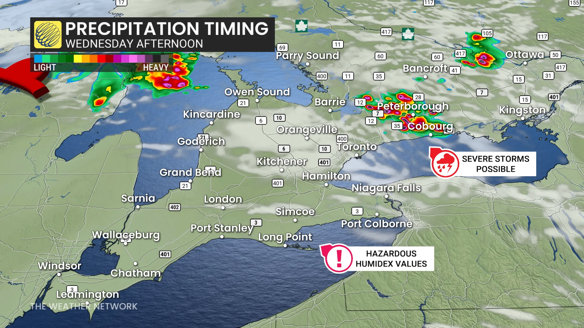
With high moisture and humidity in place, torrential rain is the primary threat. Storms could drop 30-50 mm of rain in a short amount of time. This will raise the risk of pooling water on roadways.
Wednesday evening, forecasters will closely watch possible thunderstorms near Lake Huron and the Georgian Bay shores.
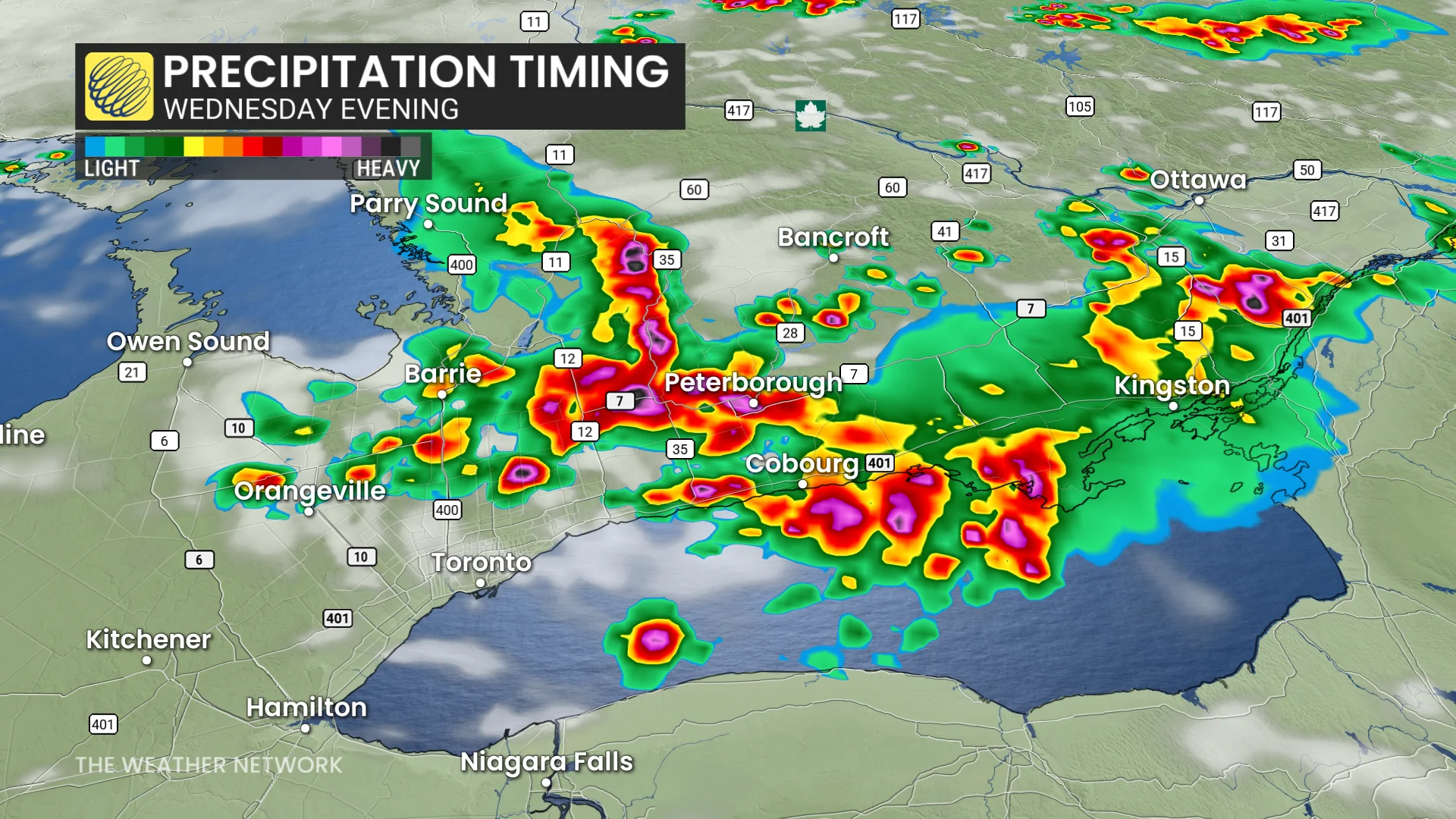
As they track inland towards Barrie, Orangeville, and the northeastern GTA, ample thunderstorm energy will provide a boost.
Torrential rain will be the primary threat alongside strong winds, but intense and frequent lightning is also possible.
However, with high heat and small-scale features as a trigger, models are somewhat disagreeing on storm development and locations.
WATCH: How to stay safe as Toronto swelters in first major heat wave of the season
Heat safety is vital
Extreme heat claims more lives around the world than any other type of severe weather.
Everyone is susceptible to heat-related illnesses without taking proper precautions, such as frequent breaks, adequate hydration, and air conditioning.
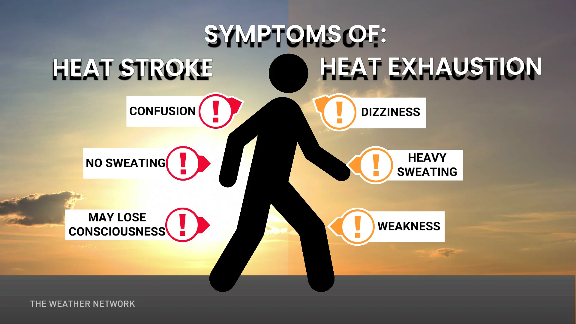
The compounding stress of hot days followed by muggy nights can be especially hard on vulnerable populations like the elderly, those with chronic health conditions, and folks who live without access to air conditioning. Keep in mind that certain medications can lower your body’s heat tolerance.