Severe weather, flood risk heightened in Quebec with soaking rains, winds
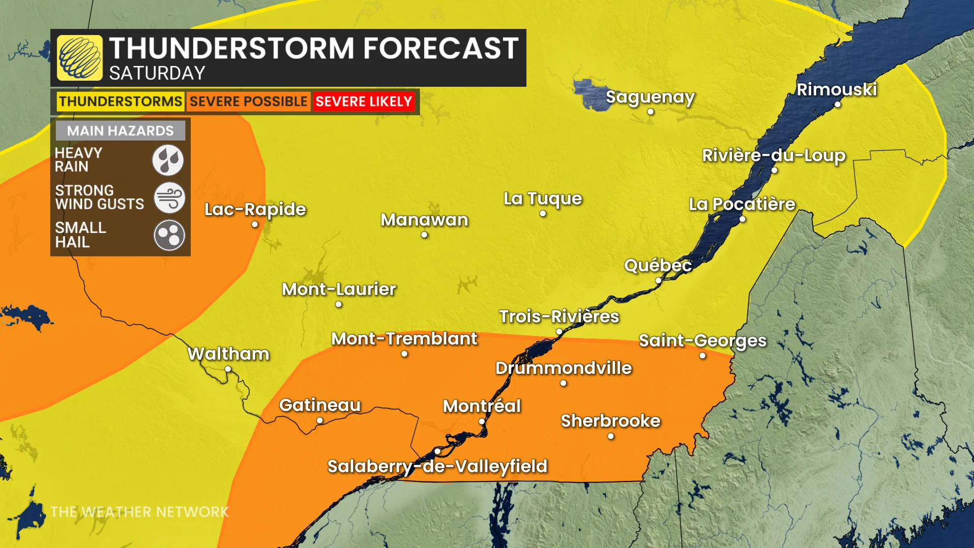
Pockets of heavy rainfall and thunderstorms, potentially severe in some areas, will pop up in parts of Quebec on Saturday, bringing the risk of localized flooding, pooling and ponding on roads
The first weekend of June could kick off on a stormy note in southern Quebec, with severe thunderstorm watches and rainfall warnings in place on Saturday.
A low-pressure system will advance east into the province, bringing heavy rain and elevating the severe thunderstorm risk for parts of southern Quebec on Saturday. Localized flooding, pooling and ponding on roads will be possible.
SEE ALSO: Peas, golf balls, and baseballs: What hailstone size means for damage
Be sure to keep an eye out for local weather alerts and be aware of changing conditions as the storms roll in.
Stormy Saturday possible in parts of Quebec
Widespread showers on Saturday morning will make way for a few breaks in the afternoon. Just enough of a dry break to allow some energy to build into the atmosphere ahead of the cold front.
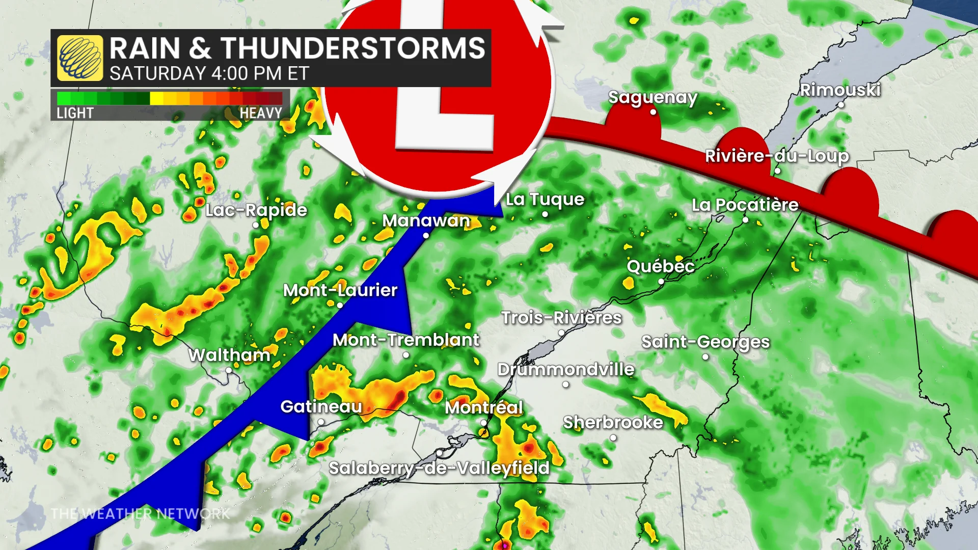
As the cold front approaches mid-afternoon, expect showers and thunderstorms to develop from western Quebec, through the Ottawa Valley, and track southward.
From the late afternoon through early evening, showers and storms will line the lower Ottawa Valley and St. Lawrence River.
Montreal, Mont-Tremblant, Trois-Rivières, Sherbrooke and the Eastern Townships can expect heavy rain, strong winds and hail as the storms move through with the cold front.
The low will likely support heavy rainfall for areas like Mont-Tremblant, Drummondville, extending to Quebec City and Saguenay.
Be sure to keep an eye out for local weather alerts and be aware of changing conditions as the storms roll in.
Sunday will improve as the day progresses
Showers will continue through Saturday overnight and early-morning hours of Sunday with the passage of the low.
Showers expected through Sunday morning, gradually tapering and tracking southward through the afternoon.
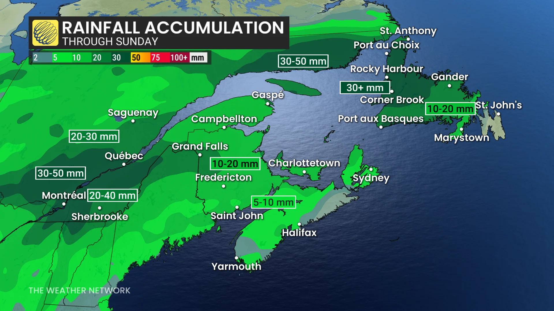
Expect strong, northeasterly winds through the mouth of the St. Lawrence. Areas along the shores can expect some water to pile up.
DON'T MISS: Tornado season is underway in Canada. Here's what you need to know
Temperatures will trend back to seasonal, and potentially even below seasonal, during the third week of June.
Stay with The Weather Network for more information and updates on your forecast for Quebec.
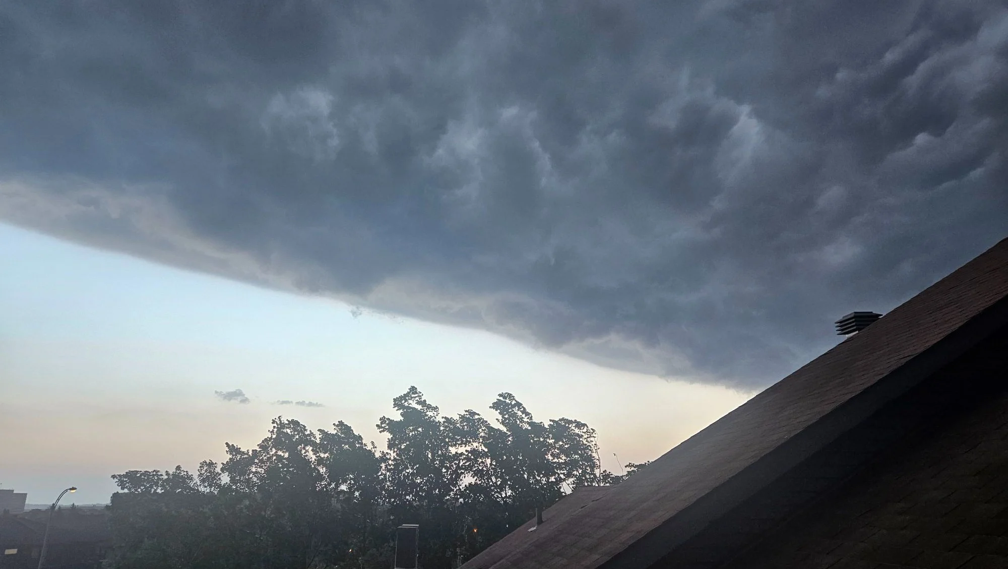
Thumbnail courtesy of Chantal Renaud via MeteoMedia, The Weather Network's sister