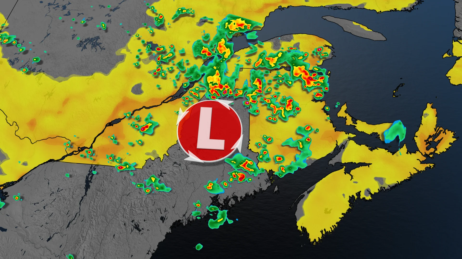
Severe thunderstorm threat covers large area of Quebec, Maritimes

Severe thunderstorms possible over Quebec and Maritimes on Thursday
A low pressure system moving across the St. Lawrence and parts of New Brunswick on Thursday could trigger severe thunderstorms over a large area. Regions at risk include Saguenay, the Eastern Townships, Fredericton, and surrounding areas.
DON'T MISS: Precise, targeted severe weather warnings coming to Canada
Residents should stay weather aware as the storms could disrupt evening commutes in affected areas.
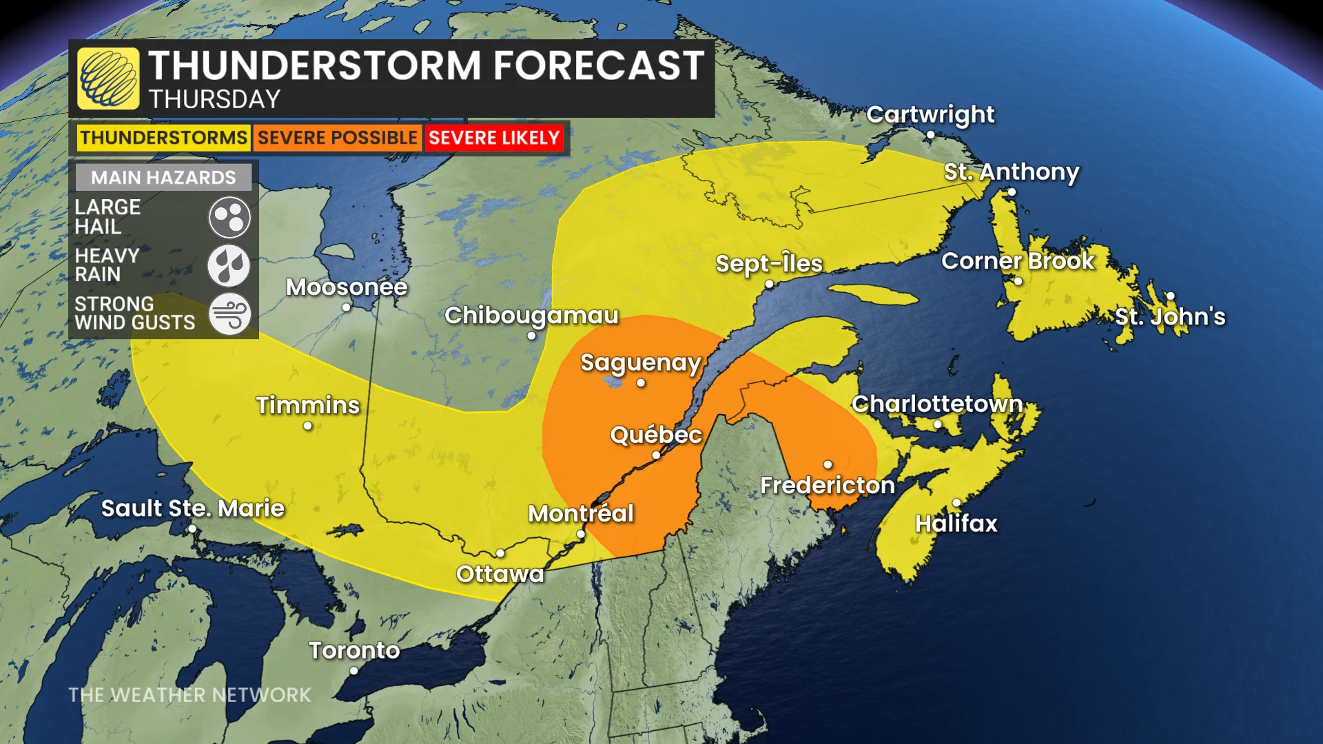
Thunderstorm threat spans Quebec and the Maritimes through Thursday evening
Scattered thunderstorms are expected to develop during the afternoon, with some maturing into severe storms as they track south and east through the evening.
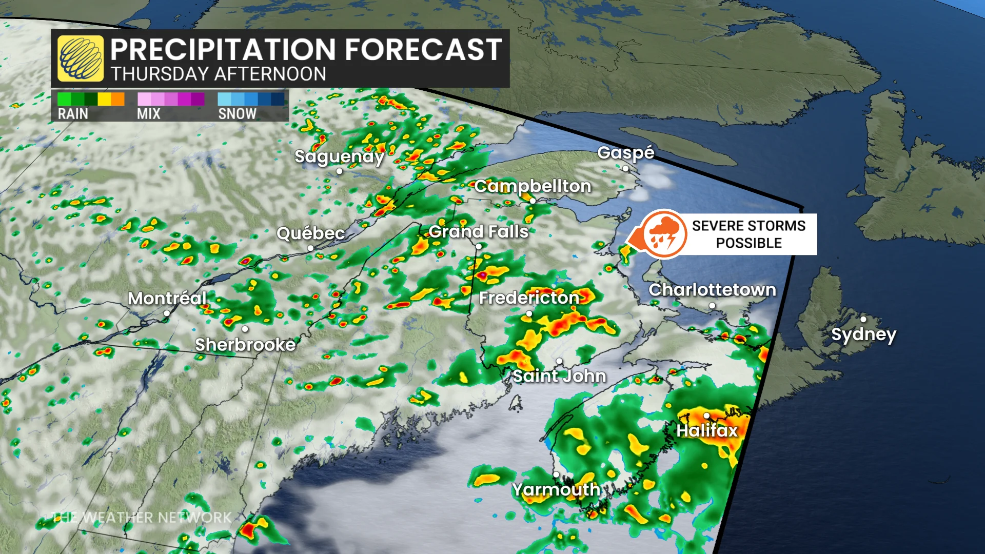
Forecast conditions indicate moderate thunderstorm energy combined with strong mid-level winds, creating the potential for large hail, up to toonie-sized.
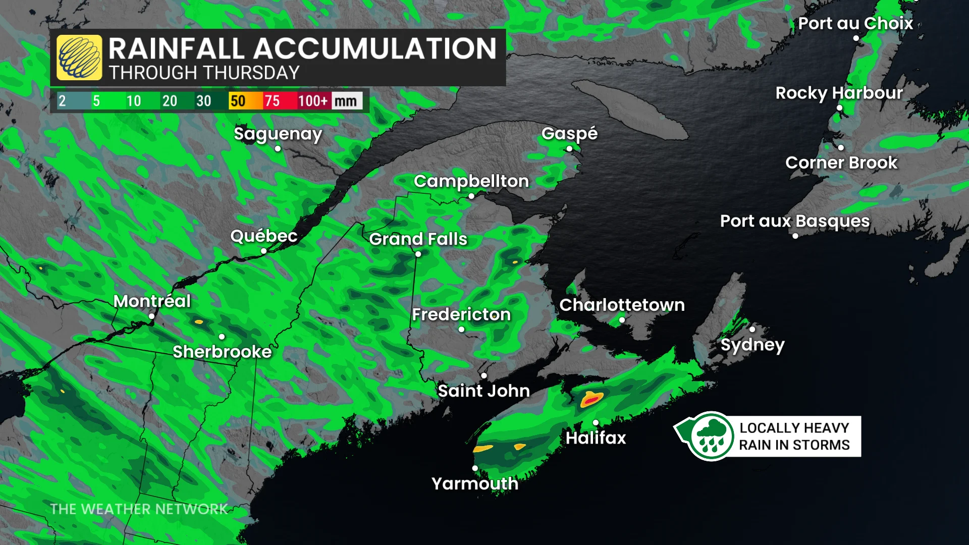
Heavy rainfall may lead to localized ponding and pooling on roads, while strong wind gusts ahead of and within the storms could cause additional impacts.
Weekend brings sunshine to Maritimes, cooler than normal finish to August
The weekend forecast shows partly to mostly sunny skies across the Maritimes, with daytime highs in the low to mid-20s. Meanwhile, Newfoundland will see showers persisting through Saturday.
SEE ALSO: Sunsets growing earlier across Canada as summer starts to fade
A new low pressure system is set to bring widespread rain and thunderstorms Monday into Monday night across the region. Rainfall is forecast to extend through Tuesday in Newfoundland.
The final two weeks of August are expected to feature near-seasonal to slightly cooler-than-seasonal temperatures, with periods of unsettled weather likely to continue.
Stay with The Weather Network for the latest updates and information on your weather across Quebec and Atlantic Canada.