
Damaging wind gust, large hail threat in Alberta, Sask., with severe storm risk

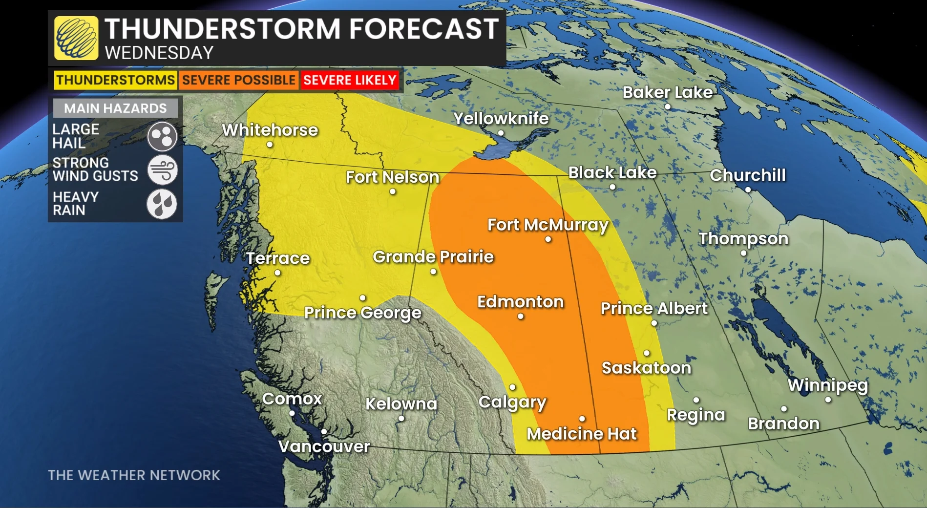
Wednesday could bring a potentially turbulent day to parts of Alberta and Saskatchewan. A threat of severe storms carries the chance of large hail, potentially golf ball-sized, and damaging winds exceeding 100 km/h.
A low-pressure system will bring active weather to parts of Alberta and Saskatchewan on Wednesday, with severe thunderstorms developing in some areas.
DON'T MISS: Say it isn't snow! Burst of July snow on tap for some Canadians this week
Winds will strengthen across northeast B.C. and parts of the Prairies, with gusts reaching 60 km/h in the afternoon.
Stay weather-aware if travelling in areas under severe storm risk, and keep informed of local alerts.
Wednesday: Severe thunderstorm risk stretches across Alberta and Saskatchewan
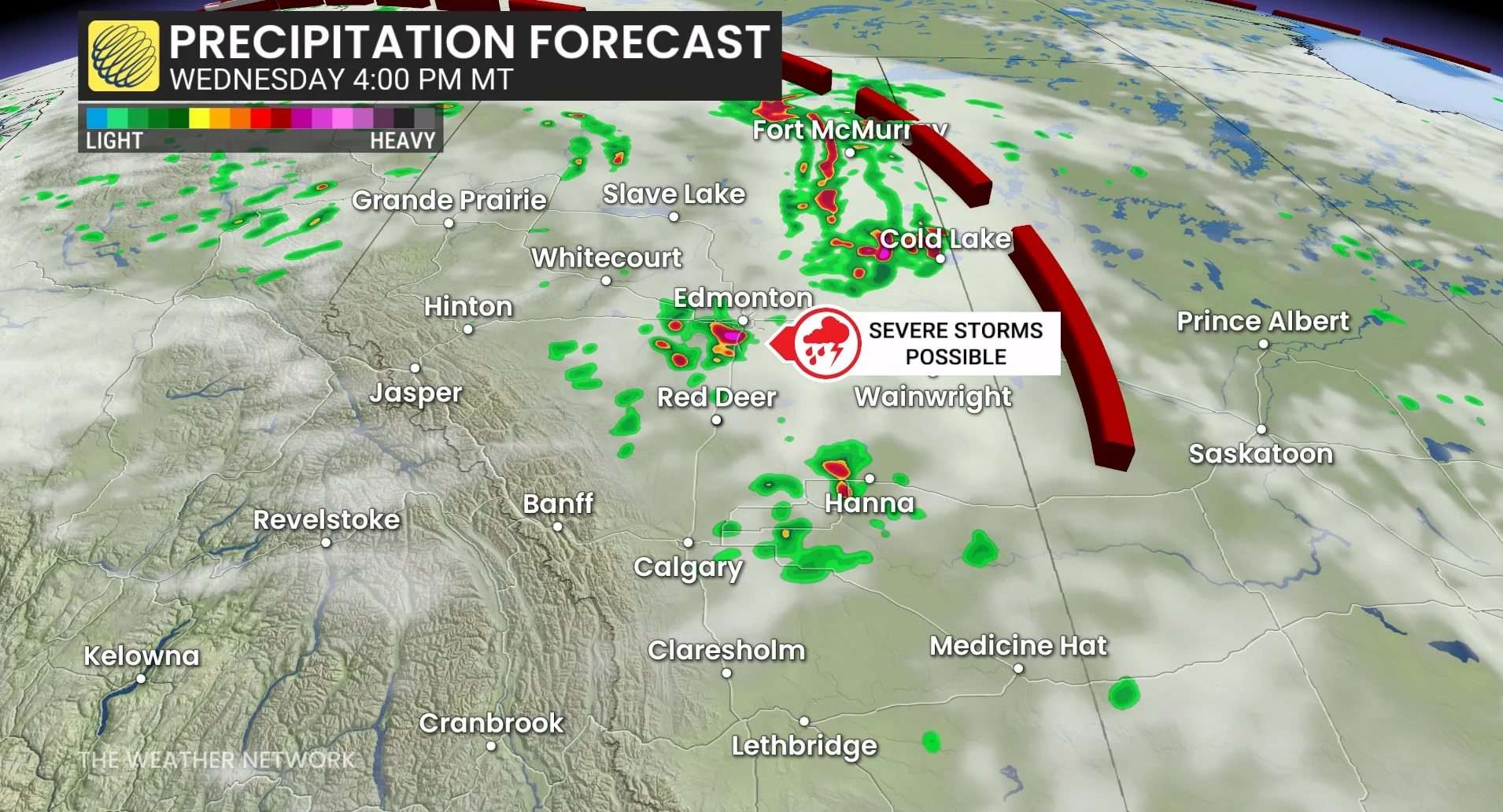
Storms are expected to develop across central and northern Alberta, including Edmonton, Slave Lake, Cold Lake, Fort McMurray, and up to Hay River, N.W.T., during the late afternoon and evening. The leading triggers will be the system's low and an amplified trough.
DON'T MISS: A normal July brings Canada drought, downpours, and dizzying heat
Areas along the Alberta-Saskatchewan border also face a risk of severe storms, with very large hail (golf ball-sized) and damaging wind gusts up to 110 km/h--as the storms line into an MCS (mesoscale convective system)--being the main threats.
Meanwhile, southern Alberta will experience a drier pattern through the week, with temperatures returning to near 30°C by the weekend.
Stay with The Weather Network for all the latest on conditions across the region.