Severe thunderstorm risk shifts across B.C. on Friday

Stay alert for rapidly changing conditions in your area through the day Friday
An active pattern draped across the western half of Canada will spark a renewed potential for thunderstorms across British Columbia on Friday. Some of these storms may turn severe.
Severe weather is relatively rare in this part of the country. Have a plan in place in case severe weather watches and warnings are issued for your location. Know what to do and where to go in the off-chance a tornado warning is issued.
DON’T MISS: How severe weather alerts are issued, and potentially save lives
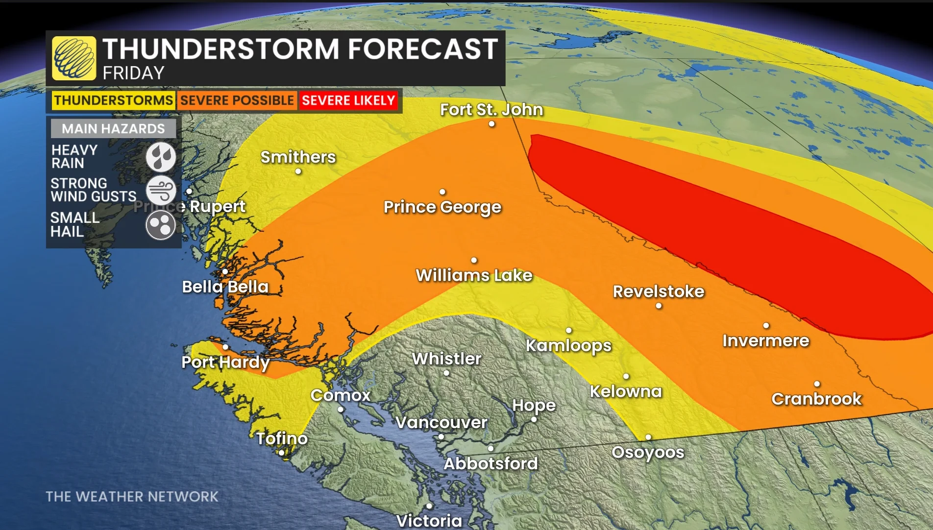
Thursday’s threat for thunderstorms across B.C. will shift northward heading into Friday. A combination of daytime heating, topography, and forcing from a nearby low-pressure system will serve to trigger the day’s thunderstorms.
We’ll see the greatest potential lift north of Vancouver, continuing for Vancouver Island and portions of the Interior. Storms will initiate into the evening from central B.C. down to the Kootenays.
Some severe thunderstorms are possible. The main hazards include heavy rainfall, small hail, and strong wind gusts. There is a very small chance that the odd storm may rotate, though the province’s high elevations and rugged terrain may stifle this potential.
Stay with The Weather Network for all the latest on conditions across B.C.