Prairies: Threat for severe weather pushes into Manitoba Monday

After a stormy Sunday in Alberta and Saskatchewan, the risk for severe thunderstorms shifts into Manitoba Monday
The weekend went out with a bang in parts of Alberta and Saskatchewan, as severe thunderstorms brought damaging hail, heavy rain and tornado warnings Sunday afternoon and evening. On Monday, the risk for severe weather will move into Manitoba, while the threat for non-severe thunderstorms will linger in Alberta and Saskatchewan. For more on Sunday's storms and a look ahead at Monday's risk areas, read below.
Summer revealed! Visit our Complete Guide to Summer 2019 for an in-depth look at the Summer Forecast, tips to plan for it and much more
WEATHER HIGHLIGHTS:
Severe storms brought tornado warnings Sunday afternoon and evening
Risk for severe weather shifts east into Manitoba on Monday
Latest watches and warnings HERE
WATCH BELOW: SEVERE STORMS BRING DAMAGING HAIL, TORNADO WARNINGS TO ALBERTA AND SASKATCHEWAN
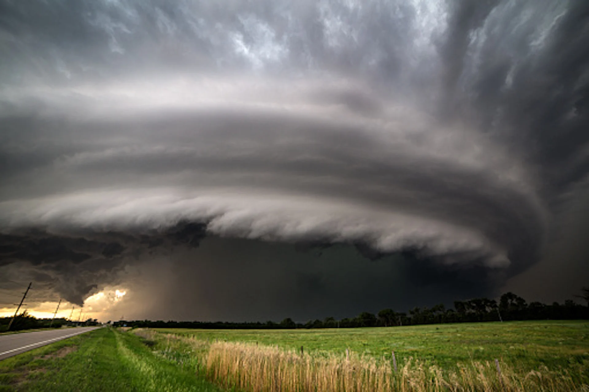
The severe thunderstorms that rolled through Alberta and Saskatchewan Sunday came courtesy of a surface low that brought heavy rain, damaging hail and tornado warnings to both provinces, which continued into the late evening before being dropped. Toonie and tennis ball-sized hail were reported.
There were reports of funnel clouds and tornadoes in both provinces, but no touchdowns have been confirmed. For more photos of the storms, click here.
ALSO WATCH: SEVERE STORM RISK SHIFTS INTO MANITOBA MONDAY
Next up for the severe weather threat is Manitoba, which saw some of the Saskatchewan storms cross into the province through the overnight hours. Though those will fizzle out, a second round looms for Monday afternoon as the cold front moves east.
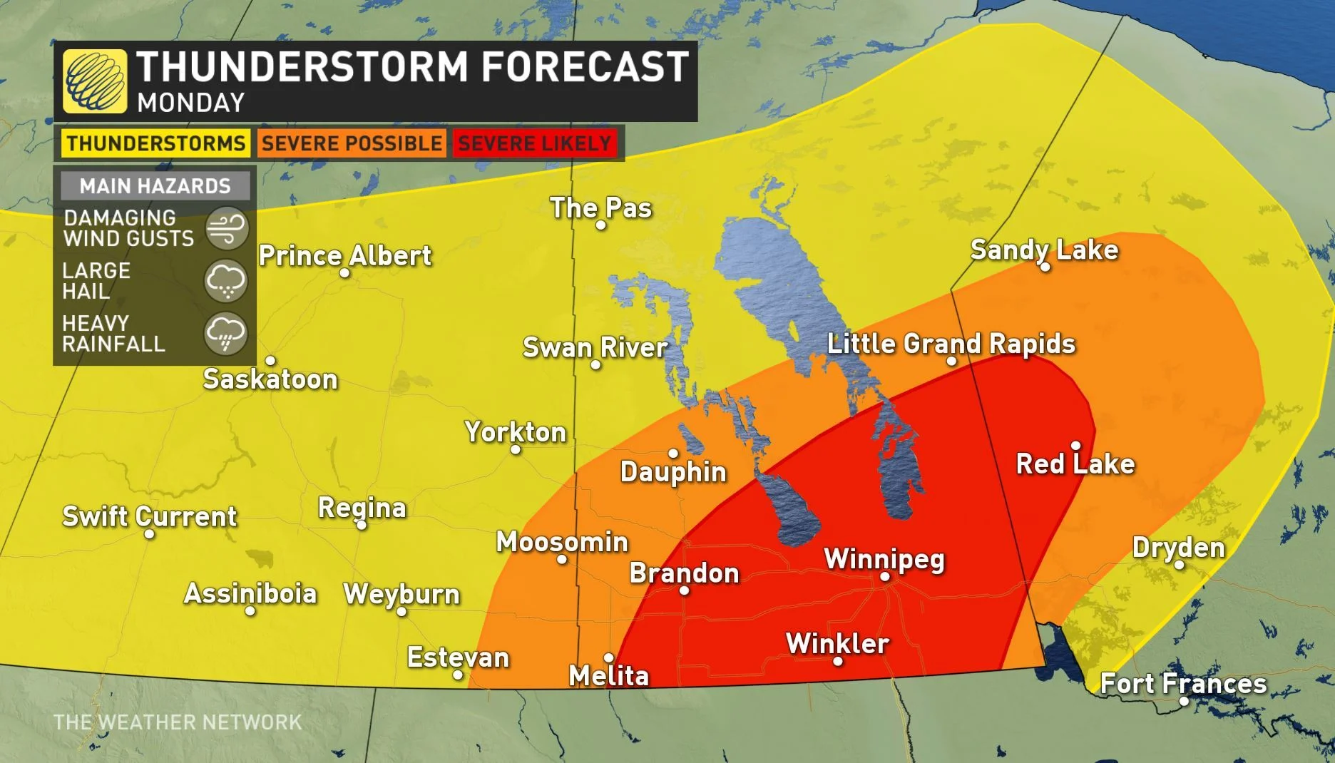
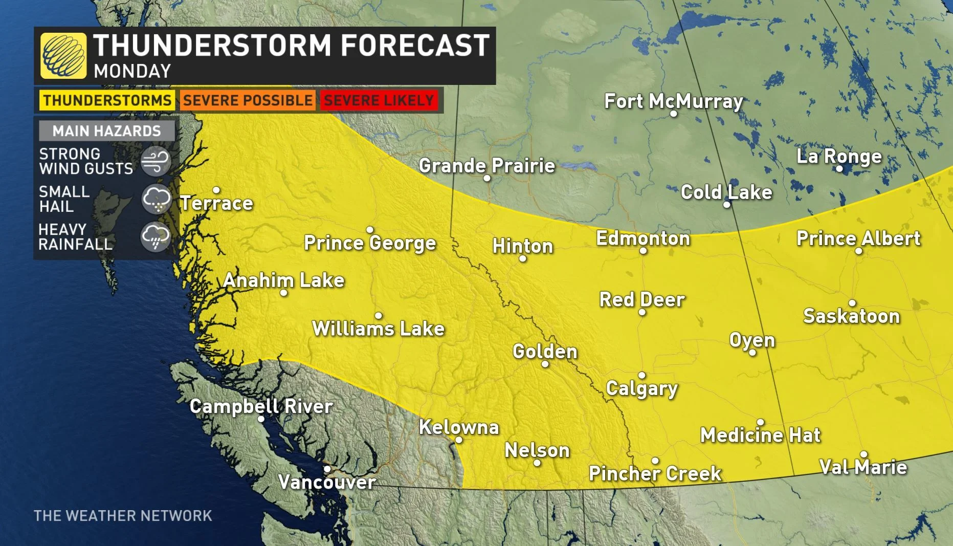
While the threat for severe thunderstorms treks eastward, Alberta and Saskatchewan may still see the development of non-severe thunderstorms in the afternoon and evening. Parts of extreme southeastern Saskatchewan may still see some of the storms turn severe.
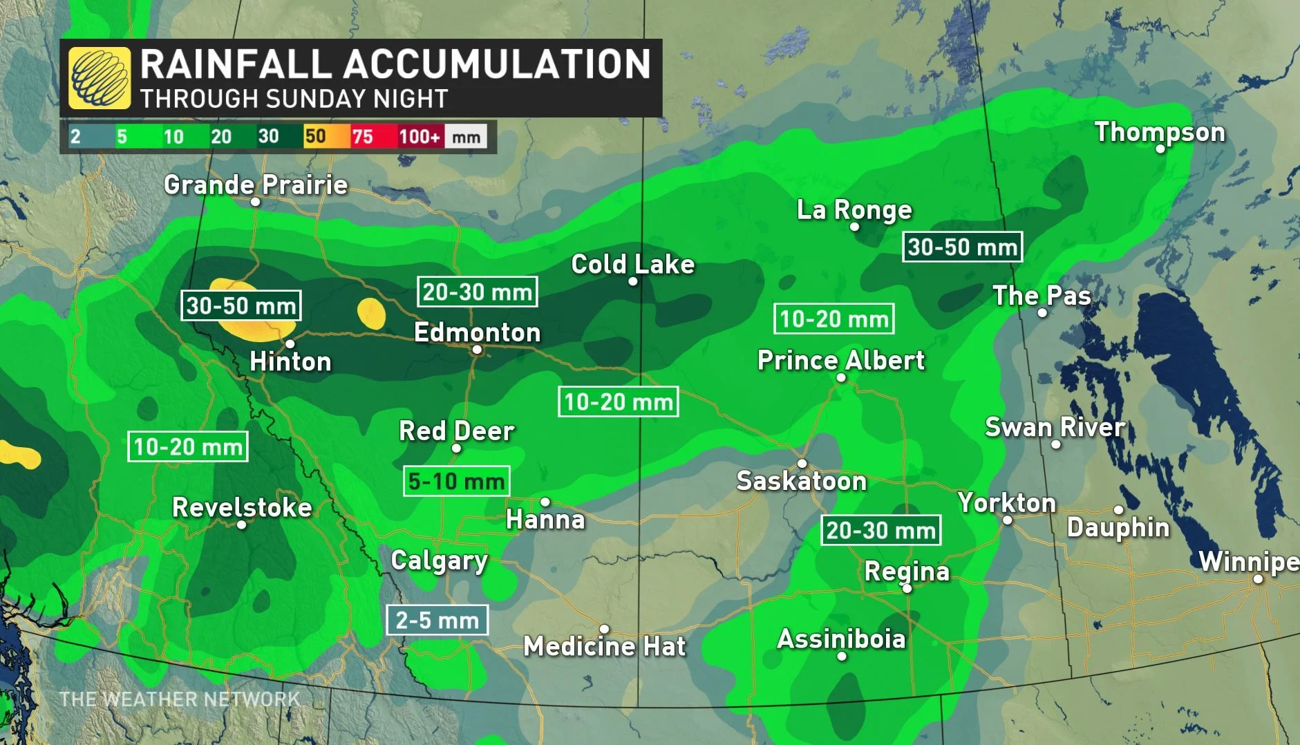
Through overnight Sunday, rainfall is expected to be heaviest in central Alberta, including parts of the Foothills, and northern Saskatchewan. Between 30 and 50 mm of rain was projected to fall in areas north of Hinton, Alta., and along central areas near the Saskatchewan and Manitoba border.
Stay with us here at The Weather Network for your latest forecast updates.